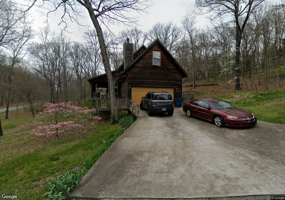
1 Euston Ln Bella Vista, AR 72714
Estimated Value: $379,000 - $456,000
Studio
2
Baths
1,935
Sq Ft
$216/Sq Ft
Est. Value
About This Home
This home is located at 1 Euston Ln, Bella Vista, AR 72714 and is currently estimated at $416,994, approximately $215 per square foot. 1 Euston Ln is a home located in Benton County with nearby schools including Cooper Elementary School, Ruth Barker Middle School, and Washington Junior High School.
Ownership History
Date
Name
Owned For
Owner Type
Purchase Details
Closed on
Feb 17, 2010
Sold by
Deutsche Bank National Trust Company
Bought by
Reid Linda A
Current Estimated Value
Purchase Details
Closed on
Oct 24, 2001
Bought by
Norris
Purchase Details
Closed on
Aug 24, 2000
Bought by
Farrer Corp
Purchase Details
Closed on
Dec 27, 1999
Bought by
Farrer
Purchase Details
Closed on
Nov 10, 1999
Bought by
Devol and Leutner
Purchase Details
Closed on
May 6, 1999
Bought by
Huck Amel
Purchase Details
Closed on
Oct 21, 1983
Bought by
Huck
Create a Home Valuation Report for This Property
The Home Valuation Report is an in-depth analysis detailing your home's value as well as a comparison with similar homes in the area
Home Values in the Area
Average Home Value in this Area
Purchase History
| Date | Buyer | Sale Price | Title Company |
|---|---|---|---|
| Reid Linda A | $59,000 | Bankers Title | |
| Norris | $140,000 | -- | |
| Farrer Corp | -- | -- | |
| Farrer | $3,000 | -- | |
| Devol | -- | -- | |
| Huck Amel | -- | -- | |
| Huck | $5,000 | -- |
Source: Public Records
Tax History
| Year | Tax Paid | Tax Assessment Tax Assessment Total Assessment is a certain percentage of the fair market value that is determined by local assessors to be the total taxable value of land and additions on the property. | Land | Improvement |
|---|---|---|---|---|
| 2025 | $3,173 | $69,420 | $1,600 | $67,820 |
| 2024 | $2,879 | $69,420 | $1,600 | $67,820 |
| 2023 | $2,617 | $45,230 | $800 | $44,430 |
| 2022 | $2,493 | $45,230 | $800 | $44,430 |
| 2021 | $2,281 | $45,230 | $800 | $44,430 |
| 2020 | $1,718 | $32,850 | $600 | $32,250 |
| 2019 | $1,718 | $32,850 | $600 | $32,250 |
| 2018 | $1,743 | $32,850 | $600 | $32,250 |
| 2017 | $1,614 | $32,850 | $600 | $32,250 |
| 2016 | $1,614 | $32,850 | $600 | $32,250 |
| 2015 | $1,840 | $30,510 | $1,000 | $29,510 |
| 2014 | $1,490 | $30,510 | $1,000 | $29,510 |
Source: Public Records
Map
Nearby Homes
- L8 Euston Ln
- 0 Euston Ln Unit 273301
- 0 Euston Ln Unit 427681
- 0 Euston Ln Unit 546875
- 0 Euston Ln Unit 594821
- 0 Euston Ln Unit 613360
- 0 Euston Ln Unit 621050
- 0 Euston Ln Unit 721130
- 0 Euston Ln Unit 737807
- 0 Euston Ln Unit 703609
- 0 Euston Ln Unit 1019434
- 0 Euston Ln Unit 1094472
- 7 Nettle Ln
- 8 Nettle Ln
- 45 Mansfield Dr
- 30 Watson Ln
- 230 Watson Ln
- 23 Euston Ln
- ----- Euston Ln
- 47 Mansfield Dr
Your Personal Tour Guide
Ask me questions while you tour the home.