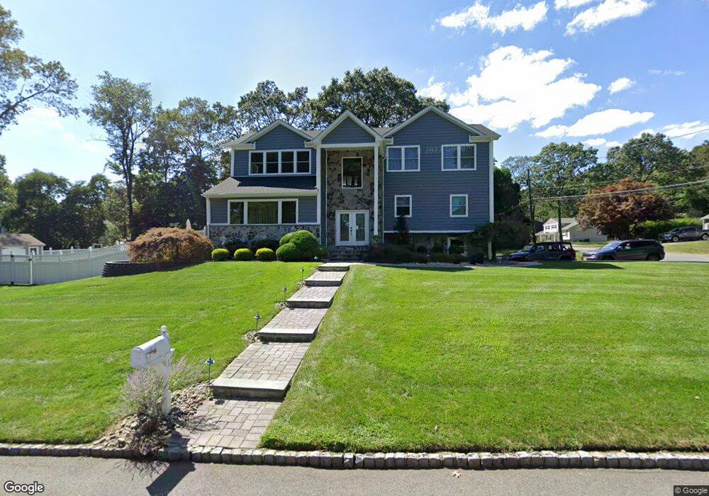
1 Forest Hill Rd Randolph, NJ 07869
Estimated Value: $874,000 - $1,056,000
--
Bed
--
Bath
3,558
Sq Ft
$270/Sq Ft
Est. Value
About This Home
This home is located at 1 Forest Hill Rd, Randolph, NJ 07869 and is currently estimated at $959,323, approximately $269 per square foot. 1 Forest Hill Rd is a home located in Morris County with nearby schools including Randolph High School, Randolph Middle School, and Cheder Lubavitch.
Ownership History
Date
Name
Owned For
Owner Type
Purchase Details
Closed on
Apr 16, 2009
Sold by
Townsend Theresa
Bought by
Townsend Michael and Townsend Theresa
Current Estimated Value
Home Financials for this Owner
Home Financials are based on the most recent Mortgage that was taken out on this home.
Original Mortgage
$400,000
Interest Rate
4.86%
Mortgage Type
New Conventional
Purchase Details
Closed on
Sep 12, 2002
Sold by
Townsend Michael
Bought by
Townsend Theresa
Create a Home Valuation Report for This Property
The Home Valuation Report is an in-depth analysis detailing your home's value as well as a comparison with similar homes in the area
Home Values in the Area
Average Home Value in this Area
Purchase History
| Date | Buyer | Sale Price | Title Company |
|---|---|---|---|
| Townsend Michael | -- | None Available | |
| Townsend Theresa | -- | -- |
Source: Public Records
Mortgage History
| Date | Status | Borrower | Loan Amount |
|---|---|---|---|
| Closed | Townsend Michael | $400,000 |
Source: Public Records
Tax History Compared to Growth
Tax History
| Year | Tax Paid | Tax Assessment Tax Assessment Total Assessment is a certain percentage of the fair market value that is determined by local assessors to be the total taxable value of land and additions on the property. | Land | Improvement |
|---|---|---|---|---|
| 2025 | $17,538 | $619,500 | $197,600 | $421,900 |
| 2024 | $17,098 | $619,500 | $197,600 | $421,900 |
| 2023 | $17,098 | $619,500 | $197,600 | $421,900 |
| 2022 | $16,429 | $619,500 | $197,600 | $421,900 |
| 2021 | $16,076 | $619,500 | $197,600 | $421,900 |
| 2020 | $16,262 | $619,500 | $197,600 | $421,900 |
| 2019 | $16,076 | $619,500 | $197,600 | $421,900 |
| 2018 | $11,947 | $466,300 | $197,600 | $268,700 |
| 2017 | $11,797 | $466,300 | $197,600 | $268,700 |
| 2016 | $10,702 | $292,400 | $142,800 | $149,600 |
| 2015 | $10,573 | $292,400 | $142,800 | $149,600 |
| 2014 | $10,409 | $292,400 | $142,800 | $149,600 |
Source: Public Records
Map
Nearby Homes
- 114 Shady Ln
- 3 Springhill Rd
- 6 Alpine Dr
- 15 Raynor Rd
- 267 Washington Valley Rd
- 25 N Star Dr
- 6 Quarry Ct
- 20 Longhill Rd
- 6 Raleigh Ct
- 2 Bickford Dr
- 5 Kensington Ct
- 34 Starlight Dr
- 160 W Hanover Ave
- 40 Lord William Penn Dr
- 13 Holly Dr
- 10 Campo Rd
- 5 Queens Ct
- 52 Schoolhouse Ln
- 3 Old Orchard Terrace
- 4 Ascot Ln
- 8 Foxwood Ln
- 1 Misty Mountain Rd
- 4 Foxwood Ln
- 3 Misty Mountain Rd
- 5 Foxwood Ln
- 7 Foxwood Ln
- 4 Forest Hill Rd
- 3 Foxwood Ln
- 10 Foxwood Ln
- 5 Misty Mountain Rd
- 2 Foxwood Ln
- 9 Foxwood Ln
- 6 Forest Hill Rd
- 4 Evergreen Ln
- 1 Foxwood Ln
- 3 Lake Shore Dr S
- 5 Forest Hill Rd
- 7 Misty Mountain Rd
- 9 Lake Shore Dr S
- 2 Deepdale Dr