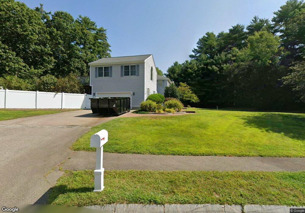
1 Forest Ln Norton, MA 02766
Estimated Value: $584,000 - $1,145,000
4
Beds
4
Baths
3,123
Sq Ft
$292/Sq Ft
Est. Value
About This Home
This home is located at 1 Forest Ln, Norton, MA 02766 and is currently estimated at $912,777, approximately $292 per square foot. 1 Forest Ln is a home with nearby schools including J.C. Solmonese Elementary School, Henri A. Yelle Elementary School, and Norton Middle School.
Ownership History
Date
Name
Owned For
Owner Type
Purchase Details
Closed on
Mar 9, 2018
Sold by
Feeney Thomas F and Feeney Michele A
Bought by
Croce Amanda and Croce Charles M
Current Estimated Value
Home Financials for this Owner
Home Financials are based on the most recent Mortgage that was taken out on this home.
Original Mortgage
$393,000
Outstanding Balance
$331,891
Interest Rate
4.15%
Mortgage Type
FHA
Estimated Equity
$580,886
Purchase Details
Closed on
Jun 28, 1999
Sold by
Laletin Paul A and Laletin Marie
Bought by
Feeney Thomas F and Feeney Michele A
Purchase Details
Closed on
Jul 30, 1997
Sold by
Phoenix Rt
Bought by
Laletin Paul A and Laletin Marie
Create a Home Valuation Report for This Property
The Home Valuation Report is an in-depth analysis detailing your home's value as well as a comparison with similar homes in the area
Home Values in the Area
Average Home Value in this Area
Purchase History
| Date | Buyer | Sale Price | Title Company |
|---|---|---|---|
| Croce Amanda | $481,000 | -- | |
| Feeney Thomas F | $273,000 | -- | |
| Laletin Paul A | $235,000 | -- |
Source: Public Records
Mortgage History
| Date | Status | Borrower | Loan Amount |
|---|---|---|---|
| Open | Croce Amanda | $393,000 | |
| Previous Owner | Laletin Paul A | $228,250 | |
| Previous Owner | Laletin Paul A | $225,000 |
Source: Public Records
Tax History
| Year | Tax Paid | Tax Assessment Tax Assessment Total Assessment is a certain percentage of the fair market value that is determined by local assessors to be the total taxable value of land and additions on the property. | Land | Improvement |
|---|---|---|---|---|
| 2025 | $9,839 | $758,600 | $187,700 | $570,900 |
| 2024 | $9,459 | $730,400 | $178,700 | $551,700 |
| 2023 | $8,903 | $685,400 | $168,500 | $516,900 |
| 2022 | $8,573 | $601,200 | $153,200 | $448,000 |
| 2021 | $8,170 | $547,200 | $145,900 | $401,300 |
| 2020 | $7,874 | $532,000 | $141,700 | $390,300 |
| 2019 | $7,839 | $526,100 | $149,900 | $376,200 |
| 2018 | $7,776 | $512,900 | $149,900 | $363,000 |
| 2017 | $7,786 | $506,600 | $149,900 | $356,700 |
| 2016 | $7,437 | $476,400 | $149,900 | $326,500 |
| 2015 | $7,224 | $469,400 | $147,000 | $322,400 |
| 2014 | $6,893 | $448,500 | $140,000 | $308,500 |
Source: Public Records
Map
Nearby Homes
- 196 Taunton Ave Unit B
- 152 Pine St Unit 23
- 11 Lloyd Cir Unit 39
- 13 Lloyd Cir Unit 34
- 29 Germain Way Unit 3
- 81 Alcott Cir Unit T5
- 38 Alcott Cir Unit 38
- Lot 3B Hill St
- 90 Pine St
- 17 Lloyd Cir Unit 36
- 24 Lloyd Cir Unit 34
- 20 Lloyd Cir Unit 32
- 14 Lloyd Cir Unit 29
- 34 Barrows St
- 27 Pinecrest Dr
- 3 Gilberts Way
- 305 Shag Bark Rd
- 26 Barrows Ct
- 169 Powderhorn Dr
- 125 John Scott Blvd
Your Personal Tour Guide
Ask me questions while you tour the home.