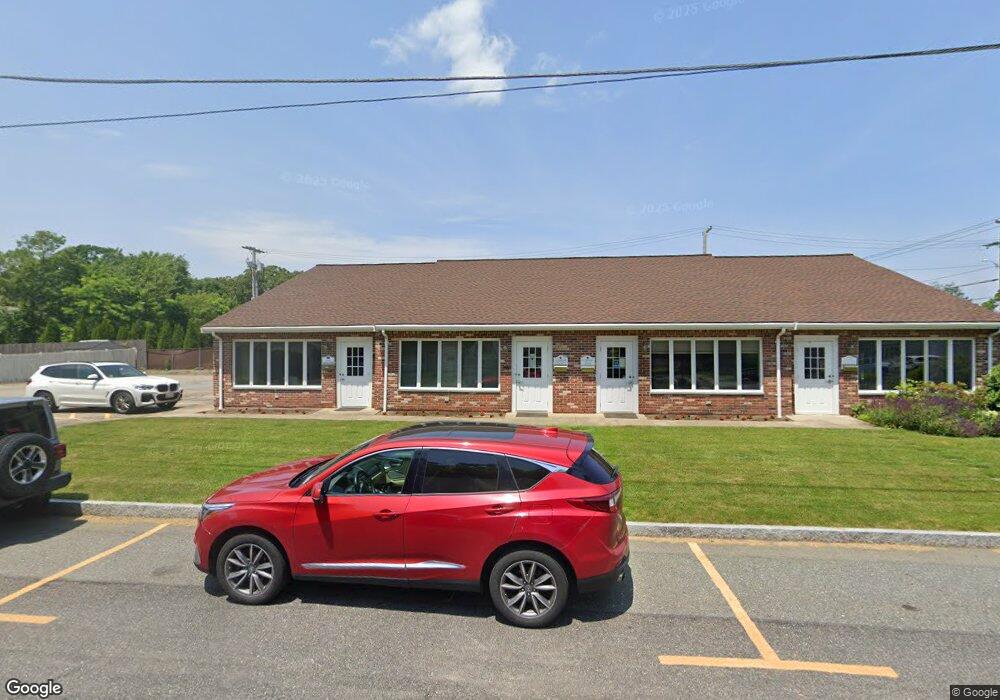
1 Fowler St Mansfield, MA 02048
Estimated Value: $859,218
2
Beds
1
Bath
3,564
Sq Ft
$241/Sq Ft
Est. Value
About This Home
This home is located at 1 Fowler St, Mansfield, MA 02048 and is currently estimated at $859,218, approximately $241 per square foot. 1 Fowler St is a home located in Bristol County with nearby schools including Everett W. Robinson Elementary School, Jordan/Jackson Elementary School, and Harold L. Qualters Middle School.
Ownership History
Date
Name
Owned For
Owner Type
Purchase Details
Closed on
Jul 31, 2014
Sold by
Fowler Street Lp
Bought by
Bun Rt
Current Estimated Value
Home Financials for this Owner
Home Financials are based on the most recent Mortgage that was taken out on this home.
Original Mortgage
$292,500
Outstanding Balance
$160,582
Interest Rate
4.18%
Mortgage Type
Commercial
Estimated Equity
$698,636
Purchase Details
Closed on
Dec 31, 1993
Sold by
Canton Inst For Sb
Bought by
One Fowler St Lp
Home Financials for this Owner
Home Financials are based on the most recent Mortgage that was taken out on this home.
Original Mortgage
$229,500
Interest Rate
7%
Mortgage Type
Commercial
Purchase Details
Closed on
Jun 13, 1988
Sold by
Paulsen Norman S
Bought by
Dei Rt Inc
Home Financials for this Owner
Home Financials are based on the most recent Mortgage that was taken out on this home.
Original Mortgage
$425,000
Interest Rate
10.21%
Mortgage Type
Commercial
Create a Home Valuation Report for This Property
The Home Valuation Report is an in-depth analysis detailing your home's value as well as a comparison with similar homes in the area
Home Values in the Area
Average Home Value in this Area
Purchase History
| Date | Buyer | Sale Price | Title Company |
|---|---|---|---|
| Bun Rt | $390,000 | -- | |
| One Fowler St Lp | $270,000 | -- | |
| Dei Rt Inc | $260,000 | -- |
Source: Public Records
Mortgage History
| Date | Status | Borrower | Loan Amount |
|---|---|---|---|
| Open | Bun Rt | $292,500 | |
| Previous Owner | Dei Rt Inc | $229,500 | |
| Previous Owner | Dei Rt Inc | $425,000 |
Source: Public Records
Tax History Compared to Growth
Tax History
| Year | Tax Paid | Tax Assessment Tax Assessment Total Assessment is a certain percentage of the fair market value that is determined by local assessors to be the total taxable value of land and additions on the property. | Land | Improvement |
|---|---|---|---|---|
| 2025 | $9,985 | $498,000 | $193,500 | $304,500 |
| 2024 | $9,415 | $493,700 | $206,900 | $286,800 |
| 2023 | $9,143 | $493,700 | $206,900 | $286,800 |
| 2022 | $9,085 | $481,200 | $206,900 | $274,300 |
| 2021 | $8,447 | $374,100 | $122,900 | $251,200 |
| 2020 | $8,081 | $374,100 | $122,900 | $251,200 |
| 2019 | $7,647 | $374,100 | $122,900 | $251,200 |
| 2018 | $7,347 | $374,100 | $122,900 | $251,200 |
| 2017 | $7,512 | $374,100 | $122,900 | $251,200 |
| 2016 | $7,841 | $381,000 | $122,900 | $258,100 |
| 2015 | $7,661 | $369,200 | $155,800 | $213,400 |
Source: Public Records
Map
Nearby Homes
- 150 Rumford Ave Unit 110
- 266 N Main St Unit 3
- 73-75 Draper Ave
- 22 Pleasant St Unit C
- 28 Court St
- 82 Brook St
- 619 N Main St
- 12 Spring St
- 233 Central St
- 460 Ware St
- 631 East St Unit E203
- 571 Ware St
- 157 Central St
- 85 Jewell St
- 155 South St
- 14 Claire Ave
- 261 East St
- 18 Columbine Rd
- 84 South St
- 151 Stearns Ave