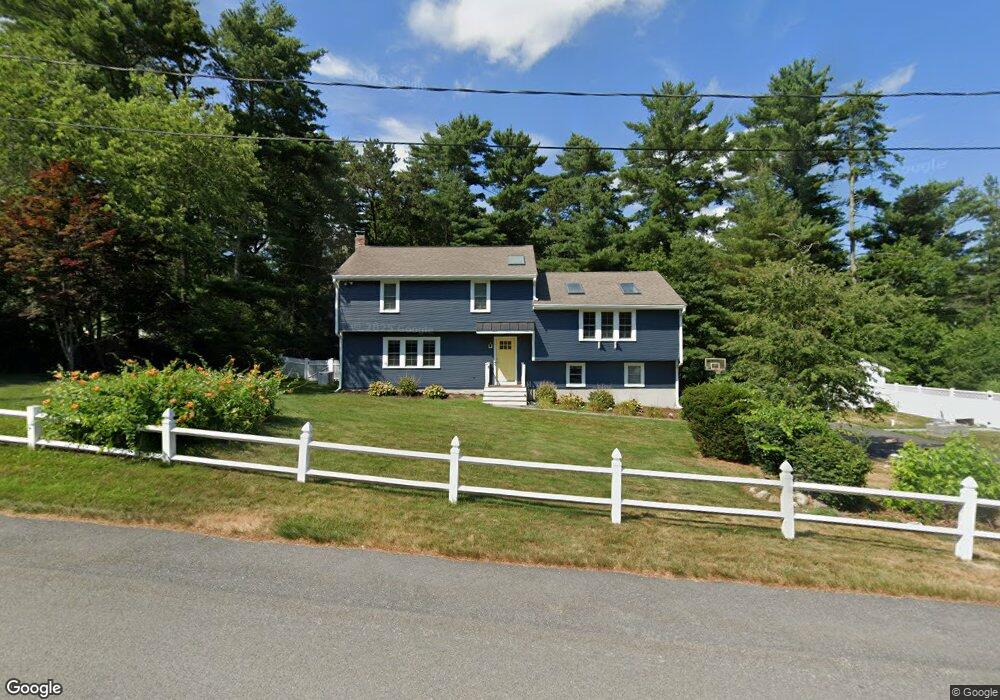
1 Frank St Carver, MA 02330
Estimated Value: $672,000 - $784,000
3
Beds
3
Baths
2,072
Sq Ft
$348/Sq Ft
Est. Value
About This Home
This home is located at 1 Frank St, Carver, MA 02330 and is currently estimated at $721,897, approximately $348 per square foot. 1 Frank St is a home located in Plymouth County with nearby schools including Carver Elementary School and Carver Middle/High School.
Ownership History
Date
Name
Owned For
Owner Type
Purchase Details
Closed on
Jul 12, 2013
Sold by
Forde Patrick and Forde Lara G
Bought by
Salaycik Anthony F
Current Estimated Value
Home Financials for this Owner
Home Financials are based on the most recent Mortgage that was taken out on this home.
Original Mortgage
$270,750
Outstanding Balance
$196,124
Interest Rate
3.83%
Mortgage Type
New Conventional
Estimated Equity
$525,773
Purchase Details
Closed on
Oct 2, 1998
Sold by
Musson Gloria J and Musson Roger E
Bought by
Forde Patrick and Forde Lara G
Home Financials for this Owner
Home Financials are based on the most recent Mortgage that was taken out on this home.
Original Mortgage
$102,500
Interest Rate
6.89%
Mortgage Type
Purchase Money Mortgage
Create a Home Valuation Report for This Property
The Home Valuation Report is an in-depth analysis detailing your home's value as well as a comparison with similar homes in the area
Home Values in the Area
Average Home Value in this Area
Purchase History
| Date | Buyer | Sale Price | Title Company |
|---|---|---|---|
| Salaycik Anthony F | $285,000 | -- | |
| Salaycik Anthony F | $285,000 | -- | |
| Forde Patrick | $174,500 | -- |
Source: Public Records
Mortgage History
| Date | Status | Borrower | Loan Amount |
|---|---|---|---|
| Open | Salaycik Anthony F | $270,750 | |
| Closed | Salaycik Anthony F | $270,750 | |
| Previous Owner | Forde Patrick | $195,000 | |
| Previous Owner | Forde Patrick | $145,000 | |
| Previous Owner | Forde Patrick | $102,500 |
Source: Public Records
Tax History
| Year | Tax Paid | Tax Assessment Tax Assessment Total Assessment is a certain percentage of the fair market value that is determined by local assessors to be the total taxable value of land and additions on the property. | Land | Improvement |
|---|---|---|---|---|
| 2025 | $8,278 | $596,800 | $142,100 | $454,700 |
| 2024 | $7,041 | $496,900 | $139,300 | $357,600 |
| 2023 | $6,774 | $464,300 | $139,300 | $325,000 |
| 2022 | $6,461 | $404,300 | $119,100 | $285,200 |
| 2021 | $6,166 | $364,000 | $106,300 | $257,700 |
| 2020 | $5,931 | $345,000 | $99,400 | $245,600 |
| 2019 | $5,725 | $335,800 | $96,500 | $239,300 |
| 2018 | $5,557 | $315,200 | $96,500 | $218,700 |
| 2017 | $5,321 | $300,800 | $92,800 | $208,000 |
| 2016 | $4,722 | $277,300 | $88,400 | $188,900 |
| 2015 | $4,588 | $269,700 | $88,400 | $181,300 |
| 2014 | $4,720 | $277,500 | $111,800 | $165,700 |
Source: Public Records
Map
Nearby Homes
- 58 Bunnys Rd
- 56 Bunnys Rd
- 13 Pond View Way
- 48 S Meadow Village
- 29 S Meadow Village
- 55 S Meadow Village
- 81 Center St
- 43 S Meadow Rd
- 89 Silva St
- 1 Pinehurst Dr
- 9 Lawrence Rd
- 6 Twin Pines Ln Unit 6
- 6 Deer Hill Ln
- 235 Main St
- 6 Coachman Terrace
- 2 Candlelight Dr
- 19 Coachman Terrace
- 35 Silva St
- 241 Carver Rd Unit 7
- 29 Wyndemere Ct
Your Personal Tour Guide
Ask me questions while you tour the home.