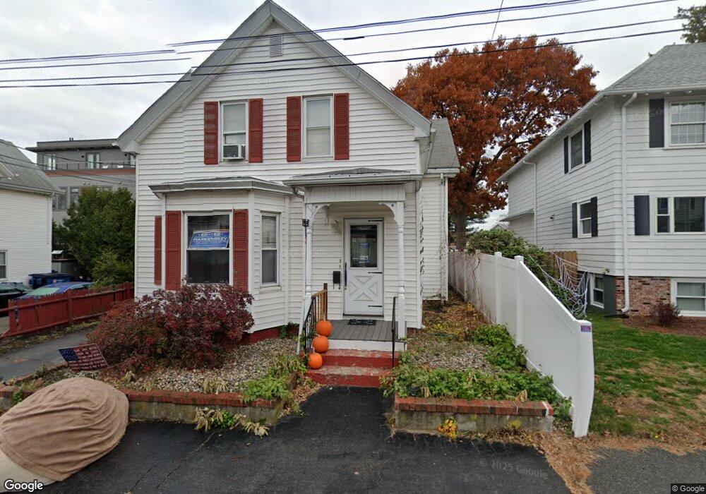
1 Franklin St Wakefield, MA 01880
East Side NeighborhoodEstimated Value: $788,632 - $867,000
4
Beds
2
Baths
1,876
Sq Ft
$440/Sq Ft
Est. Value
About This Home
This home is located at 1 Franklin St, Wakefield, MA 01880 and is currently estimated at $825,158, approximately $439 per square foot. 1 Franklin St is a home located in Middlesex County with nearby schools including Wakefield Memorial High School, Pioneer Charter School Of Science II, and St Joseph School.
Ownership History
Date
Name
Owned For
Owner Type
Purchase Details
Closed on
Dec 23, 1987
Sold by
Rich Susie L Est
Bought by
Rich Rt
Current Estimated Value
Home Financials for this Owner
Home Financials are based on the most recent Mortgage that was taken out on this home.
Original Mortgage
$88,000
Interest Rate
10.67%
Mortgage Type
Purchase Money Mortgage
Create a Home Valuation Report for This Property
The Home Valuation Report is an in-depth analysis detailing your home's value as well as a comparison with similar homes in the area
Home Values in the Area
Average Home Value in this Area
Purchase History
| Date | Buyer | Sale Price | Title Company |
|---|---|---|---|
| Rich Rt | $178,000 | -- |
Source: Public Records
Mortgage History
| Date | Status | Borrower | Loan Amount |
|---|---|---|---|
| Open | Rich Rt | $124,400 | |
| Closed | Rich Rt | $16,000 | |
| Closed | Rich Rt | $88,000 |
Source: Public Records
Tax History
| Year | Tax Paid | Tax Assessment Tax Assessment Total Assessment is a certain percentage of the fair market value that is determined by local assessors to be the total taxable value of land and additions on the property. | Land | Improvement |
|---|---|---|---|---|
| 2025 | $7,864 | $692,900 | $343,000 | $349,900 |
| 2024 | $7,751 | $689,000 | $341,100 | $347,900 |
| 2023 | $7,370 | $628,300 | $311,000 | $317,300 |
| 2022 | $7,050 | $572,200 | $283,300 | $288,900 |
| 2021 | $6,751 | $530,300 | $264,100 | $266,200 |
| 2020 | $6,301 | $493,400 | $244,500 | $248,900 |
| 2019 | $6,017 | $469,000 | $232,400 | $236,600 |
| 2018 | $5,610 | $433,200 | $214,400 | $218,800 |
| 2017 | $5,276 | $404,900 | $200,400 | $204,500 |
| 2016 | $4,985 | $369,500 | $189,600 | $179,900 |
| 2015 | $4,653 | $345,200 | $177,100 | $168,100 |
| 2014 | $4,242 | $331,900 | $170,300 | $161,600 |
Source: Public Records
Map
Nearby Homes
- 38 Bennett St Unit 3D
- 69 Foundry St Unit 310
- 69 Foundry St Unit 416
- 62 Foundry St Unit 310
- 62 Foundry St Unit 312
- 62 Foundry St Unit 204
- 62 Foundry St Unit 202
- 62 Foundry St Unit 208
- 62 Foundry St Unit 414
- 1 Sidney St
- 762 Main St
- 51 Crescent St
- 252 Albion St Unit 3
- 248 Albion St Unit 321
- 199 Nahant St
- 16 Pleasant St
- 0 Everett St
- 34 Cedar St
- 177 Oak St
- 15 Hickory Hill Rd
- 642 Main St Unit 300
- 642 Main St Unit FFL/RT
- 642 Main St Unit 203 203
- 642 Main St Unit 400
- 642 Main St Unit 100
- 642 Main St Unit 302
- 642 Main St Unit 301
- 642 Main St Unit 202
- 642 Main St Unit 201
- 7 Franklin St
- 7 Franklin St Unit 1
- 650 Main St Unit 652
- 640 Main St Unit 4
- 6 Franklin St
- 9 Franklin St
- 9 Franklin St Unit 2
- 2 Franklin St
- 8 Franklin St
- 11 Franklin St
- 666-670 Main St