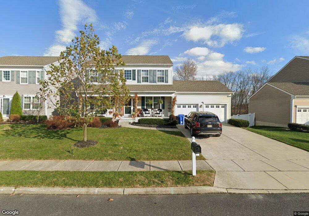
1 Garwood Blvd Clayton, NJ 08312
4
Beds
3
Baths
2,717
Sq Ft
0.26
Acres
About This Home
This home is located at 1 Garwood Blvd, Clayton, NJ 08312. 1 Garwood Blvd is a home located in Gloucester County with nearby schools including Herma S. Simmons Elementary School, Clayton Middle School, and Clayton High School.
Ownership History
Date
Name
Owned For
Owner Type
Purchase Details
Closed on
Dec 18, 2020
Sold by
Hovbros Clayton Urban Renewal Llc
Bought by
Borough Of Clayton
Purchase Details
Closed on
Oct 28, 2015
Sold by
Hovbros Clayton Urban Renewal Llc
Bought by
Borough Of Clayton
Purchase Details
Closed on
May 6, 2005
Sold by
J S Hovnanian & Sons Llc
Bought by
Hovbros Clayton Llc
Purchase Details
Closed on
Jan 9, 2003
Sold by
Clayton Estates Co
Bought by
Skips Properties Llc
Home Financials for this Owner
Home Financials are based on the most recent Mortgage that was taken out on this home.
Original Mortgage
$1,150,000
Interest Rate
6.19%
Mortgage Type
Purchase Money Mortgage
Create a Home Valuation Report for This Property
The Home Valuation Report is an in-depth analysis detailing your home's value as well as a comparison with similar homes in the area
Home Values in the Area
Average Home Value in this Area
Purchase History
| Date | Buyer | Sale Price | Title Company |
|---|---|---|---|
| Borough Of Clayton | -- | None Available | |
| Borough Of Clayton | -- | Surety Title Co Llc | |
| Hovbros Clayton Llc | -- | Certified Title Agency | |
| Skips Properties Llc | $1,000,000 | West Jersey Title Agency |
Source: Public Records
Mortgage History
| Date | Status | Borrower | Loan Amount |
|---|---|---|---|
| Previous Owner | Skips Properties Llc | $1,150,000 |
Source: Public Records
Tax History Compared to Growth
Tax History
| Year | Tax Paid | Tax Assessment Tax Assessment Total Assessment is a certain percentage of the fair market value that is determined by local assessors to be the total taxable value of land and additions on the property. | Land | Improvement |
|---|---|---|---|---|
| 2025 | -- | -- | -- | -- |
| 2024 | -- | $0 | $0 | $0 |
| 2022 | -- | $0 | $0 | $0 |
| 2021 | $11,066 | $0 | $0 | $0 |
| 2020 | $0 | $0 | $0 | $0 |
| 2019 | $0 | $0 | $0 | $0 |
| 2018 | $0 | $0 | $0 | $0 |
| 2017 | $0 | $0 | $0 | $0 |
| 2016 | $0 | $0 | $0 | $0 |
| 2015 | -- | $0 | $0 | $0 |
| 2014 | -- | $0 | $0 | $0 |
Source: Public Records
Map
Nearby Homes
- 13 W Dehart Ave
- 35 W Dehart Ave
- 510 Coleman Dr
- 6 Dubois Ave
- 320 E Clayton Ave
- 216 E Howard St
- 170 S Dennis Dr
- 807 N New St
- 7 Hawthorn Way
- 338 Sugar Hill Dr
- 180 S Dennis Dr
- 125 W Clayton Ave
- 124 W Howard St
- 131 W Clinton St
- 100 Aura Rd Unit 112
- 100 Aura Rd Unit 212
- 100 Aura Rd Unit 311
- 100 Aura Rd Unit 111
- 100 Aura Rd Unit 110
- 238 W Center St
- 21 W Dehart Ave
- 23 W Dehart Ave
- 27 W Dehart Ave
- 29 W Dehart Ave
- 31 W Dehart Ave
- 521 Coleman Dr
- 519 Coleman Dr
- 15 W Dehart Ave
- 523 Coleman Dr
- 517 Coleman Dr
- 33 W Dehart Ave
- 2 Groff St
- 525 Coleman Dr
- 515 Coleman Dr
- 18 W Dehart Ave
- 16 W Dehart Ave
- 20 W Dehart Ave
- 22 W Dehart Ave
- 513 Coleman Dr
- 527 Coleman Dr