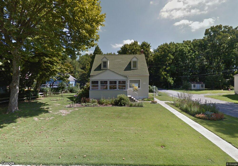
1 Harvey Ct Pennsville, NJ 08070
Estimated Value: $219,000 - $245,000
--
Bed
--
Bath
1,118
Sq Ft
$209/Sq Ft
Est. Value
About This Home
This home is located at 1 Harvey Ct, Pennsville, NJ 08070 and is currently estimated at $233,427, approximately $208 per square foot. 1 Harvey Ct is a home located in Salem County with nearby schools including Valley Park Elementary School, Central Park Elementary School, and Penn Beach Elementary School.
Ownership History
Date
Name
Owned For
Owner Type
Purchase Details
Closed on
Dec 22, 2021
Sold by
Wilson Sr Jeremy D and Wilson Jessica L
Bought by
Wilson Jeremy D and Wilson Jessica L
Current Estimated Value
Home Financials for this Owner
Home Financials are based on the most recent Mortgage that was taken out on this home.
Original Mortgage
$144,000
Outstanding Balance
$132,442
Interest Rate
3.11%
Mortgage Type
New Conventional
Estimated Equity
$100,985
Purchase Details
Closed on
Sep 28, 2007
Sold by
Sassi Patrick C
Bought by
Wilson Jeremy D
Create a Home Valuation Report for This Property
The Home Valuation Report is an in-depth analysis detailing your home's value as well as a comparison with similar homes in the area
Home Values in the Area
Average Home Value in this Area
Purchase History
| Date | Buyer | Sale Price | Title Company |
|---|---|---|---|
| Wilson Jeremy D | -- | Hale Leila H | |
| Wilson Jeremy D | -- | None Listed On Document | |
| Wilson Jeremy D | $157,500 | -- |
Source: Public Records
Mortgage History
| Date | Status | Borrower | Loan Amount |
|---|---|---|---|
| Open | Wilson Jeremy D | $144,000 | |
| Closed | Wilson Jeremy D | $144,000 |
Source: Public Records
Tax History Compared to Growth
Tax History
| Year | Tax Paid | Tax Assessment Tax Assessment Total Assessment is a certain percentage of the fair market value that is determined by local assessors to be the total taxable value of land and additions on the property. | Land | Improvement |
|---|---|---|---|---|
| 2025 | $5,924 | $116,200 | $47,500 | $68,700 |
| 2024 | $5,703 | $116,200 | $47,500 | $68,700 |
| 2023 | $5,703 | $116,200 | $47,500 | $68,700 |
| 2022 | $5,524 | $116,200 | $47,500 | $68,700 |
| 2021 | $5,372 | $116,200 | $47,500 | $68,700 |
| 2020 | $5,209 | $116,200 | $47,500 | $68,700 |
| 2019 | $4,951 | $116,200 | $47,500 | $68,700 |
| 2018 | $4,774 | $116,200 | $47,500 | $68,700 |
| 2017 | $4,605 | $116,200 | $47,500 | $68,700 |
| 2016 | $4,238 | $116,200 | $47,500 | $68,700 |
| 2015 | $4,044 | $116,200 | $47,500 | $68,700 |
| 2014 | $3,936 | $116,200 | $47,500 | $68,700 |
Source: Public Records
Map
Nearby Homes
- 23 Churchtown Rd
- 0 Kent Ave
- 20 Church Landing Rd
- 11 Leap Ct
- 240 N Broadway
- Part of Lot 34 Heron Ave
- 12 Johnstone St
- 33 Meadow Rd
- 20 Grace Ave
- 18 Cedar St
- 6 Sunset Ave
- 176 N Broadway
- 88 Church Landing Rd
- 187 N River Dr
- 51 Marlyn Ave
- 1 Victory Ave Unit 55
- 1 Victory Ave Unit 27
- 1 Victory Ave Unit 74
- 1 Victory Ave Unit 8
- 1 Victory Ave Unit 100
- 50 Churchtown Rd
- 46 Churchtown Rd
- 44 Churchtown Rd
- 54 Churchtown Rd
- 36 Churchtown Rd
- 301 Churchtown Rd
- 43 Churchtown Rd
- 34 Churchtown Rd
- 39 Churchtown Rd
- 45 Churchtown Rd
- 37 Churchtown Rd
- 47 Churchtown Rd
- 35 Churchtown Rd
- 333 Washington Dr
- 331 Washington Dr
- 33 Churchtown Rd
- 30 Churchtown Rd Unit FRONT
- 30 Churchtown Rd
- 30 1/2 Churchtown Rd
- 31 Churchtown Rd