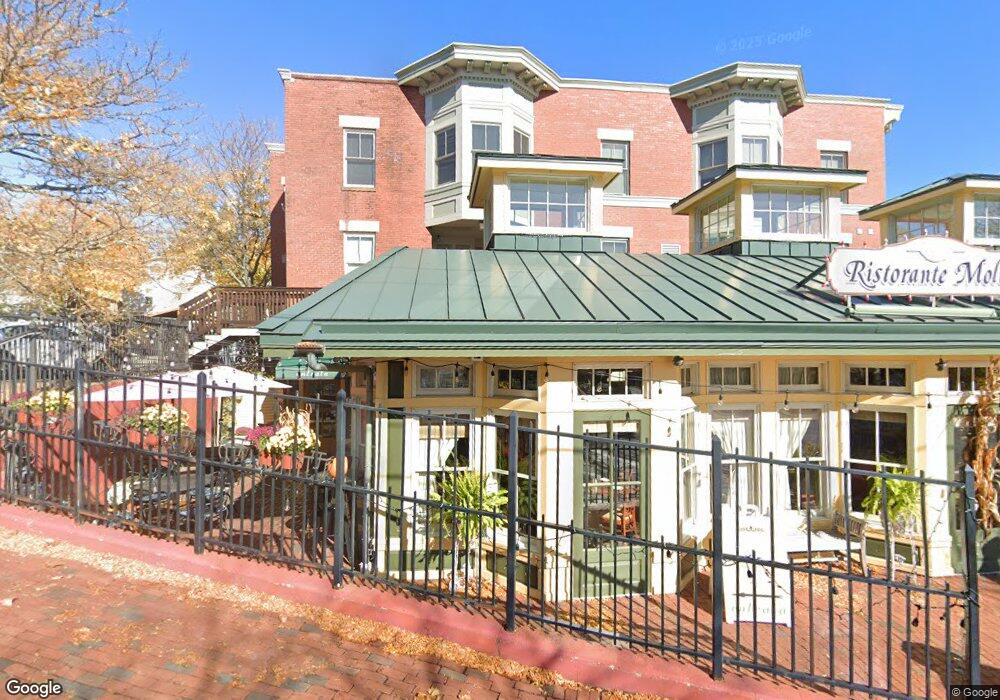
1 High St Unit C Amesbury, MA 01913
Estimated Value: $295,000 - $424,000
1
Bed
1
Bath
578
Sq Ft
$592/Sq Ft
Est. Value
About This Home
This home is located at 1 High St Unit C, Amesbury, MA 01913 and is currently estimated at $342,213, approximately $592 per square foot. 1 High St Unit C is a home located in Essex County with nearby schools including Amesbury High School and Amesbury Seventh-Day Adventist School.
Ownership History
Date
Name
Owned For
Owner Type
Purchase Details
Closed on
Aug 26, 2011
Sold by
Hume Elizabeth
Bought by
Pesce Richard and Pesce Kelly
Current Estimated Value
Purchase Details
Closed on
Feb 28, 2006
Sold by
Knott Elizabeth A
Bought by
Hume Elizabeth
Home Financials for this Owner
Home Financials are based on the most recent Mortgage that was taken out on this home.
Original Mortgage
$159,920
Interest Rate
6.17%
Mortgage Type
Purchase Money Mortgage
Purchase Details
Closed on
Oct 15, 2003
Sold by
Solari Market Sq Corp
Bought by
Knott Elizabeth A
Home Financials for this Owner
Home Financials are based on the most recent Mortgage that was taken out on this home.
Original Mortgage
$169,900
Interest Rate
6.43%
Mortgage Type
Purchase Money Mortgage
Create a Home Valuation Report for This Property
The Home Valuation Report is an in-depth analysis detailing your home's value as well as a comparison with similar homes in the area
Home Values in the Area
Average Home Value in this Area
Purchase History
| Date | Buyer | Sale Price | Title Company |
|---|---|---|---|
| Pesce Richard | $75,000 | -- | |
| Hume Elizabeth | $199,900 | -- | |
| Knott Elizabeth A | $179,900 | -- |
Source: Public Records
Mortgage History
| Date | Status | Borrower | Loan Amount |
|---|---|---|---|
| Previous Owner | Knott Elizabeth A | $159,920 | |
| Previous Owner | Knott Elizabeth A | $29,950 | |
| Previous Owner | Knott Elizabeth A | $169,900 |
Source: Public Records
Tax History Compared to Growth
Tax History
| Year | Tax Paid | Tax Assessment Tax Assessment Total Assessment is a certain percentage of the fair market value that is determined by local assessors to be the total taxable value of land and additions on the property. | Land | Improvement |
|---|---|---|---|---|
| 2025 | $4,582 | $299,500 | $0 | $299,500 |
| 2024 | $4,403 | $281,500 | $0 | $281,500 |
| 2023 | $3,176 | $194,400 | $0 | $194,400 |
| 2022 | $3,396 | $192,000 | $0 | $192,000 |
| 2021 | $3,351 | $183,600 | $0 | $183,600 |
| 2020 | $3,051 | $177,600 | $0 | $177,600 |
| 2019 | $3,020 | $164,400 | $0 | $164,400 |
| 2018 | $2,999 | $157,900 | $0 | $157,900 |
| 2017 | $3,098 | $155,300 | $0 | $155,300 |
| 2016 | $2,945 | $145,200 | $0 | $145,200 |
| 2015 | $2,828 | $137,700 | $0 | $137,700 |
| 2014 | $2,888 | $137,700 | $0 | $137,700 |
Source: Public Records
Map
Nearby Homes
- 13 High St Unit 2
- 4 Clark St
- 37 Millyard Unit 204
- 5 Richs Ct Unit 3
- 4 Winter St
- 97 Elm St
- 25 Cedar St Unit 4
- 25 Cedar St Unit 14
- 25 Cedar St Unit 7
- 25 Cedar St Unit 3
- 118 Elm St
- 3 Arlington St
- 101 Market St Unit B
- 101 Market St Unit A
- 105 Market St Unit B
- 93 Friend St
- 48 Orchard St
- 161 Elm St Unit A
- 22 Huntington Ave
- 18 E Greenwood St
- 1 High St Unit F
- 1 High St Unit E
- 1 High St Unit D
- 1 High St Unit B
- 1 High St Unit A
- 5 Birchwood Court Unit 203 Unit 203
- 1 Market St
- 123 Confidential Way
- 24 Market St
- 16 Market St
- 18 Market St
- 22 Market St
- 28 Market St
- 28 Market St Unit 2
- 28 Market St Unit 3
- 7 Linwood Place
- 1 Main St
- 5 Market Square Unit 207
- 5 Market Square Unit 105
- 5 Market Square Unit 206A