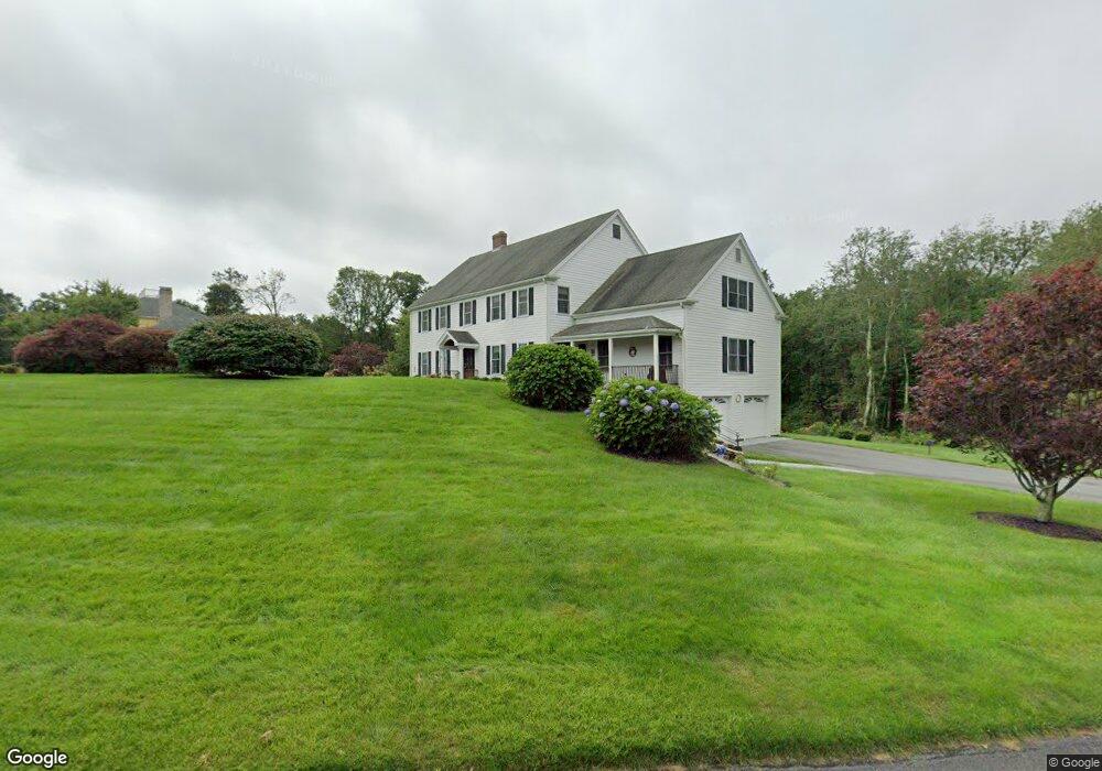
1 Highridge Rd Westport, MA 02790
Estimated Value: $596,000 - $1,243,000
5
Beds
--
Bath
4,073
Sq Ft
$245/Sq Ft
Est. Value
About This Home
This home is located at 1 Highridge Rd, Westport, MA 02790 and is currently estimated at $999,550, approximately $245 per square foot. 1 Highridge Rd is a home located in Bristol County with nearby schools including Alice A. Macomber Primary School, Westport Elementary School, and Westport Middle-High School.
Ownership History
Date
Name
Owned For
Owner Type
Purchase Details
Closed on
Feb 17, 2015
Sold by
Nickerson Sharon L and Brick John W
Bought by
Brick John W
Current Estimated Value
Purchase Details
Closed on
Oct 18, 1999
Sold by
Patys Sherry L
Bought by
Nickerson Sharon L
Home Financials for this Owner
Home Financials are based on the most recent Mortgage that was taken out on this home.
Original Mortgage
$265,000
Interest Rate
7.8%
Mortgage Type
Purchase Money Mortgage
Purchase Details
Closed on
Oct 30, 1996
Sold by
Neves Bernard and Woollam Gordon
Bought by
Patys Sherry L
Home Financials for this Owner
Home Financials are based on the most recent Mortgage that was taken out on this home.
Original Mortgage
$150,000
Interest Rate
8.07%
Mortgage Type
Purchase Money Mortgage
Create a Home Valuation Report for This Property
The Home Valuation Report is an in-depth analysis detailing your home's value as well as a comparison with similar homes in the area
Home Values in the Area
Average Home Value in this Area
Purchase History
| Date | Buyer | Sale Price | Title Company |
|---|---|---|---|
| Brick John W | -- | -- | |
| Nickerson Sharon L | $372,000 | -- | |
| Patys Sherry L | $350,000 | -- |
Source: Public Records
Mortgage History
| Date | Status | Borrower | Loan Amount |
|---|---|---|---|
| Previous Owner | Patys Sherry L | $265,000 | |
| Previous Owner | Patys Sherry L | $150,000 |
Source: Public Records
Tax History Compared to Growth
Tax History
| Year | Tax Paid | Tax Assessment Tax Assessment Total Assessment is a certain percentage of the fair market value that is determined by local assessors to be the total taxable value of land and additions on the property. | Land | Improvement |
|---|---|---|---|---|
| 2025 | $5,325 | $714,800 | $265,200 | $449,600 |
| 2024 | $5,126 | $663,100 | $223,700 | $439,400 |
| 2023 | $5,272 | $646,100 | $213,800 | $432,300 |
| 2022 | $4,987 | $588,100 | $199,000 | $389,100 |
| 2021 | $4,846 | $562,200 | $182,200 | $380,000 |
| 2020 | $4,604 | $546,200 | $175,400 | $370,800 |
| 2019 | $4,634 | $560,300 | $188,400 | $371,900 |
| 2018 | $4,565 | $558,700 | $175,300 | $383,400 |
| 2017 | $4,489 | $563,200 | $175,300 | $387,900 |
| 2016 | $4,130 | $522,100 | $175,300 | $346,800 |
| 2015 | $4,035 | $508,800 | $179,000 | $329,800 |
Source: Public Records
Map
Nearby Homes
- 73 White Oak Run
- 47 Fallon Dr
- 0 Hidden Glen Ln
- 118 Charlotte White Rd Extension
- Lot 0 Marcotte
- 8 Strawberry Ln
- 920 Drift Rd
- 225 Hixbridge Rd
- 2 Slades Farm Ln
- 118 Charlotte White Rd
- 4 Main Rd
- 7 Village Way
- 8 Village Way
- 15 Village Way
- 837 Main Rd
- 3 Roller Coaster Way Unit Lot 1
- 27 Dias Ave
- 101 Adamsville Rd
- 461 Reed Rd
- 1150 Russells Mills Rd
- 25 Highridge Rd
- 14 Highridge Rd
- 8 Highridge Rd
- 31 Highridge Rd
- 20 Highridge Rd
- 26 Highridge Rd
- 2 Highridge Rd
- 37 Highridge Rd
- 0 Highridge Rd
- 1T Highridge Rd
- 34 Highridge Rd
- 430 Pine Hill Rd
- 40 Highridge Rd
- 43 Highridge Rd
- 434 Pine Hill Rd
- 46 Highridge Rd
- 422 Pine Hill Rd
- 422 Pine Hill Rd Unit n/a
- 49 Highridge Rd
- 400 Pine Hill Rd