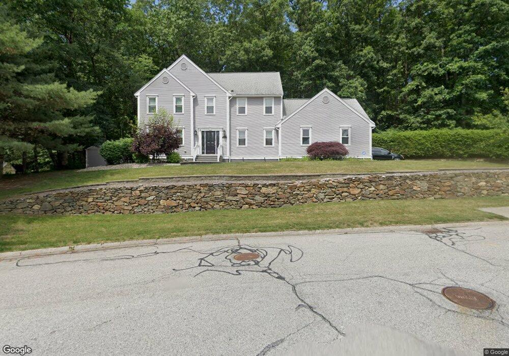
1 Keith David Dr Millbury, MA 01527
Estimated Value: $628,000 - $800,000
4
Beds
3
Baths
2,265
Sq Ft
$319/Sq Ft
Est. Value
About This Home
This home is located at 1 Keith David Dr, Millbury, MA 01527 and is currently estimated at $721,944, approximately $318 per square foot. 1 Keith David Dr is a home located in Worcester County with nearby schools including Elmwood Street Elementary School, Raymond E. Shaw Elementary School, and Millbury Junior/Senior High School.
Ownership History
Date
Name
Owned For
Owner Type
Purchase Details
Closed on
May 28, 1999
Sold by
Sutton Gary L and Sutton Deborah L
Bought by
Roy Roger W and Roy Judith A
Current Estimated Value
Home Financials for this Owner
Home Financials are based on the most recent Mortgage that was taken out on this home.
Original Mortgage
$180,000
Outstanding Balance
$46,573
Interest Rate
6.82%
Mortgage Type
Purchase Money Mortgage
Estimated Equity
$675,371
Purchase Details
Closed on
Oct 24, 1996
Sold by
Longwood Dev Corp
Bought by
Sutton Gary L and Sutton Deborah
Create a Home Valuation Report for This Property
The Home Valuation Report is an in-depth analysis detailing your home's value as well as a comparison with similar homes in the area
Home Values in the Area
Average Home Value in this Area
Purchase History
| Date | Buyer | Sale Price | Title Company |
|---|---|---|---|
| Roy Roger W | $260,000 | -- | |
| Roy Roger W | $260,000 | -- | |
| Sutton Gary L | $252,312 | -- | |
| Sutton Gary L | $252,312 | -- |
Source: Public Records
Mortgage History
| Date | Status | Borrower | Loan Amount |
|---|---|---|---|
| Open | Sutton Gary L | $90,000 | |
| Open | Sutton Gary L | $180,000 | |
| Closed | Sutton Gary L | $180,000 |
Source: Public Records
Tax History Compared to Growth
Tax History
| Year | Tax Paid | Tax Assessment Tax Assessment Total Assessment is a certain percentage of the fair market value that is determined by local assessors to be the total taxable value of land and additions on the property. | Land | Improvement |
|---|---|---|---|---|
| 2025 | $8,066 | $602,400 | $120,500 | $481,900 |
| 2024 | $7,295 | $551,400 | $111,600 | $439,800 |
| 2023 | $6,797 | $470,400 | $78,300 | $392,100 |
| 2022 | $6,116 | $407,700 | $78,300 | $329,400 |
| 2021 | $6,027 | $390,600 | $78,300 | $312,300 |
| 2020 | $7,651 | $384,900 | $78,300 | $306,600 |
| 2019 | $5,865 | $370,000 | $77,900 | $292,100 |
| 2018 | $5,812 | $355,700 | $77,900 | $277,800 |
| 2017 | $7,291 | $329,300 | $77,900 | $251,400 |
| 2016 | $5,277 | $320,600 | $77,900 | $242,700 |
| 2015 | $5,112 | $310,600 | $79,200 | $231,400 |
| 2014 | $4,978 | $291,100 | $82,800 | $208,300 |
Source: Public Records
Map
Nearby Homes
- 52 Clearview Terrace Unit 39
- 14 Howe Ln
- 15 Clearview Terrace Unit 68
- 12 Alstead Path
- 64 Millbury Ave
- 90 Park Hill Ave
- 123 Riverlin St
- 1 Broadmeadow Ave
- 7 Heather Ave
- 17 Atwood Ave
- 2 Diane St
- 5- 33 Tainter Hill Rd Unit 33A
- 5- 33 Tainter Hill Rd
- 330 Millbury Ave
- 33 Tainter Hill Rd Unit 33B
- 1295 Millbury St Unit B
- 457 Granite St
- 54 Park Hill Rd
- 12 Irene Ct
- 422 Granite St
- 13 Wingfoot Ln
- 3 Keith David Dr
- 5 Matthew Cir
- 16 Hayward Glen Dr
- 15 Hayward Glen Dr
- 3 Matthew Cir
- 10 Wingfoot Ln
- 11 Wingfoot Ln
- 2 Augusta Dr
- 14 Hayward Glen Dr
- 8 Wingfoot Ln
- 6 Keith David Dr
- 13 Hayward Glen Dr
- 9 Wingfoot Ln
- 4 Matthew Cir
- 4 Augusta Dr
- 12 Hayward Glen Dr
- 8 Keith David Dr
- 2 Matthew Cir
- 3 Augusta Dr