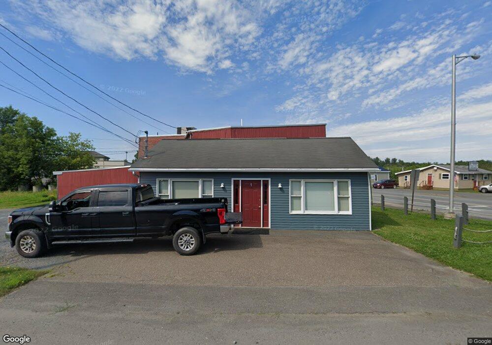
1 Kendall St Houlton, ME 04730
Estimated Value: $151,227
--
Bed
--
Bath
640
Sq Ft
$236/Sq Ft
Est. Value
About This Home
This home is located at 1 Kendall St, Houlton, ME 04730 and is currently estimated at $151,227, approximately $236 per square foot. 1 Kendall St is a home located in Aroostook County with nearby schools including Houlton Elementary School, Houlton Southside School, and Houlton Junior High School.
Ownership History
Date
Name
Owned For
Owner Type
Purchase Details
Closed on
Aug 31, 2022
Sold by
Kofstad Realty Hldg Llc
Bought by
Bates Fuel Inc
Current Estimated Value
Home Financials for this Owner
Home Financials are based on the most recent Mortgage that was taken out on this home.
Original Mortgage
$105,000
Outstanding Balance
$100,544
Interest Rate
5.54%
Mortgage Type
Commercial
Estimated Equity
$50,683
Create a Home Valuation Report for This Property
The Home Valuation Report is an in-depth analysis detailing your home's value as well as a comparison with similar homes in the area
Home Values in the Area
Average Home Value in this Area
Purchase History
| Date | Buyer | Sale Price | Title Company |
|---|---|---|---|
| Bates Fuel Inc | $125,000 | None Available |
Source: Public Records
Mortgage History
| Date | Status | Borrower | Loan Amount |
|---|---|---|---|
| Open | Bates Fuel Inc | $105,000 |
Source: Public Records
Tax History Compared to Growth
Tax History
| Year | Tax Paid | Tax Assessment Tax Assessment Total Assessment is a certain percentage of the fair market value that is determined by local assessors to be the total taxable value of land and additions on the property. | Land | Improvement |
|---|---|---|---|---|
| 2024 | $1,703 | $87,800 | $9,600 | $78,200 |
| 2023 | $1,809 | $87,800 | $9,600 | $78,200 |
| 2022 | $1,089 | $48,200 | $14,300 | $33,900 |
| 2021 | $1,089 | $48,200 | $14,300 | $33,900 |
| 2020 | $962 | $42,300 | $14,300 | $28,000 |
| 2019 | $941 | $42,300 | $14,300 | $28,000 |
| 2018 | $941 | $42,300 | $14,300 | $28,000 |
| 2017 | $941 | $42,300 | $14,300 | $28,000 |
| 2016 | $941 | $42,300 | $14,300 | $28,000 |
| 2015 | $920 | $42,300 | $14,300 | $28,000 |
| 2014 | $972 | $44,700 | $16,700 | $28,000 |
| 2013 | $972 | $44,700 | $16,700 | $28,000 |
Source: Public Records
Map
Nearby Homes
- 16 Bangor St
- 20 Bangor St
- Lot 12 Bangor St
- 7 Kendall St
- 01 Bangor Rd
- 12 Kendall St
- M12L11 Off Bangor Rd
- 1 Market Square
- 34 Military St
- 2 Market Square
- 0 Rural Route 2
- 0 U S 1 Route Unit 982664
- M2L38 Rt 2 County Rd
- Lot 2-3 Us Route 2a
- 9 Market Square
- 6-10 Market Square
- 34 Bangor St
- 0 Military St
- 23 Court St
- 23 Market Square