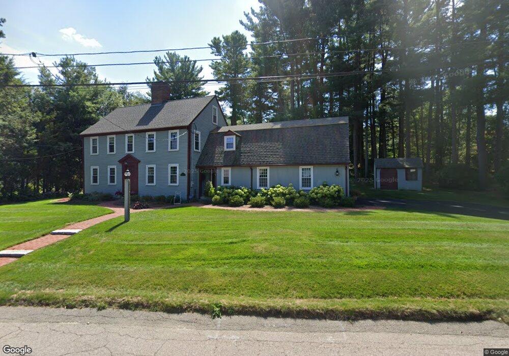
1 King Philip Path Hingham, MA 02043
South Hingham NeighborhoodEstimated Value: $1,238,732 - $1,469,000
4
Beds
3
Baths
2,477
Sq Ft
$539/Sq Ft
Est. Value
About This Home
This home is located at 1 King Philip Path, Hingham, MA 02043 and is currently estimated at $1,335,933, approximately $539 per square foot. 1 King Philip Path is a home located in Plymouth County with nearby schools including South Elementary School, Hingham Middle School, and Hingham High School.
Ownership History
Date
Name
Owned For
Owner Type
Purchase Details
Closed on
Jan 26, 2001
Sold by
Queens Anne Rt and Ayers Kathleen
Bought by
Power Mary M
Current Estimated Value
Home Financials for this Owner
Home Financials are based on the most recent Mortgage that was taken out on this home.
Original Mortgage
$275,000
Outstanding Balance
$101,637
Interest Rate
7.39%
Mortgage Type
Purchase Money Mortgage
Estimated Equity
$1,234,296
Create a Home Valuation Report for This Property
The Home Valuation Report is an in-depth analysis detailing your home's value as well as a comparison with similar homes in the area
Home Values in the Area
Average Home Value in this Area
Purchase History
| Date | Buyer | Sale Price | Title Company |
|---|---|---|---|
| Power Mary M | $545,000 | -- |
Source: Public Records
Mortgage History
| Date | Status | Borrower | Loan Amount |
|---|---|---|---|
| Open | Power Mary M | $275,000 |
Source: Public Records
Tax History
| Year | Tax Paid | Tax Assessment Tax Assessment Total Assessment is a certain percentage of the fair market value that is determined by local assessors to be the total taxable value of land and additions on the property. | Land | Improvement |
|---|---|---|---|---|
| 2025 | $11,425 | $1,068,800 | $457,200 | $611,600 |
| 2024 | $11,020 | $1,015,700 | $457,200 | $558,500 |
| 2023 | $9,656 | $965,600 | $457,200 | $508,400 |
| 2022 | $8,796 | $760,900 | $352,900 | $408,000 |
| 2021 | $8,615 | $730,100 | $352,900 | $377,200 |
| 2020 | $8,334 | $722,800 | $352,900 | $369,900 |
| 2019 | $8,260 | $699,400 | $352,900 | $346,500 |
| 2018 | $8,232 | $699,400 | $352,900 | $346,500 |
| 2017 | $7,831 | $639,300 | $361,000 | $278,300 |
| 2016 | $7,770 | $622,100 | $343,800 | $278,300 |
| 2015 | $7,591 | $605,800 | $327,500 | $278,300 |
Source: Public Records
Map
Nearby Homes
- 12 Country Dr
- 100 Whiting St
- 1 Kerri Ln
- 4 Kerri Ln
- 17 Pine Haven Cir
- 183 Gardner St
- 214 Washington St Unit 24
- 214 Washington St Unit 28
- 22 Longmeadow Rd
- 18 Colby St
- 18 Whiting Ln
- 5 Blueberry Ct
- 8 Blueberry Ct
- 55 Turner Rd
- 9 Mast Hill Rd
- 5 Old County Rd
- 49 Washington Park Dr
- 251 Prospect St
- 18 Winterberry Ln
- 738 Whiting St
- 6 Queen Anne Ln
- 3 King Philip Path
- 2 King Philip Path
- 3 Queen Anne Ln
- 4 King Philip Path
- 8 Queen Anne Ln
- 1 Queen Anne Ln
- 2 Queen Anne Ln
- 1186 Main St
- 5 Queen Anne Ln
- 7 Queen Anne Ln
- 5 King Philip Path
- 6 King Philip Path
- 9 Queen Anne Ln
- 1166 Main St
- 10 Queen Anne Ln
- 8 King Philip Path
- 12 Queen Anne Ln
- 1187 Main St
- 1175 Main St
Your Personal Tour Guide
Ask me questions while you tour the home.