Estimated Value: $206,000 - $270,000
4
Beds
4
Baths
2,044
Sq Ft
$112/Sq Ft
Est. Value
About This Home
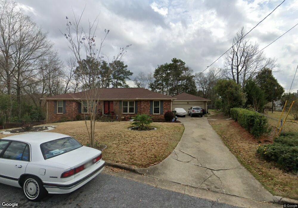
This home is located at 1 Knight Ct, Columbus, GA 31906 and is currently estimated at $229,017, approximately $112 per square foot. 1 Knight Ct is a home located in Muscogee County with nearby schools including Rigdon Road Elementary School, Richards Middle School, and Hardaway High School.
Ownership History
Date
Name
Owned For
Owner Type
Purchase Details
Closed on
Dec 6, 2013
Sold by
Kennon Realty Svcs Inc
Bought by
Iverson Joe N
Current Estimated Value
Home Financials for this Owner
Home Financials are based on the most recent Mortgage that was taken out on this home.
Original Mortgage
$155,000
Outstanding Balance
$115,760
Interest Rate
4.19%
Mortgage Type
VA
Estimated Equity
$113,257
Purchase Details
Closed on
Jul 2, 2013
Sold by
Jackson Lawton
Bought by
Kennon Realty Svcs Inc
Create a Home Valuation Report for This Property
The Home Valuation Report is an in-depth analysis detailing your home's value as well as a comparison with similar homes in the area
Home Values in the Area
Average Home Value in this Area
Purchase History
| Date | Buyer | Sale Price | Title Company |
|---|---|---|---|
| Iverson Joe N | $155,000 | -- | |
| Kennon Realty Svcs Inc | $75,000 | -- |
Source: Public Records
Mortgage History
| Date | Status | Borrower | Loan Amount |
|---|---|---|---|
| Open | Iverson Joe N | $155,000 |
Source: Public Records
Tax History Compared to Growth
Tax History
| Year | Tax Paid | Tax Assessment Tax Assessment Total Assessment is a certain percentage of the fair market value that is determined by local assessors to be the total taxable value of land and additions on the property. | Land | Improvement |
|---|---|---|---|---|
| 2025 | -- | $68,752 | $7,332 | $61,420 |
| 2024 | -- | $68,752 | $7,332 | $61,420 |
| 2023 | $0 | $68,752 | $7,332 | $61,420 |
| 2022 | $0 | $56,704 | $7,332 | $49,372 |
| 2021 | $0 | $56,392 | $7,332 | $49,060 |
| 2020 | $0 | $56,392 | $7,332 | $49,060 |
| 2019 | $2,010 | $56,392 | $7,332 | $49,060 |
| 2018 | $0 | $56,392 | $7,332 | $49,060 |
| 2017 | $0 | $56,392 | $7,332 | $49,060 |
| 2016 | $2,010 | $62,000 | $5,289 | $56,711 |
| 2015 | $2,013 | $62,000 | $5,289 | $56,711 |
| 2014 | $2,016 | $62,000 | $5,289 | $56,711 |
| 2013 | -- | $44,210 | $5,289 | $38,921 |
Source: Public Records
Map
Nearby Homes
- 3570 Stratford Dr
- 1312 Glenwood Rd
- 937 Diggs Ave
- 938 Diggs Ave
- 1061 Dunbar Ave
- 3122 Glenwood Dr
- 3319 Decatur St
- 3415 Terminal St
- 1459 Alta Vista Dr
- 1047 Fisk Ave
- 3414 Terminal St
- 1553 Violet Ave
- 1301 Rigdon Rd
- 776 Terminal Ct
- 3413 Terminal Ct
- 1554 Holland Ave
- 3560 Woodland Dr
- 3562 Woodland Dr
- 939 Pembrook Dr
- 800 Morris Rd