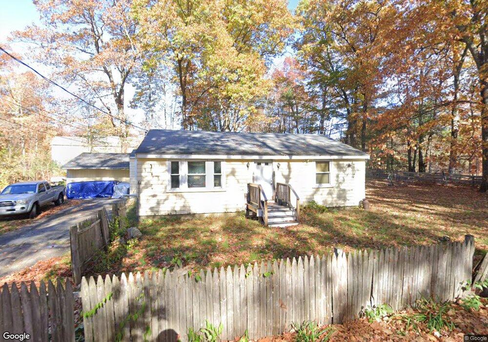
1 Lake Attitash Rd Amesbury, MA 01913
Estimated Value: $512,000 - $623,000
2
Beds
1
Bath
1,044
Sq Ft
$531/Sq Ft
Est. Value
About This Home
This home is located at 1 Lake Attitash Rd, Amesbury, MA 01913 and is currently estimated at $554,833, approximately $531 per square foot. 1 Lake Attitash Rd is a home located in Essex County with nearby schools including Amesbury High School.
Ownership History
Date
Name
Owned For
Owner Type
Purchase Details
Closed on
Dec 11, 2023
Sold by
Donahue Edward D
Bought by
E D Jr & C A Donahue Lt and Donahue
Current Estimated Value
Purchase Details
Closed on
Aug 21, 2009
Sold by
Leblanc 2Nd Joseph W and Leblanc Suzanne
Bought by
Wilson Lauren E
Home Financials for this Owner
Home Financials are based on the most recent Mortgage that was taken out on this home.
Original Mortgage
$293,584
Interest Rate
5.19%
Mortgage Type
Purchase Money Mortgage
Purchase Details
Closed on
Feb 18, 2005
Sold by
Pearson 3Rd Carl R and Pearson Ivonne M
Bought by
Donahue Edward D
Purchase Details
Closed on
Jun 30, 1999
Sold by
Merrill Thomas E and Merrill Louise A
Bought by
Kokaras Pamela A
Purchase Details
Closed on
May 22, 1995
Sold by
Cliff Elsie A and Cliff Philip W
Bought by
Merrill Thomas E and Merrill Louise A
Create a Home Valuation Report for This Property
The Home Valuation Report is an in-depth analysis detailing your home's value as well as a comparison with similar homes in the area
Home Values in the Area
Average Home Value in this Area
Purchase History
| Date | Buyer | Sale Price | Title Company |
|---|---|---|---|
| E D Jr & C A Donahue Lt | -- | None Available | |
| Wilson Lauren E | $299,000 | -- | |
| Donahue Edward D | $230,000 | -- | |
| Kokaras Pamela A | $137,000 | -- | |
| Merrill Thomas E | $50,000 | -- |
Source: Public Records
Mortgage History
| Date | Status | Borrower | Loan Amount |
|---|---|---|---|
| Previous Owner | Merrill Thomas E | $138,000 | |
| Previous Owner | Merrill Thomas E | $293,584 |
Source: Public Records
Tax History Compared to Growth
Tax History
| Year | Tax Paid | Tax Assessment Tax Assessment Total Assessment is a certain percentage of the fair market value that is determined by local assessors to be the total taxable value of land and additions on the property. | Land | Improvement |
|---|---|---|---|---|
| 2025 | $6,539 | $427,400 | $191,800 | $235,600 |
| 2024 | $6,350 | $406,000 | $187,100 | $218,900 |
| 2023 | $6,173 | $377,800 | $170,100 | $207,700 |
| 2022 | $5,785 | $327,000 | $136,000 | $191,000 |
| 2021 | $5,780 | $316,700 | $136,000 | $180,700 |
| 2020 | $5,326 | $310,000 | $136,000 | $174,000 |
| 2019 | $4,776 | $260,000 | $129,600 | $130,400 |
| 2018 | $4,782 | $251,800 | $123,400 | $128,400 |
| 2017 | $5,111 | $256,200 | $144,000 | $112,200 |
| 2016 | $5,092 | $251,100 | $144,000 | $107,100 |
| 2015 | $4,831 | $235,200 | $144,000 | $91,200 |
| 2014 | $4,800 | $228,900 | $144,000 | $84,900 |
Source: Public Records
Map
Nearby Homes
- 4 Acadia Kimball Rd
- 1 Acadia Kimball Rd Unit 1
- 20 Hillside Ct
- 1 Bisson Ln
- 160 Haverhill Rd
- 2 Alnette Rd
- 3 Greystone Rd
- 10 Sharon Cir
- 5 Moncrief St Unit 5
- 188 Lions Mouth Rd
- 3 B St
- 6 B St
- 34 Emery St
- 1 Tuxbury Ln
- 31 Whitter Meadows Dr Unit 31
- 152 Kimball Rd
- 61 E Main St
- 129 Friend St
- 49 W Greenwood St
- 16 Glen Devin St
- X Lake Attitash Rd
- 36 Spindle Tree Ln
- 3 Lake Attitash Rd
- 10 Whitewood Cir
- 8 Whitewood Cir
- 2A Lake Attitash Rd
- 2 Lake Attitash Rd
- 5 Lake Attitash Rd
- 33 Spindle Tree Ln
- 4 Lake Attitash Rd Unit A
- 4 Lake Attitash Rd
- 4A Lake Attitash Rd
- 6 Whitewood Cir
- 7 Lake Attitash Rd
- 12 Whitewood Cir
- 9 Lake Attitash Rd
- 31 Spindle Tree Ln
- 4 Whitewood Cir
- 6 Lake Attitash Rd
- 11 Lake Attitash Rd