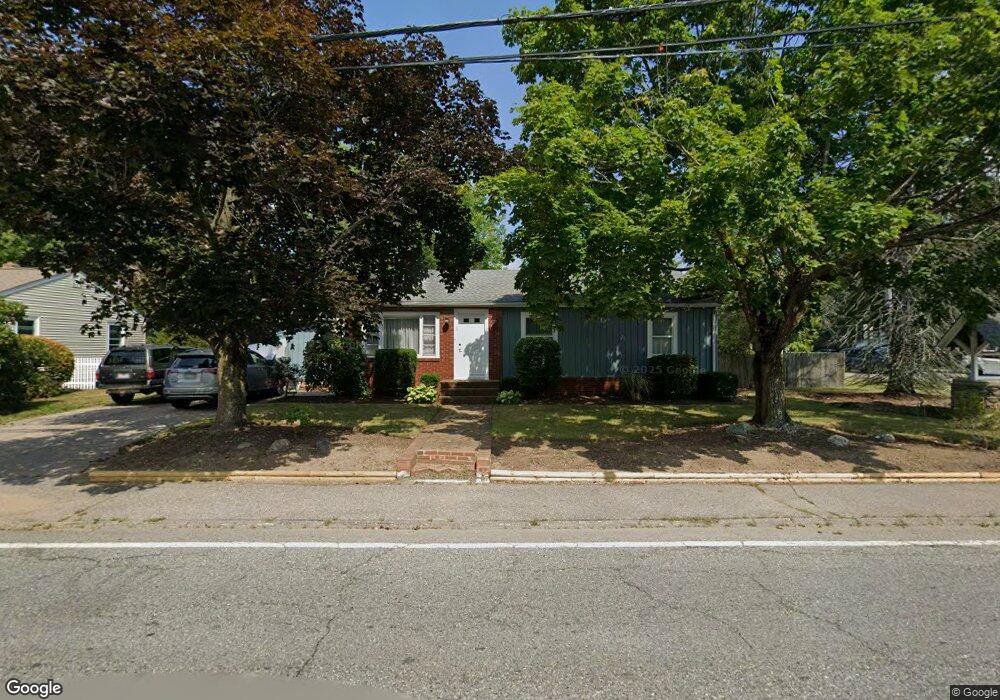
1 Landry Ave North Attleboro, MA 02760
North Attleboro NeighborhoodEstimated Value: $468,089 - $549,000
2
Beds
1
Bath
1,160
Sq Ft
$455/Sq Ft
Est. Value
About This Home
This home is located at 1 Landry Ave, North Attleboro, MA 02760 and is currently estimated at $528,022, approximately $455 per square foot. 1 Landry Ave is a home located in Bristol County with nearby schools including North Attleboro High School, Cadence Academy Preschool - North Attleborough, and Bishop Feehan High School.
Ownership History
Date
Name
Owned For
Owner Type
Purchase Details
Closed on
Jun 29, 1995
Sold by
Carter Lena and Carter Susan L
Bought by
Magliocco Richard J
Current Estimated Value
Home Financials for this Owner
Home Financials are based on the most recent Mortgage that was taken out on this home.
Original Mortgage
$114,950
Interest Rate
7.8%
Mortgage Type
Purchase Money Mortgage
Create a Home Valuation Report for This Property
The Home Valuation Report is an in-depth analysis detailing your home's value as well as a comparison with similar homes in the area
Home Values in the Area
Average Home Value in this Area
Purchase History
| Date | Buyer | Sale Price | Title Company |
|---|---|---|---|
| Magliocco Richard J | $121,000 | -- |
Source: Public Records
Mortgage History
| Date | Status | Borrower | Loan Amount |
|---|---|---|---|
| Open | Magliocco Richard J | $32,500 | |
| Open | Magliocco Richard J | $114,600 | |
| Closed | Magliocco Richard J | $114,950 |
Source: Public Records
Tax History Compared to Growth
Tax History
| Year | Tax Paid | Tax Assessment Tax Assessment Total Assessment is a certain percentage of the fair market value that is determined by local assessors to be the total taxable value of land and additions on the property. | Land | Improvement |
|---|---|---|---|---|
| 2025 | $4,308 | $365,400 | $117,900 | $247,500 |
| 2024 | $4,082 | $353,700 | $117,900 | $235,800 |
| 2023 | $4,024 | $314,600 | $117,900 | $196,700 |
| 2022 | $3,728 | $267,600 | $117,900 | $149,700 |
| 2021 | $3,906 | $273,700 | $117,900 | $155,800 |
| 2020 | $3,685 | $256,800 | $117,900 | $138,900 |
| 2019 | $3,504 | $246,100 | $107,200 | $138,900 |
| 2018 | $4,833 | $231,700 | $107,200 | $124,500 |
| 2017 | $2,984 | $225,700 | $107,200 | $118,500 |
| 2016 | $2,902 | $219,500 | $119,100 | $100,400 |
| 2015 | $2,853 | $217,100 | $125,100 | $92,000 |
| 2014 | $2,745 | $207,300 | $115,600 | $91,700 |
Source: Public Records
Map
Nearby Homes
- 11 Landry Ave
- 10 Sleepy Hollow Cir
- 16 Raymond Hall Dr
- 57 Vine St
- 15 Old Wood Rd
- 116 George St
- 115 Westfield Dr
- Lot 5 Jeffrey Dr
- Lot 2 Jeffrey Dr
- 36 Cranberry Rd
- 17 Peters Way
- 12 Houde St
- 122 Mary Ann Way
- 1730 West St
- 28 Messenger St
- 2 George St Unit C
- 47 Old Farm Rd
- 166 E Bacon St Unit 4
- 33 Dublin Way
- 59 Laurelwood Dr
- 1 Sleepy Hollow Cir
- 392 Kelley Blvd
- 393 Kelley Blvd
- 393 Kelley Blvd Unit Apartment 1
- 21 Landry Ave
- 401 Kelley Blvd
- 11 Sleepy Hollow Cir
- 22 Landry Ave
- 0 Landry Ave
- 2 Sleepy Hollow Cir
- 384 Kelley Blvd
- 29 Landry Ave
- 30 Landry Ave
- 377 Kelley Blvd
- 405 Kelley Blvd
- 21 Sleepy Hollow Cir
- 15 Kenney Ln
- 36 Landry Ave
- 412 Kelley Blvd
- 42 Landry Ave