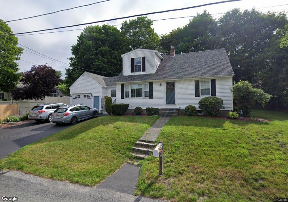
1 Linda Circuit Unit 1 North Grafton, MA 01536
Estimated Value: $514,000 - $606,000
4
Beds
1
Bath
1,142
Sq Ft
$506/Sq Ft
Est. Value
About This Home
This home is located at 1 Linda Circuit Unit 1, North Grafton, MA 01536 and is currently estimated at $577,788, approximately $505 per square foot. 1 Linda Circuit Unit 1 is a home located in Worcester County with nearby schools including Grafton High School, Silver Spruce Montessori School, and Al-Hamra Academy.
Ownership History
Date
Name
Owned For
Owner Type
Purchase Details
Closed on
Mar 26, 2003
Sold by
Somers Robert W and Somers Diane J
Bought by
Noel Michael F
Current Estimated Value
Home Financials for this Owner
Home Financials are based on the most recent Mortgage that was taken out on this home.
Original Mortgage
$220,000
Outstanding Balance
$95,620
Interest Rate
5.91%
Mortgage Type
Purchase Money Mortgage
Estimated Equity
$482,168
Create a Home Valuation Report for This Property
The Home Valuation Report is an in-depth analysis detailing your home's value as well as a comparison with similar homes in the area
Home Values in the Area
Average Home Value in this Area
Purchase History
| Date | Buyer | Sale Price | Title Company |
|---|---|---|---|
| Noel Michael F | $245,000 | -- | |
| Noel Michael F | $245,000 | -- |
Source: Public Records
Mortgage History
| Date | Status | Borrower | Loan Amount |
|---|---|---|---|
| Open | Noel Michael F | $220,000 | |
| Closed | Noel Michael F | $220,000 | |
| Previous Owner | Noel Michael F | $87,000 |
Source: Public Records
Tax History Compared to Growth
Tax History
| Year | Tax Paid | Tax Assessment Tax Assessment Total Assessment is a certain percentage of the fair market value that is determined by local assessors to be the total taxable value of land and additions on the property. | Land | Improvement |
|---|---|---|---|---|
| 2025 | $7,864 | $564,100 | $173,200 | $390,900 |
| 2024 | $7,005 | $489,500 | $165,000 | $324,500 |
| 2023 | $6,619 | $421,300 | $165,000 | $256,300 |
| 2022 | $6,325 | $374,700 | $141,700 | $233,000 |
| 2021 | $6,128 | $356,700 | $128,700 | $228,000 |
| 2020 | $5,886 | $356,700 | $128,700 | $228,000 |
| 2019 | $5,271 | $316,400 | $125,000 | $191,400 |
| 2018 | $5,159 | $311,000 | $124,400 | $186,600 |
| 2017 | $4,082 | $248,900 | $117,100 | $131,800 |
| 2016 | $3,729 | $222,600 | $94,100 | $128,500 |
| 2015 | $3,676 | $222,800 | $93,000 | $129,800 |
| 2014 | $3,533 | $231,500 | $109,800 | $121,700 |
Source: Public Records
Map
Nearby Homes
- 0 East St
- 4 Winslow Ln Unit 1410
- 2 Winslow Ln Unit 2302
- 2 Winslow Ln Unit 406
- 14 Indian Path
- 3 Abby Rd
- 17 Hingham Rd
- 150 North St
- 4 Westboro Rd
- 30 Falmouth Dr
- 15 Windle Ave
- 55 Carroll Rd
- 11 Hovey Pond Dr Unit 11
- 194 Worcester St
- 14 Northgate Ct Unit 14
- 44 Meadow Ln
- 1 Doris Dr
- 9 Logan Path
- 34 Clews St
- 11 1/2 Carroll Rd Unit B