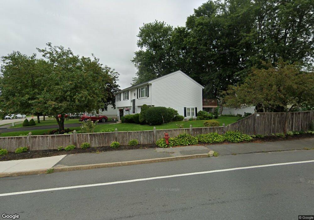
1 Litchfield Dr Woburn, MA 01801
Shakerhill NeighborhoodEstimated Value: $695,000 - $891,000
4
Beds
3
Baths
1,190
Sq Ft
$654/Sq Ft
Est. Value
About This Home
This home is located at 1 Litchfield Dr, Woburn, MA 01801 and is currently estimated at $777,898, approximately $653 per square foot. 1 Litchfield Dr is a home located in Middlesex County with nearby schools including Reeves Elementary School, Daniel L. Joyce Middle School, and Woburn High School.
Create a Home Valuation Report for This Property
The Home Valuation Report is an in-depth analysis detailing your home's value as well as a comparison with similar homes in the area
Home Values in the Area
Average Home Value in this Area
Tax History
| Year | Tax Paid | Tax Assessment Tax Assessment Total Assessment is a certain percentage of the fair market value that is determined by local assessors to be the total taxable value of land and additions on the property. | Land | Improvement |
|---|---|---|---|---|
| 2025 | $6,675 | $781,600 | $368,000 | $413,600 |
| 2024 | $6,010 | $745,600 | $350,500 | $395,100 |
| 2023 | $5,790 | $665,500 | $318,600 | $346,900 |
| 2022 | $5,950 | $637,000 | $277,100 | $359,900 |
| 2021 | $5,610 | $601,300 | $263,900 | $337,400 |
| 2020 | $6,765 | $571,300 | $263,900 | $307,400 |
| 2019 | $6,525 | $538,100 | $251,300 | $286,800 |
| 2018 | $4,740 | $479,300 | $230,600 | $248,700 |
| 2017 | $4,617 | $464,500 | $219,600 | $244,900 |
| 2016 | $4,412 | $439,000 | $205,300 | $233,700 |
| 2015 | $4,141 | $407,200 | $191,800 | $215,400 |
| 2014 | $4,192 | $401,500 | $188,000 | $213,500 |
Source: Public Records
Map
Nearby Homes
- 212 Cambridge Rd
- 19 Indian Hill Rd
- 15 Crescent Rd
- 7 Wainwright Rd Unit 15
- 299 Lexington St Unit 51
- 16 Battlemarch Way
- 36 Cambridge Rd Unit 24
- 36 Cambridge Rd Unit 40
- 8 Buckman Dr
- 5 Squire Rd
- 20 Amberwood Dr
- 14 Liana St
- 136 Bedford Rd
- 10 Hawthorne Rd
- 454 Lexington St
- 31 Arlington Rd Unit 1-6
- 54 Johnson Rd
- 27 Arlington Rd Unit 2
- 12 Cassidy Dr
- 15 Sturgis St
Your Personal Tour Guide
Ask me questions while you tour the home.