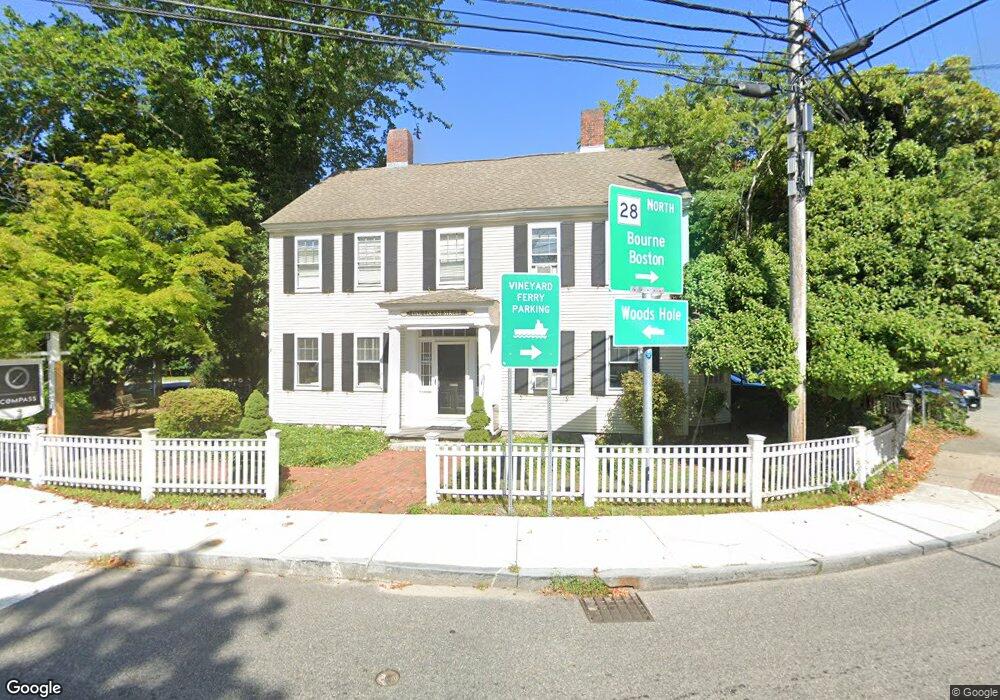
1 Locust St Falmouth, MA 2540
Falmouth Village NeighborhoodEstimated Value: $1,042,369
6
Beds
2
Baths
2,800
Sq Ft
$372/Sq Ft
Est. Value
About This Home
This home is located at 1 Locust St, Falmouth, MA 2540 and is currently estimated at $1,042,369, approximately $372 per square foot. 1 Locust St is a home located in Barnstable County with nearby schools including Mullen-Hall School, Lawrence School, and Morse Pond School.
Ownership History
Date
Name
Owned For
Owner Type
Purchase Details
Closed on
May 7, 2025
Sold by
Freitas Livio A and Freitas Margaret A
Bought by
Freitas Ft and Cutrona
Current Estimated Value
Purchase Details
Closed on
Jun 23, 2000
Sold by
Locust St Rt and Alkon
Bought by
Freitas Livio A and Freitas Margaret A
Create a Home Valuation Report for This Property
The Home Valuation Report is an in-depth analysis detailing your home's value as well as a comparison with similar homes in the area
Home Values in the Area
Average Home Value in this Area
Purchase History
| Date | Buyer | Sale Price | Title Company |
|---|---|---|---|
| Freitas Ft | -- | -- | |
| Freitas Ft | -- | -- | |
| Freitas Livio A | $260,000 | -- | |
| Freitas Livio A | $260,000 | -- |
Source: Public Records
Mortgage History
| Date | Status | Borrower | Loan Amount |
|---|---|---|---|
| Previous Owner | Freitas Livio A | $100,000 | |
| Previous Owner | Freitas Livio A | $260,000 |
Source: Public Records
Tax History Compared to Growth
Tax History
| Year | Tax Paid | Tax Assessment Tax Assessment Total Assessment is a certain percentage of the fair market value that is determined by local assessors to be the total taxable value of land and additions on the property. | Land | Improvement |
|---|---|---|---|---|
| 2025 | $5,734 | $976,900 | $415,400 | $561,500 |
| 2024 | $5,412 | $861,800 | $376,900 | $484,900 |
| 2023 | $5,080 | $734,100 | $330,800 | $403,300 |
| 2022 | $4,871 | $605,100 | $275,100 | $330,000 |
| 2021 | $4,672 | $549,600 | $263,200 | $286,400 |
| 2020 | $4,832 | $562,500 | $263,200 | $299,300 |
| 2019 | $4,717 | $551,000 | $254,100 | $296,900 |
| 2018 | $4,380 | $509,300 | $238,100 | $271,200 |
| 2017 | $4,202 | $492,600 | $228,500 | $264,100 |
| 2016 | $4,123 | $492,600 | $228,500 | $264,100 |
| 2015 | $4,034 | $492,600 | $228,500 | $264,100 |
| 2014 | $3,842 | $471,400 | $216,500 | $254,900 |
Source: Public Records
Map
Nearby Homes
- 71 Main St
- 98 Main St
- 98 Main St Unit 1
- 30 Katherine Lee Bates Rd
- 33 Oakwood Ave
- 65 Walker St
- 480 Main St Unit 1
- 110 Dillingham Ave Unit 322
- 15 Hedge Ln
- 354 Gifford St Unit 5
- 354 Gifford St Unit 2
- 354 Gifford St Unit 6
- 253 Scranton Ave
- 38 Landfall Unit 38
- 38 Landfall
- 37 Rydal Mount Dr
- 22 Alma Rd
- 55 Jericho Path
- 10 Shanks Pond Rd