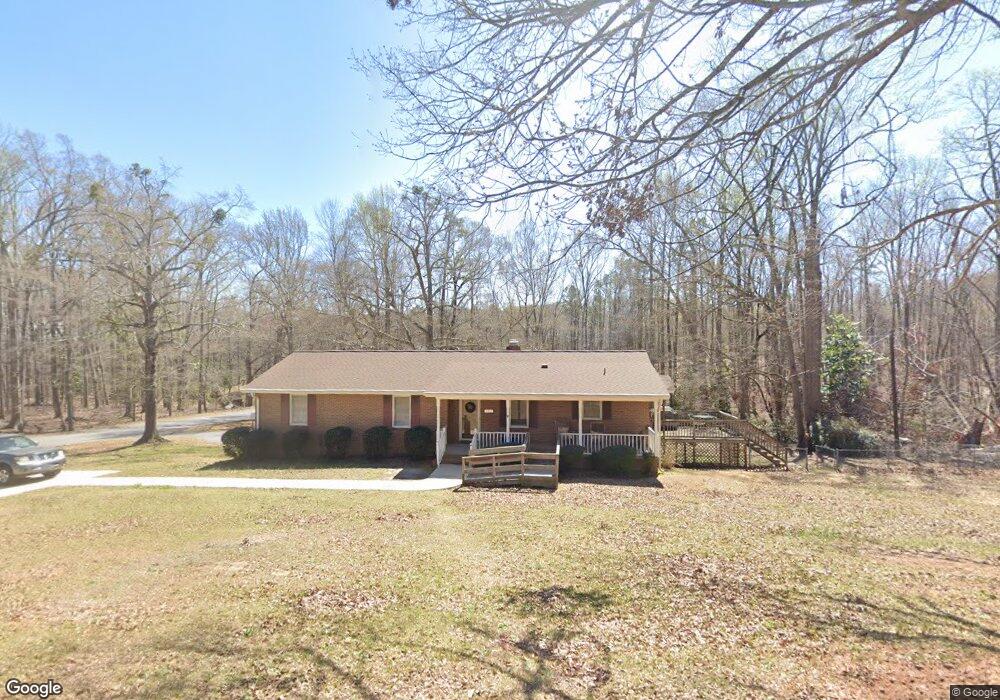
1 Lola Ln Honea Path, SC 29654
Estimated Value: $265,000 - $298,000
3
Beds
--
Bath
2,193
Sq Ft
$126/Sq Ft
Est. Value
About This Home
This home is located at 1 Lola Ln, Honea Path, SC 29654 and is currently estimated at $276,517, approximately $126 per square foot. 1 Lola Ln is a home located in Anderson County with nearby schools including Belton Honea Path High School and Whispering Pines Mennonite School.
Ownership History
Date
Name
Owned For
Owner Type
Purchase Details
Closed on
Jun 29, 2018
Sold by
Whitworth James F and Whitworth Dorothy Patricia W
Bought by
Whitworth James F and Whitworth Dorothy W
Current Estimated Value
Home Financials for this Owner
Home Financials are based on the most recent Mortgage that was taken out on this home.
Original Mortgage
$122,000
Interest Rate
4.5%
Mortgage Type
New Conventional
Create a Home Valuation Report for This Property
The Home Valuation Report is an in-depth analysis detailing your home's value as well as a comparison with similar homes in the area
Home Values in the Area
Average Home Value in this Area
Purchase History
| Date | Buyer | Sale Price | Title Company |
|---|---|---|---|
| Whitworth James F | -- | None Available |
Source: Public Records
Mortgage History
| Date | Status | Borrower | Loan Amount |
|---|---|---|---|
| Closed | Whitworth James F | $122,000 |
Source: Public Records
Tax History
| Year | Tax Paid | Tax Assessment Tax Assessment Total Assessment is a certain percentage of the fair market value that is determined by local assessors to be the total taxable value of land and additions on the property. | Land | Improvement |
|---|---|---|---|---|
| 2024 | $1,280 | $8,530 | $340 | $8,190 |
| 2023 | $1,250 | $8,530 | $340 | $8,190 |
| 2022 | $1,218 | $8,530 | $340 | $8,190 |
| 2021 | $987 | $7,270 | $320 | $6,950 |
| 2020 | $977 | $7,270 | $320 | $6,950 |
| 2019 | $969 | $7,270 | $320 | $6,950 |
| 2018 | $974 | $7,270 | $320 | $6,950 |
| 2017 | -- | $7,270 | $320 | $6,950 |
| 2016 | $782 | $6,450 | $240 | $6,210 |
| 2015 | $817 | $6,450 | $240 | $6,210 |
| 2014 | $824 | $6,450 | $240 | $6,210 |
Source: Public Records
Map
Nearby Homes
Your Personal Tour Guide
Ask me questions while you tour the home.