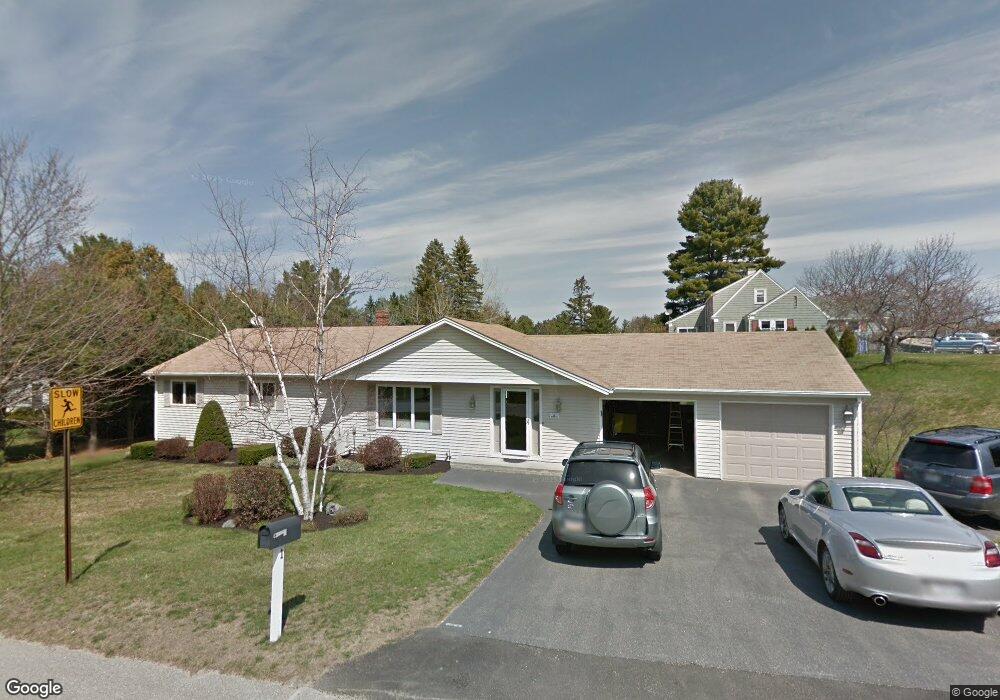
1 Manning Ave Lewiston, ME 04240
Estimated Value: $373,000 - $403,863
3
Beds
2
Baths
1,680
Sq Ft
$232/Sq Ft
Est. Value
About This Home
This home is located at 1 Manning Ave, Lewiston, ME 04240 and is currently estimated at $389,716, approximately $231 per square foot. 1 Manning Ave is a home with nearby schools including Raymond A. Geiger Elementary School, Lewiston High School, and The Discovery School.
Create a Home Valuation Report for This Property
The Home Valuation Report is an in-depth analysis detailing your home's value as well as a comparison with similar homes in the area
Home Values in the Area
Average Home Value in this Area
Tax History Compared to Growth
Tax History
| Year | Tax Paid | Tax Assessment Tax Assessment Total Assessment is a certain percentage of the fair market value that is determined by local assessors to be the total taxable value of land and additions on the property. | Land | Improvement |
|---|---|---|---|---|
| 2025 | $5,700 | $173,900 | $32,760 | $141,140 |
| 2024 | $5,525 | $173,900 | $32,760 | $141,140 |
| 2023 | $5,217 | $173,900 | $32,760 | $141,140 |
| 2022 | $4,956 | $173,900 | $32,760 | $141,140 |
| 2021 | $4,914 | $173,900 | $32,760 | $141,140 |
| 2020 | $4,986 | $173,900 | $32,760 | $141,140 |
| 2019 | $5,027 | $173,900 | $32,760 | $141,140 |
| 2018 | $4,759 | $165,980 | $32,760 | $133,220 |
| 2017 | $4,284 | $152,880 | $32,760 | $120,120 |
| 2016 | $4,210 | $152,880 | $32,760 | $120,120 |
| 2015 | $4,184 | $152,880 | $32,760 | $120,120 |
| 2014 | $4,065 | $152,880 | $32,760 | $120,120 |
| 2013 | $4,042 | $152,880 | $32,760 | $120,120 |
Source: Public Records
Map
Nearby Homes
- 462 College St
- 5 Manning Ave
- 454 College St
- 466 College St
- 2 Manning Place
- 7 Manning Ave
- 450 College St
- 457 College St
- 6 Manning Ave
- 465 College St
- 470 College St
- 1 Wicklow Place
- 469 College St
- 446 College St
- 445 College St
- 4 Manning Place
- 3 Manning Place
- 473 College St
- 474 College St
- 443 College St