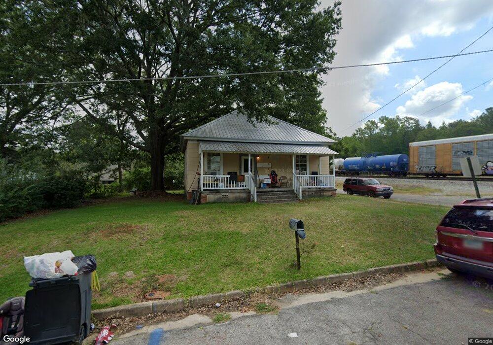
1 Maple St Manchester, GA 31816
Estimated Value: $42,000 - $98,000
3
Beds
1
Bath
1,024
Sq Ft
$75/Sq Ft
Est. Value
About This Home
This home is located at 1 Maple St, Manchester, GA 31816 and is currently estimated at $76,531, approximately $74 per square foot. 1 Maple St is a home located in Meriwether County with nearby schools including Mountain View Elementary School, Manchester Middle School, and Manchester High School.
Ownership History
Date
Name
Owned For
Owner Type
Purchase Details
Closed on
Nov 7, 2017
Sold by
Meriwether County Tax Comm
Bought by
Pearson James Allen
Current Estimated Value
Purchase Details
Closed on
Jun 21, 1999
Sold by
Watermark Contractin
Bought by
Shearouse Lisa
Purchase Details
Closed on
Nov 1, 1996
Sold by
Bailey Frank and Bailey
Bought by
Watermark Contractin
Purchase Details
Closed on
Aug 1, 1996
Sold by
Mays Sylvia Johnson
Bought by
Bailey Frank and Bailey
Purchase Details
Closed on
Jun 1, 1992
Sold by
Johnson J W
Bought by
Mays Sylvia Johnson
Purchase Details
Closed on
Jan 1, 1960
Bought by
Johnson J W
Create a Home Valuation Report for This Property
The Home Valuation Report is an in-depth analysis detailing your home's value as well as a comparison with similar homes in the area
Home Values in the Area
Average Home Value in this Area
Purchase History
| Date | Buyer | Sale Price | Title Company |
|---|---|---|---|
| Pearson James Allen | -- | -- | |
| Shearouse Lisa | $10,000 | -- | |
| Watermark Contractin | -- | -- | |
| Bailey Frank | $16,500 | -- | |
| Mays Sylvia Johnson | -- | -- | |
| Johnson J W | -- | -- |
Source: Public Records
Tax History Compared to Growth
Tax History
| Year | Tax Paid | Tax Assessment Tax Assessment Total Assessment is a certain percentage of the fair market value that is determined by local assessors to be the total taxable value of land and additions on the property. | Land | Improvement |
|---|---|---|---|---|
| 2024 | $247 | $5,240 | $1,440 | $3,800 |
| 2023 | $254 | $5,240 | $1,440 | $3,800 |
| 2022 | $254 | $5,240 | $1,440 | $3,800 |
| 2021 | $167 | $5,240 | $1,440 | $3,800 |
| 2020 | $168 | $5,240 | $1,440 | $3,800 |
| 2019 | $156 | $4,840 | $1,440 | $3,400 |
| 2018 | $158 | $4,840 | $1,440 | $3,400 |
| 2017 | $160 | $4,840 | $1,440 | $3,400 |
| 2016 | $159 | $4,840 | $1,440 | $3,400 |
| 2015 | $160 | $4,840 | $1,440 | $3,400 |
| 2014 | $160 | $4,840 | $1,440 | $3,400 |
| 2013 | -- | $4,840 | $1,440 | $3,400 |
Source: Public Records
Map
Nearby Homes