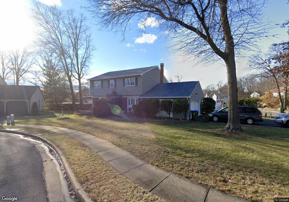
1 Megan Ct Edison, NJ 08820
Estimated Value: $836,843 - $1,040,000
4
Beds
3
Baths
2,214
Sq Ft
$419/Sq Ft
Est. Value
About This Home
This home is located at 1 Megan Ct, Edison, NJ 08820 and is currently estimated at $926,711, approximately $418 per square foot. 1 Megan Ct is a home located in Middlesex County with nearby schools including Menlo Park Elementary School, Woodrow Wilson Middle School, and J.P. Stevens High School.
Ownership History
Date
Name
Owned For
Owner Type
Purchase Details
Closed on
Jul 25, 2008
Sold by
Ma Stan and Lao Zhege
Bought by
Wang Kuan and Gu Mingdi
Current Estimated Value
Home Financials for this Owner
Home Financials are based on the most recent Mortgage that was taken out on this home.
Original Mortgage
$300,000
Outstanding Balance
$182,775
Interest Rate
5%
Mortgage Type
Purchase Money Mortgage
Estimated Equity
$743,936
Purchase Details
Closed on
Dec 9, 1999
Sold by
Abramson Paul
Bought by
Ma Stan and Zhege Lao
Home Financials for this Owner
Home Financials are based on the most recent Mortgage that was taken out on this home.
Original Mortgage
$100,000
Interest Rate
7.84%
Purchase Details
Closed on
Sep 29, 1993
Sold by
Galkin Roberta
Bought by
Abramson Paul and Abramson Amy
Home Financials for this Owner
Home Financials are based on the most recent Mortgage that was taken out on this home.
Original Mortgage
$190,000
Interest Rate
7%
Create a Home Valuation Report for This Property
The Home Valuation Report is an in-depth analysis detailing your home's value as well as a comparison with similar homes in the area
Home Values in the Area
Average Home Value in this Area
Purchase History
| Date | Buyer | Sale Price | Title Company |
|---|---|---|---|
| Wang Kuan | $525,000 | Multiple | |
| Ma Stan | $332,500 | -- | |
| Abramson Paul | $250,000 | -- |
Source: Public Records
Mortgage History
| Date | Status | Borrower | Loan Amount |
|---|---|---|---|
| Open | Wang Kuan | $300,000 | |
| Previous Owner | Ma Stan | $100,000 | |
| Previous Owner | Abramson Paul | $190,000 |
Source: Public Records
Tax History Compared to Growth
Tax History
| Year | Tax Paid | Tax Assessment Tax Assessment Total Assessment is a certain percentage of the fair market value that is determined by local assessors to be the total taxable value of land and additions on the property. | Land | Improvement |
|---|---|---|---|---|
| 2025 | $13,793 | $231,700 | $108,200 | $123,500 |
| 2024 | $13,719 | $231,700 | $108,200 | $123,500 |
| 2023 | $13,719 | $231,700 | $108,200 | $123,500 |
| 2022 | $13,724 | $231,700 | $108,200 | $123,500 |
| 2021 | $13,040 | $231,700 | $108,200 | $123,500 |
| 2020 | $13,552 | $231,700 | $108,200 | $123,500 |
| 2019 | $13,040 | $231,700 | $108,200 | $123,500 |
| 2018 | $12,725 | $231,700 | $108,200 | $123,500 |
| 2017 | $12,456 | $231,700 | $108,200 | $123,500 |
| 2016 | $12,224 | $231,700 | $108,200 | $123,500 |
| 2015 | $11,756 | $231,700 | $108,200 | $123,500 |
| 2014 | $11,414 | $231,700 | $108,200 | $123,500 |
Source: Public Records
Map
Nearby Homes