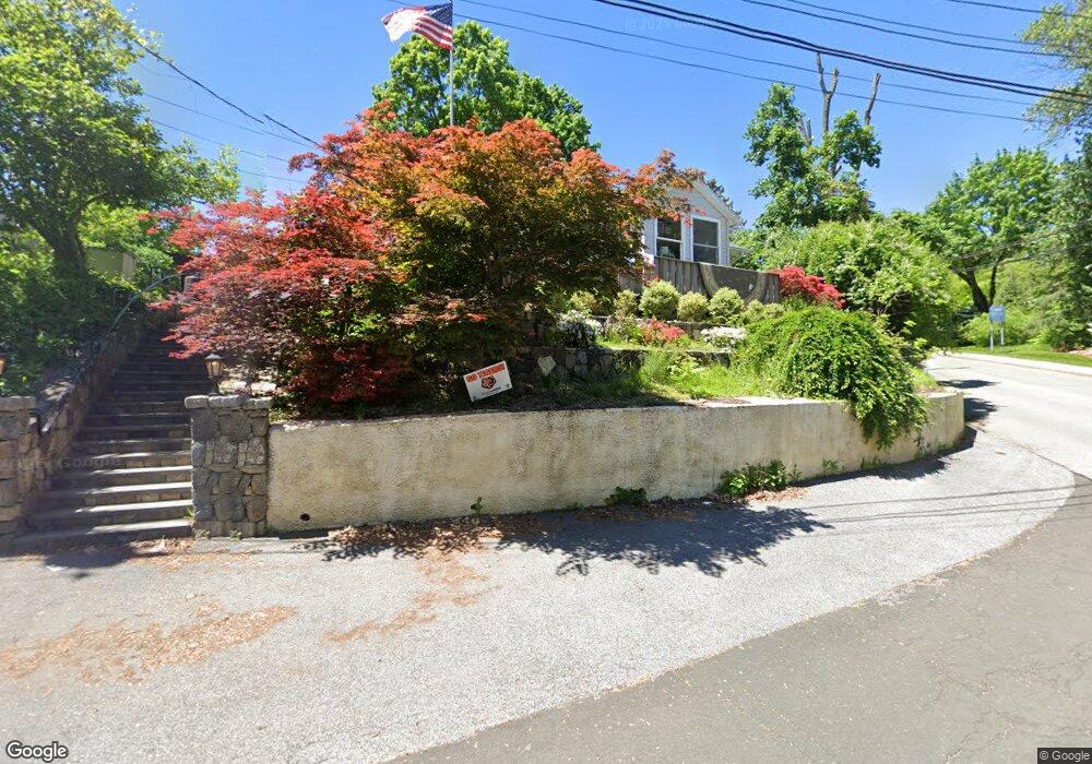
1 Michaels Ln Croton On Hudson, NY 10520
Estimated Value: $513,990 - $779,000
--
Bed
--
Bath
--
Sq Ft
6,186
Sq Ft Lot
About This Home
This home is located at 1 Michaels Ln, Croton On Hudson, NY 10520 and is currently estimated at $640,248. 1 Michaels Ln is a home located in Westchester County with nearby schools including Carrie E Tompkins School, Pierre Van Cortlandt Middle School, and St. Augustine School.
Ownership History
Date
Name
Owned For
Owner Type
Purchase Details
Closed on
Nov 29, 2006
Sold by
Anfiteatro Adam J
Bought by
Anfiteatro Adam J and Anfiteatro Alicia L
Current Estimated Value
Home Financials for this Owner
Home Financials are based on the most recent Mortgage that was taken out on this home.
Original Mortgage
$332,000
Outstanding Balance
$198,496
Interest Rate
6.31%
Mortgage Type
Purchase Money Mortgage
Estimated Equity
$441,752
Purchase Details
Closed on
Jun 15, 2004
Sold by
Anfiteatro Adam T and Matyi Alicia
Bought by
Anfiteatro Adam J
Purchase Details
Closed on
Nov 3, 1995
Sold by
Matyi Andrew G and Matyi Margaret A
Bought by
Anfiteratro Adam J and Matyi Alicia
Create a Home Valuation Report for This Property
The Home Valuation Report is an in-depth analysis detailing your home's value as well as a comparison with similar homes in the area
Home Values in the Area
Average Home Value in this Area
Purchase History
| Date | Buyer | Sale Price | Title Company |
|---|---|---|---|
| Anfiteatro Adam J | -- | Commonwealth Title | |
| Anfiteatro Adam J | -- | -- | |
| Anfiteratro Adam J | $125,000 | Chicago Title Insurance Co |
Source: Public Records
Mortgage History
| Date | Status | Borrower | Loan Amount |
|---|---|---|---|
| Open | Anfiteatro Adam J | $332,000 |
Source: Public Records
Tax History Compared to Growth
Tax History
| Year | Tax Paid | Tax Assessment Tax Assessment Total Assessment is a certain percentage of the fair market value that is determined by local assessors to be the total taxable value of land and additions on the property. | Land | Improvement |
|---|---|---|---|---|
| 2024 | $9,854 | $4,175 | $450 | $3,725 |
| 2023 | $9,661 | $4,175 | $450 | $3,725 |
| 2022 | $9,336 | $4,175 | $450 | $3,725 |
| 2021 | $9,171 | $4,175 | $450 | $3,725 |
| 2020 | $9,595 | $4,175 | $450 | $3,725 |
| 2019 | $7,486 | $4,175 | $450 | $3,725 |
| 2018 | $9,938 | $4,175 | $450 | $3,725 |
| 2017 | $3,084 | $4,175 | $450 | $3,725 |
| 2016 | $8,615 | $4,175 | $450 | $3,725 |
| 2015 | -- | $4,175 | $450 | $3,725 |
| 2014 | -- | $4,175 | $450 | $3,725 |
| 2013 | -- | $4,175 | $450 | $3,725 |
Source: Public Records
Map
Nearby Homes
- 19 Hunter St
- 72 Old Post Rd N
- 43 High St
- 35 Brook St
- 25 S Riverside Ave Unit 201
- 25 S Riverside Ave Unit 308
- 25 S Riverside Ave Unit 108
- 25 S Riverside Ave Unit 211
- 102 Maple St
- 20 Wolf Rd
- 170 Grand St
- Lot 18 Wolf Rd
- 152 Old Post Rd N
- 56 Irving Ave
- D-20 Half Moon Bay Marina
- B-11 Half Moon Bay Marina Unit B-11
- 34 Ridge Rd
- 1 Wood Rd
- 8 Prickly Pear Hill Rd
- 3 Prickly Pear Hill Rd