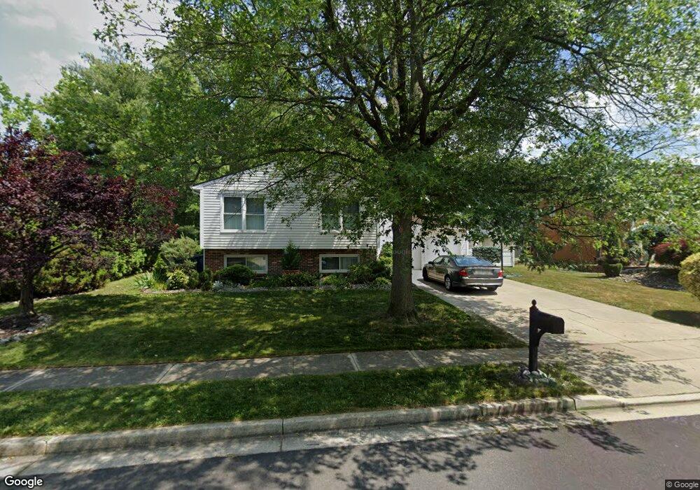
1 Millbank Ln Voorhees, NJ 08043
Estimated Value: $455,000 - $534,000
--
Bed
--
Bath
2,680
Sq Ft
$185/Sq Ft
Est. Value
About This Home
This home is located at 1 Millbank Ln, Voorhees, NJ 08043 and is currently estimated at $495,404, approximately $184 per square foot. 1 Millbank Ln is a home located in Camden County with nearby schools including Osage Elementary School, Voorhees Middle School, and Eastern Regional High School.
Ownership History
Date
Name
Owned For
Owner Type
Purchase Details
Closed on
Apr 30, 2025
Sold by
Robbins Michael
Bought by
Robbins Erlyn
Current Estimated Value
Purchase Details
Closed on
Oct 18, 2002
Sold by
Lewis Frank A
Bought by
Robbinws Michael and Robbins Erlyn
Home Financials for this Owner
Home Financials are based on the most recent Mortgage that was taken out on this home.
Original Mortgage
$159,000
Interest Rate
6.03%
Create a Home Valuation Report for This Property
The Home Valuation Report is an in-depth analysis detailing your home's value as well as a comparison with similar homes in the area
Home Values in the Area
Average Home Value in this Area
Purchase History
| Date | Buyer | Sale Price | Title Company |
|---|---|---|---|
| Robbins Erlyn | -- | None Listed On Document | |
| Robbins Erlyn | -- | None Listed On Document | |
| Robbinws Michael | $199,500 | -- |
Source: Public Records
Mortgage History
| Date | Status | Borrower | Loan Amount |
|---|---|---|---|
| Previous Owner | Robbinws Michael | $159,000 |
Source: Public Records
Tax History Compared to Growth
Tax History
| Year | Tax Paid | Tax Assessment Tax Assessment Total Assessment is a certain percentage of the fair market value that is determined by local assessors to be the total taxable value of land and additions on the property. | Land | Improvement |
|---|---|---|---|---|
| 2025 | $8,316 | $442,000 | $81,600 | $360,400 |
| 2024 | $8,167 | $193,400 | $61,600 | $131,800 |
| 2023 | $8,167 | $193,400 | $61,600 | $131,800 |
| 2022 | $8,003 | $193,400 | $61,600 | $131,800 |
| 2021 | $7,953 | $193,400 | $61,600 | $131,800 |
| 2020 | $7,910 | $193,400 | $61,600 | $131,800 |
| 2019 | $7,632 | $193,400 | $61,600 | $131,800 |
| 2018 | $7,581 | $193,400 | $61,600 | $131,800 |
| 2017 | $7,452 | $193,400 | $61,600 | $131,800 |
| 2016 | $6,521 | $177,400 | $61,600 | $115,800 |
| 2015 | $6,649 | $177,400 | $61,600 | $115,800 |
| 2014 | $6,566 | $177,400 | $61,600 | $115,800 |
Source: Public Records
Map
Nearby Homes
- 5102 Tracy Ct
- 3401 Jennifer Ct
- 804 S Burnt Mill Rd
- 37 Dunhill Dr
- 1100 Rural Ave
- 116 Van Buren Rd Unit 8
- 1800 S Burnt Mill Rd
- 1309 Locust Ave
- 113 Harvard Ave
- 1135 Gibbsboro Rd
- 401 S Browning Ave
- 126 1 Kirkbride Rd
- 18 Yale Ave
- 8 Pennsylvania Ave
- 116 Acorn Ln
- 8 Echelon Rd
- 12 Country Ln
- 102 Gregorys Way
- 218 E Somerdale Rd
- 308 Gregorys Way
- 71 Dunhill Dr
- 73 Dunhill Dr
- 1608 Britton Place
- 1607 Britton Place
- 2 Millbank Ln
- 5 Millbank Ln
- 1601 Britton Place
- 4 Millbank Ln
- 1606 Britton Place Unit C1606
- 1605 Britton Place
- 1604 Britton Place Unit C1604
- 4808 Gina Ct
- 75 Dunhill Dr
- 69 Dunhill Dr
- 4806 Gina Ct
- 4805 Gina Ct
- 6 Millbank Ln
- 4803 Gina Ct
- 7 Millbank Ln
- 4802 Gina Ct