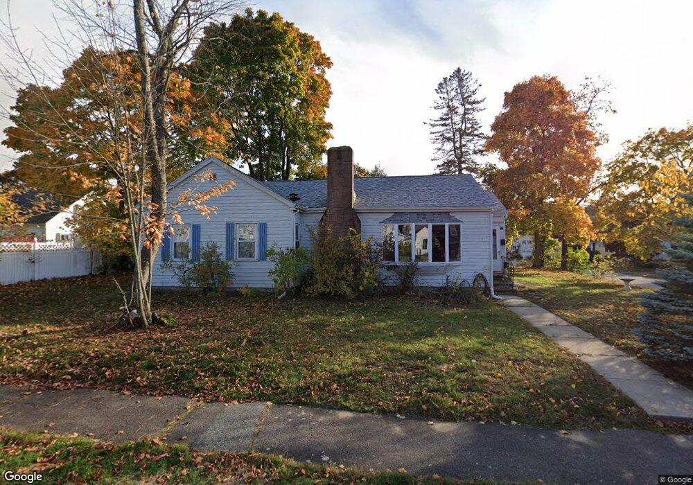
1 Minot St Wakefield, MA 01880
Greenwood NeighborhoodEstimated Value: $830,000 - $965,000
4
Beds
3
Baths
2,406
Sq Ft
$375/Sq Ft
Est. Value
About This Home
This home is located at 1 Minot St, Wakefield, MA 01880 and is currently estimated at $903,119, approximately $375 per square foot. 1 Minot St is a home located in Middlesex County with nearby schools including Wakefield Memorial High School, Melrose Montessori School, and St Mary's School.
Ownership History
Date
Name
Owned For
Owner Type
Purchase Details
Closed on
Sep 8, 2023
Sold by
1 Minot St Llc
Bought by
Audcharevorakul Pattra and Swartz Johann T
Current Estimated Value
Home Financials for this Owner
Home Financials are based on the most recent Mortgage that was taken out on this home.
Original Mortgage
$486,000
Outstanding Balance
$472,027
Interest Rate
6.81%
Mortgage Type
Purchase Money Mortgage
Estimated Equity
$431,092
Purchase Details
Closed on
Feb 8, 2023
Sold by
Palermino David J Est and Muraca
Bought by
1 Minot St Llc
Home Financials for this Owner
Home Financials are based on the most recent Mortgage that was taken out on this home.
Original Mortgage
$444,000
Interest Rate
6.42%
Mortgage Type
Purchase Money Mortgage
Purchase Details
Closed on
Mar 15, 2004
Sold by
Minot Rt and Palermino
Bought by
Palermino David J
Home Financials for this Owner
Home Financials are based on the most recent Mortgage that was taken out on this home.
Original Mortgage
$272,000
Interest Rate
5.67%
Mortgage Type
Purchase Money Mortgage
Create a Home Valuation Report for This Property
The Home Valuation Report is an in-depth analysis detailing your home's value as well as a comparison with similar homes in the area
Home Values in the Area
Average Home Value in this Area
Purchase History
We collect this data history from publicly available records. To have your information removed, we recommend requesting removal directly through your county’s website.
| Date | Buyer | Sale Price | Title Company |
|---|---|---|---|
| Audcharevorakul Pattra | $836,000 | None Available | |
| 1 Minot St Llc | $510,000 | None Available | |
| Palermino David J | $340,000 | -- | |
| Palermino David J | $340,000 | -- |
Source: Public Records
Mortgage History
We collect this data history from publicly available records. To have your information removed, we recommend requesting removal directly through your county’s website.
| Date | Status | Borrower | Loan Amount |
|---|---|---|---|
| Open | Audcharevorakul Pattra | $486,000 | |
| Previous Owner | 1 Minot St Llc | $444,000 | |
| Previous Owner | Palermino David J | $272,000 |
Source: Public Records
Tax History
| Year | Tax Paid | Tax Assessment Tax Assessment Total Assessment is a certain percentage of the fair market value that is determined by local assessors to be the total taxable value of land and additions on the property. | Land | Improvement |
|---|---|---|---|---|
| 2025 | $9,254 | $815,300 | $384,700 | $430,600 |
| 2024 | $8,027 | $713,500 | $357,800 | $355,700 |
| 2023 | $6,490 | $553,300 | $334,000 | $219,300 |
| 2022 | $6,086 | $494,000 | $298,200 | $195,800 |
| 2021 | $5,857 | $460,100 | $272,600 | $187,500 |
| 2020 | $5,509 | $431,400 | $255,600 | $175,800 |
| 2019 | $5,167 | $402,700 | $238,600 | $164,100 |
| 2018 | $4,982 | $384,700 | $227,900 | $156,800 |
| 2017 | $4,684 | $359,500 | $213,000 | $146,500 |
| 2016 | $4,734 | $350,900 | $210,300 | $140,600 |
| 2015 | $4,420 | $327,900 | $196,500 | $131,400 |
| 2014 | $4,088 | $319,900 | $191,700 | $128,200 |
Source: Public Records
Map
Nearby Homes
- 33 Ledge St
- 17 Heywood Ave
- 24 Mount Zion Rd
- 22 Mount Zion Rd
- 2 Gates Ln Unit B
- 48 Spring St
- 6 Atwood St
- 3 Fellsmere Ave
- 12 Lovis Ave
- 601 Franklin St Unit 2
- 180 Green St Unit 101
- 161 Green St
- 51 Melrose St Unit 2D
- 51 Melrose St Unit 1A
- 62 Elm St
- 24 Juniper Dr
- 43-51 Albion St Unit C9
- 49 Melrose St Unit 4B
- 53 Melrose St Unit 2B
- 53 Melrose St Unit 5H
Your Personal Tour Guide
Ask me questions while you tour the home.