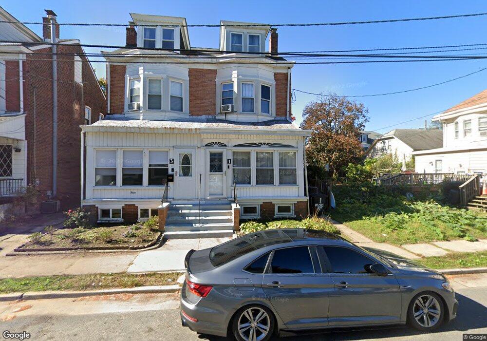
1 Moffatt Ave Trenton, NJ 08629
Estimated Value: $276,000 - $290,000
--
Bed
--
Bath
1,416
Sq Ft
$199/Sq Ft
Est. Value
About This Home
This home is located at 1 Moffatt Ave, Trenton, NJ 08629 and is currently estimated at $281,561, approximately $198 per square foot. 1 Moffatt Ave is a home located in Mercer County with nearby schools including Kuser Elementary School, Emily C. Reynolds Middle School, and Steinert - Hamilton High East.
Ownership History
Date
Name
Owned For
Owner Type
Purchase Details
Closed on
Nov 7, 2018
Sold by
Selensnick Elijah
Bought by
Selesnick Elijah and Selesnick Sandra
Current Estimated Value
Home Financials for this Owner
Home Financials are based on the most recent Mortgage that was taken out on this home.
Original Mortgage
$124,950
Outstanding Balance
$95,070
Interest Rate
4.9%
Mortgage Type
New Conventional
Estimated Equity
$186,491
Purchase Details
Closed on
Jul 27, 2005
Create a Home Valuation Report for This Property
The Home Valuation Report is an in-depth analysis detailing your home's value as well as a comparison with similar homes in the area
Home Values in the Area
Average Home Value in this Area
Purchase History
| Date | Buyer | Sale Price | Title Company |
|---|---|---|---|
| Selesnick Elijah | -- | Service Link East Escrow | |
| Selenick Elijah | $59,812 | Service Link East Escrow | |
| -- | -- | -- |
Source: Public Records
Mortgage History
| Date | Status | Borrower | Loan Amount |
|---|---|---|---|
| Open | Selesnick Elijah | $124,950 |
Source: Public Records
Tax History Compared to Growth
Tax History
| Year | Tax Paid | Tax Assessment Tax Assessment Total Assessment is a certain percentage of the fair market value that is determined by local assessors to be the total taxable value of land and additions on the property. | Land | Improvement |
|---|---|---|---|---|
| 2025 | $3,831 | $108,700 | $28,500 | $80,200 |
| 2024 | $3,590 | $108,700 | $28,500 | $80,200 |
| 2023 | $3,590 | $108,700 | $28,500 | $80,200 |
| 2022 | $3,534 | $108,700 | $28,500 | $80,200 |
| 2021 | $4,058 | $108,700 | $28,500 | $80,200 |
| 2020 | $3,666 | $108,700 | $28,500 | $80,200 |
| 2019 | $3,571 | $108,700 | $28,500 | $80,200 |
| 2018 | $3,384 | $104,200 | $24,000 | $80,200 |
| 2017 | $3,211 | $104,200 | $24,000 | $80,200 |
| 2016 | $2,818 | $104,200 | $24,000 | $80,200 |
| 2015 | $4,359 | $89,700 | $22,000 | $67,700 |
| 2014 | $4,289 | $89,700 | $22,000 | $67,700 |
Source: Public Records
Map
Nearby Homes
- 20 Charlotte Ave
- 11 Klein Ave
- 631 S Olden Ave
- 657 S Olden Ave
- 51 Charlotte Ave
- 1427 Hamilton Ave
- 42 Bismarck Ave
- 618 Atlantic Ave
- 1122 Hamilton Ave
- 365 Cleveland Ave
- 541 Emmett Ave
- 816 S Olden Ave
- 1110 Hamilton Ave
- 235 Darcy Ave
- 1524 Elizabeth Ave
- 877 Park Ave
- 144 Beal St
- 822 Fairmount Ave
- 2026 Liberty St
- 1114 Park Ave
- 3 Moffatt Ave
- 5 Moffatt Ave
- 7 Moffatt Ave
- 1285 Hamilton Ave
- 1283 Hamilton Ave
- 1287 Hamilton Ave
- 9 Moffatt Ave
- 1275 Hamilton Ave
- 2 Perry Ave
- 11 Moffatt Ave
- 1271 Hamilton Ave
- 6 Perry Ave
- 13 Moffatt Ave
- 10 Perry Ave
- 1301 Hamilton Ave
- 15 Moffatt Ave
- 2 Moffatt Ave
- 1307 Hamilton Ave
- 16 Perry Ave
- 21 Moffatt Ave