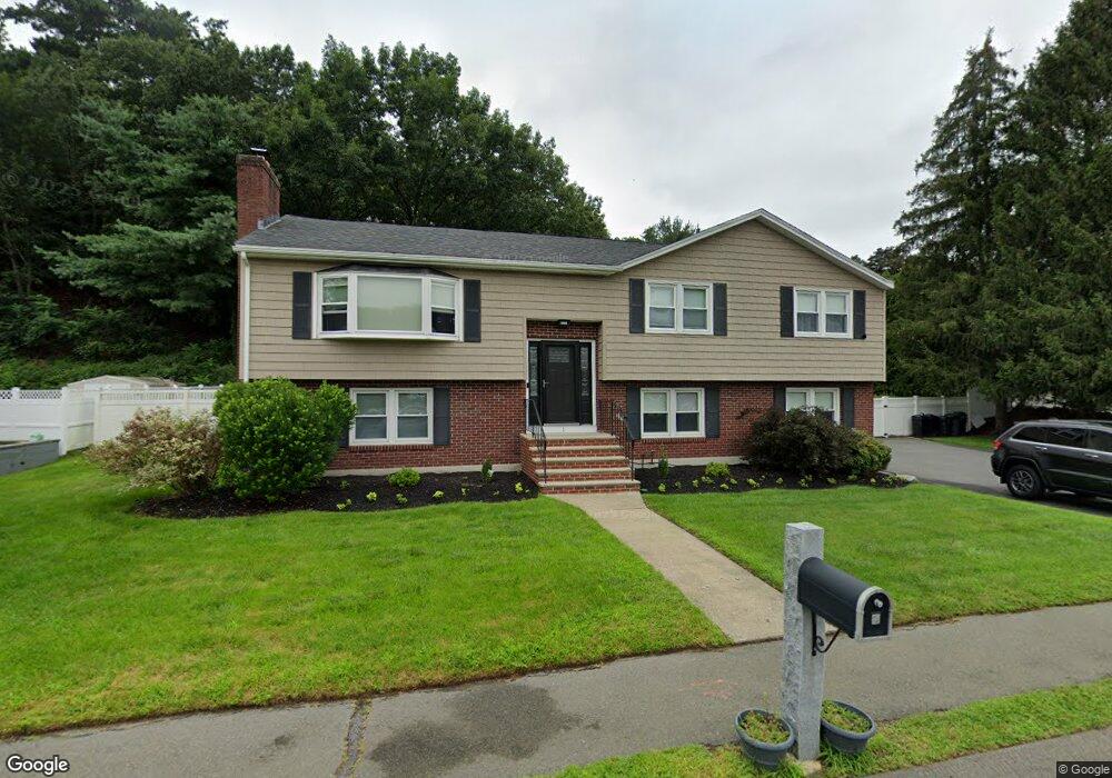
1 Morningside Cir Woburn, MA 01801
Shakerhill NeighborhoodEstimated Value: $802,895 - $958,000
3
Beds
4
Baths
1,400
Sq Ft
$632/Sq Ft
Est. Value
About This Home
This home is located at 1 Morningside Cir, Woburn, MA 01801 and is currently estimated at $884,474, approximately $631 per square foot. 1 Morningside Cir is a home located in Middlesex County with nearby schools including Reeves Elementary School, Daniel L. Joyce Middle School, and Woburn High School.
Ownership History
Date
Name
Owned For
Owner Type
Purchase Details
Closed on
Sep 8, 2010
Sold by
Bunker Robert A and Bunker Katherine
Bought by
Fumicello Steven and Fumicello Dorothy A
Current Estimated Value
Home Financials for this Owner
Home Financials are based on the most recent Mortgage that was taken out on this home.
Original Mortgage
$261,000
Outstanding Balance
$173,306
Interest Rate
4.55%
Mortgage Type
Purchase Money Mortgage
Estimated Equity
$711,168
Create a Home Valuation Report for This Property
The Home Valuation Report is an in-depth analysis detailing your home's value as well as a comparison with similar homes in the area
Home Values in the Area
Average Home Value in this Area
Purchase History
| Date | Buyer | Sale Price | Title Company |
|---|---|---|---|
| Fumicello Steven | $461,000 | -- | |
| Fumicello Steven | $461,000 | -- |
Source: Public Records
Mortgage History
| Date | Status | Borrower | Loan Amount |
|---|---|---|---|
| Open | Fumicello Steven | $261,000 | |
| Closed | Fumicello Steven | $261,000 | |
| Previous Owner | Fumicello Steven | $150,000 | |
| Previous Owner | Fumicello Steven | $100,000 |
Source: Public Records
Tax History
| Year | Tax Paid | Tax Assessment Tax Assessment Total Assessment is a certain percentage of the fair market value that is determined by local assessors to be the total taxable value of land and additions on the property. | Land | Improvement |
|---|---|---|---|---|
| 2025 | $6,969 | $816,100 | $386,700 | $429,400 |
| 2024 | $6,430 | $797,800 | $368,400 | $429,400 |
| 2023 | $6,224 | $715,400 | $334,900 | $380,500 |
| 2022 | $6,003 | $642,700 | $291,500 | $351,200 |
| 2021 | $24,579 | $598,700 | $277,700 | $321,000 |
| 2020 | $5,458 | $585,600 | $277,700 | $307,900 |
| 2019 | $23,464 | $544,600 | $264,600 | $280,000 |
| 2018 | $4,951 | $500,600 | $242,900 | $257,700 |
| 2017 | $22,495 | $474,800 | $231,400 | $243,400 |
| 2016 | $4,507 | $448,500 | $216,400 | $232,100 |
| 2015 | $4,396 | $432,300 | $202,300 | $230,000 |
| 2014 | $4,024 | $385,400 | $202,300 | $183,100 |
Source: Public Records
Map
Nearby Homes
- 212 Cambridge Rd
- 19 Indian Hill Rd
- 20 Amberwood Dr
- 10 Gately Dr
- 54 Johnson Rd
- 12 Thornberry Rd
- 15 Crescent Rd
- 4 Dartmouth St
- 10 Dartmouth St
- 89 Wildwood St
- 4 Gangi Terrace
- 16 Battlemarch Way
- 14 Liana St
- 76 Woodside Rd
- 34 Robinhood Rd
- 114 Johnson Rd
- 9 Albamont Rd
- 1 Douglass Green
- 28 Emerson Rd
- 149 Horn Pond Brook Rd
- 8 New Village Rd
- 3 Morningside Cir
- 2 Morningside Cir
- 5 New Village Rd
- 4 Morningside Cir
- 10 New Village Rd
- 5 Morningside Cir
- 1 Morningside Dr
- 249 Cambridge Rd
- 9 New Village Rd
- 4 Morningside Dr
- 6 Morningside Cir
- 253 Cambridge Rd
- 245 Cambridge Rd
- 3 Morningside Dr
- 6 Morningside Dr
- 255 Cambridge Rd
- 8 Morningside Dr
- 259 Cambridge Rd
- 261R Cambridge Rd
Your Personal Tour Guide
Ask me questions while you tour the home.