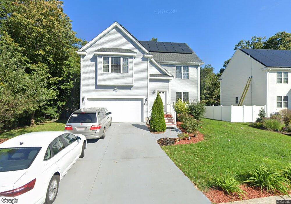
1 Morningside Dr Medway, MA 02053
Estimated Value: $397,000 - $851,000
4
Beds
2
Baths
2,033
Sq Ft
$297/Sq Ft
Est. Value
About This Home
This home is located at 1 Morningside Dr, Medway, MA 02053 and is currently estimated at $604,435, approximately $297 per square foot. 1 Morningside Dr is a home with nearby schools including John D. McGovern Elementary School, Burke-Memorial Elementary, and Medway Middle School.
Ownership History
Date
Name
Owned For
Owner Type
Purchase Details
Closed on
Jun 13, 2014
Sold by
Fox Run Development Gr
Bought by
Dasilva Murilo and Dasilva Carmen S
Current Estimated Value
Home Financials for this Owner
Home Financials are based on the most recent Mortgage that was taken out on this home.
Original Mortgage
$205,612
Outstanding Balance
$155,890
Interest Rate
4.27%
Mortgage Type
New Conventional
Estimated Equity
$448,545
Create a Home Valuation Report for This Property
The Home Valuation Report is an in-depth analysis detailing your home's value as well as a comparison with similar homes in the area
Home Values in the Area
Average Home Value in this Area
Purchase History
| Date | Buyer | Sale Price | Title Company |
|---|---|---|---|
| Dasilva Murilo | $201,500 | -- | |
| Dasilva Murilo | $201,500 | -- |
Source: Public Records
Mortgage History
| Date | Status | Borrower | Loan Amount |
|---|---|---|---|
| Open | Dasilva Murilo | $205,612 | |
| Closed | Dasilva Murilo | $205,612 |
Source: Public Records
Tax History
| Year | Tax Paid | Tax Assessment Tax Assessment Total Assessment is a certain percentage of the fair market value that is determined by local assessors to be the total taxable value of land and additions on the property. | Land | Improvement |
|---|---|---|---|---|
| 2025 | $3,903 | $273,900 | $115,000 | $158,900 |
| 2024 | $3,944 | $273,900 | $115,000 | $158,900 |
| 2023 | $4,758 | $298,500 | $135,600 | $162,900 |
| 2022 | $4,388 | $259,200 | $106,300 | $152,900 |
| 2021 | $4,419 | $253,100 | $97,100 | $156,000 |
| 2020 | $4,029 | $230,200 | $86,400 | $143,800 |
| 2019 | $4,655 | $274,300 | $104,000 | $170,300 |
| 2018 | $3,890 | $220,300 | $82,500 | $137,800 |
| 2017 | $3,772 | $210,500 | $81,100 | $129,400 |
| 2016 | $3,834 | $211,700 | $79,700 | $132,000 |
| 2015 | $3,721 | $204,000 | $69,200 | $134,800 |
| 2014 | $241 | $12,800 | $12,800 | $0 |
Source: Public Records
Map
Nearby Homes
- 33 Gorwin Dr
- 50 Main St
- 79 Lovering St Unit B
- 19 Sycamore Way
- 40 Timber Crest Dr
- 11 Fairway Ln
- 17 Fairway Ln
- 8 Winthrop St
- 116 Winthrop St
- 5 Richardson St
- 0 Hill St
- 204 Village St
- 20 Broad St Unit 1
- 20 Broad St Unit 6
- 20 Broad St Unit A
- 20 Broad St Unit 4
- 4 Shaw St
- 20 Jameson Dr Unit 20
- 3 Jameson Dr Unit 3
- 66 Lakeshore Dr
- 122 Holliston St
- 3 Morningside Dr
- 2 Morningside Dr
- 124 Holliston St
- 4 Morningside Dr
- 7 Morningside Dr
- 6 Morningside Dr
- 9 Morningside Dr
- 126 Holliston St
- 11 Morningside Dr
- 8 Morningside Dr
- 4 Goldenrod Dr
- 12 Morningside Dr
- 10 Morningside Dr
- 119 Holliston St
- 118 Holliston St
- 128 Holliston St
- 6 Goldenrod Dr
- 1 Higgins Rd
- 1 Shamrock Ln
Your Personal Tour Guide
Ask me questions while you tour the home.