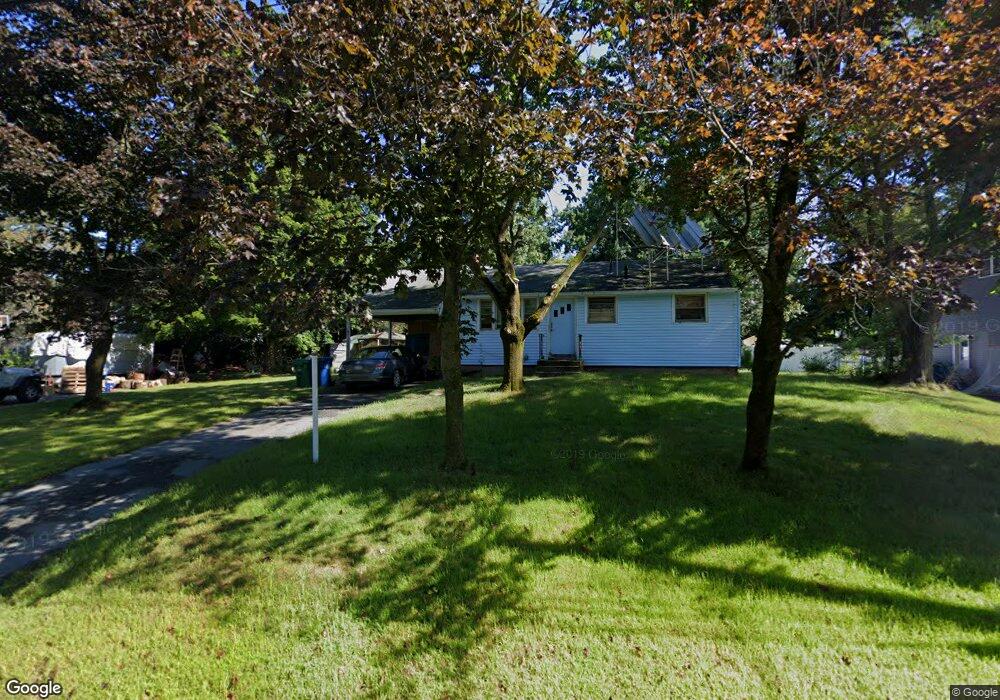
1 Morrison Rd Burlington, MA 01803
Havenville NeighborhoodEstimated Value: $657,000 - $815,597
3
Beds
1
Bath
912
Sq Ft
$795/Sq Ft
Est. Value
About This Home
This home is located at 1 Morrison Rd, Burlington, MA 01803 and is currently estimated at $725,149, approximately $795 per square foot. 1 Morrison Rd is a home located in Middlesex County with nearby schools including Burlington High School, Francis Wyman Elementary School, and Marshall Simonds Middle School.
Ownership History
Date
Name
Owned For
Owner Type
Purchase Details
Closed on
Nov 4, 2024
Sold by
Price George F
Bought by
George F Price Lt and Price
Current Estimated Value
Purchase Details
Closed on
Feb 4, 2015
Sold by
Price George F and Price Irene B
Bought by
Price George F
Purchase Details
Closed on
Mar 11, 1975
Bought by
Price George F
Create a Home Valuation Report for This Property
The Home Valuation Report is an in-depth analysis detailing your home's value as well as a comparison with similar homes in the area
Home Values in the Area
Average Home Value in this Area
Purchase History
| Date | Buyer | Sale Price | Title Company |
|---|---|---|---|
| George F Price Lt | -- | None Available | |
| George F Price Lt | -- | None Available | |
| Price George F | -- | -- | |
| Price George F | -- | -- | |
| Price George F | -- | -- |
Source: Public Records
Tax History
| Year | Tax Paid | Tax Assessment Tax Assessment Total Assessment is a certain percentage of the fair market value that is determined by local assessors to be the total taxable value of land and additions on the property. | Land | Improvement |
|---|---|---|---|---|
| 2025 | $4,929 | $569,200 | $425,800 | $143,400 |
| 2024 | $4,704 | $526,200 | $392,700 | $133,500 |
| 2023 | $4,429 | $471,200 | $340,700 | $130,500 |
| 2022 | $4,332 | $435,400 | $310,700 | $124,700 |
| 2021 | $417 | $420,400 | $295,700 | $124,700 |
| 2020 | $4,053 | $420,400 | $295,700 | $124,700 |
| 2019 | $3,982 | $380,000 | $275,700 | $104,300 |
| 2018 | $8,199 | $366,800 | $266,700 | $100,100 |
| 2017 | $3,787 | $366,800 | $266,700 | $100,100 |
| 2016 | $3,749 | $327,100 | $230,700 | $96,400 |
| 2015 | $3,713 | $327,100 | $230,700 | $96,400 |
| 2014 | $3,647 | $303,900 | $210,700 | $93,200 |
Source: Public Records
Map
Nearby Homes
- 55 Francis Wyman Rd
- 13 Wing Terrace
- 23 County Rd
- 1 Highland Way
- 1 Joanne Rd
- 345 Cambridge St
- 0 Bedford St
- 23 Wilmington Rd
- 27 Purity Springs Rd
- 12 Pleasant St
- 21 Meadowvale Rd
- 12 Murray Ave Unit 18
- 12 Ridgeway Ave
- 4 Hallmark Gardens Unit 2
- 225 Middlesex Turnpike Unit 109
- 225 Middlesex Turnpike Unit 105
- 225 Middlesex Turnpike Unit 106
- 29 Beaverbrook Rd
- 23 Rocky Hill Rd
- 5 Porter Ave
- 41 Francis Wyman Rd
- 37 Francis Wyman Rd
- 39 Francis Wyman Rd
- 2 Morrison Rd
- 5 Morrison Rd
- 5 Brantwood Ln
- 3 Brantwood Ln
- 4 Morrison Rd
- 43 Francis Wyman Rd
- 7 Brantwood Ln
- 35 Francis Wyman Rd
- 7 Morrison Rd
- 6 Morrison Rd
- 9 Brantwood Ln
- 46 Francis Wyman Rd
- 1 Brantwood Ln
- 45 Francis Wyman Rd
- 50 Francis Wyman Rd
- 6 Brantwood Ln
- 4 Brantwood Ln
Your Personal Tour Guide
Ask me questions while you tour the home.