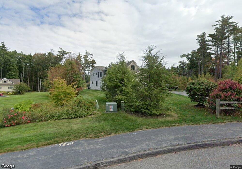
1 Nicola's Way Cumberland, ME 04110
Cumberland Foreside NeighborhoodEstimated Value: $2,551,979 - $2,677,000
5
Beds
4
Baths
3,800
Sq Ft
$692/Sq Ft
Est. Value
About This Home
This home is located at 1 Nicola's Way, Cumberland, ME 04110 and is currently estimated at $2,628,993, approximately $691 per square foot. 1 Nicola's Way is a home located in Cumberland County with nearby schools including Mabel I. Wilson School, Greely Middle School 4-5, and Greely Middle School.
Ownership History
Date
Name
Owned For
Owner Type
Purchase Details
Closed on
Sep 24, 2024
Sold by
Pourchot Elizabeth C
Bought by
Giancotti Marco P and Giancotti Kristen E
Current Estimated Value
Home Financials for this Owner
Home Financials are based on the most recent Mortgage that was taken out on this home.
Original Mortgage
$1,500,000
Outstanding Balance
$1,476,317
Interest Rate
5.5%
Mortgage Type
Purchase Money Mortgage
Estimated Equity
$1,152,676
Create a Home Valuation Report for This Property
The Home Valuation Report is an in-depth analysis detailing your home's value as well as a comparison with similar homes in the area
Home Values in the Area
Average Home Value in this Area
Purchase History
| Date | Buyer | Sale Price | Title Company |
|---|---|---|---|
| Giancotti Marco P | $2,500,000 | None Available | |
| Giancotti Marco P | $2,500,000 | None Available | |
| Giancotti Marco P | $2,500,000 | None Available |
Source: Public Records
Mortgage History
| Date | Status | Borrower | Loan Amount |
|---|---|---|---|
| Open | Giancotti Marco P | $1,500,000 | |
| Closed | Giancotti Marco P | $1,500,000 |
Source: Public Records
Tax History Compared to Growth
Tax History
| Year | Tax Paid | Tax Assessment Tax Assessment Total Assessment is a certain percentage of the fair market value that is determined by local assessors to be the total taxable value of land and additions on the property. | Land | Improvement |
|---|---|---|---|---|
| 2025 | $34,464 | $1,368,700 | $335,600 | $1,033,100 |
| 2024 | $31,822 | $1,368,700 | $335,600 | $1,033,100 |
| 2023 | $30,317 | $1,368,700 | $335,600 | $1,033,100 |
| 2022 | $29,016 | $1,368,700 | $335,600 | $1,033,100 |
| 2021 | $28,127 | $1,368,700 | $335,600 | $1,033,100 |
| 2020 | $27,853 | $1,368,700 | $335,600 | $1,033,100 |
| 2019 | $26,446 | $1,332,300 | $335,600 | $996,700 |
| 2018 | $9,976 | $506,400 | $335,600 | $170,800 |
| 2017 | $6,309 | $335,600 | $335,600 | $0 |
| 2016 | $6,125 | $335,600 | $335,600 | $0 |
| 2015 | $6,074 | $335,600 | $335,600 | $0 |
| 2014 | $5,839 | $335,600 | $335,600 | $0 |
| 2013 | $2,038 | $119,900 | $119,900 | $0 |
Source: Public Records
Map
Nearby Homes
- 15 Sea Cove Rd
- 59 Underwood Rd
- 30 Seaside Way Unit Lot 3
- 263 Foreside Rd
- 78 Applegate Ln
- 186 Foreside Rd
- 5 Harmony Way
- 54 Longwoods Rd
- 267 U S Route 1 Unit 308
- 267 U S Route 1 Unit 404
- 267 U S Route 1 Unit 306
- 267 U S Route 1 Unit 211
- 267 U S Route 1 Unit 309 & 311
- 267 U S Route 1 Unit 201
- 267 U S Route 1 Unit 305
- R03-54-4 Longwoods Rd
- 258 Foreside Rd
- 109 Foreside Rd
- Lot 3 Dunham Ln
- Lot 2 Dunham Ln
- 1 Nicolas Way
- 1 Nicolas Way
- 44 Maeve's Way
- 36 Maeves Way
- 36 Maeve's Way
- 44 Maeves Way
- 3 Nicola's Way
- 7 Nicola's Way
- 31 Maeve's Way Unit Lot 9
- 31 Maeve's Way
- 30 Maeves Way
- 5 Nicola's Way
- 30 Maeve's Way (Lot 2)
- 13 Stony Ridge Rd
- 15 Stony Ridge Rd
- 17 Stony Ridge Rd
- 52 Maeves Way
- 11 Stony Ridge Rd
- 29 Maeves Way
- 29 Maeve's Way