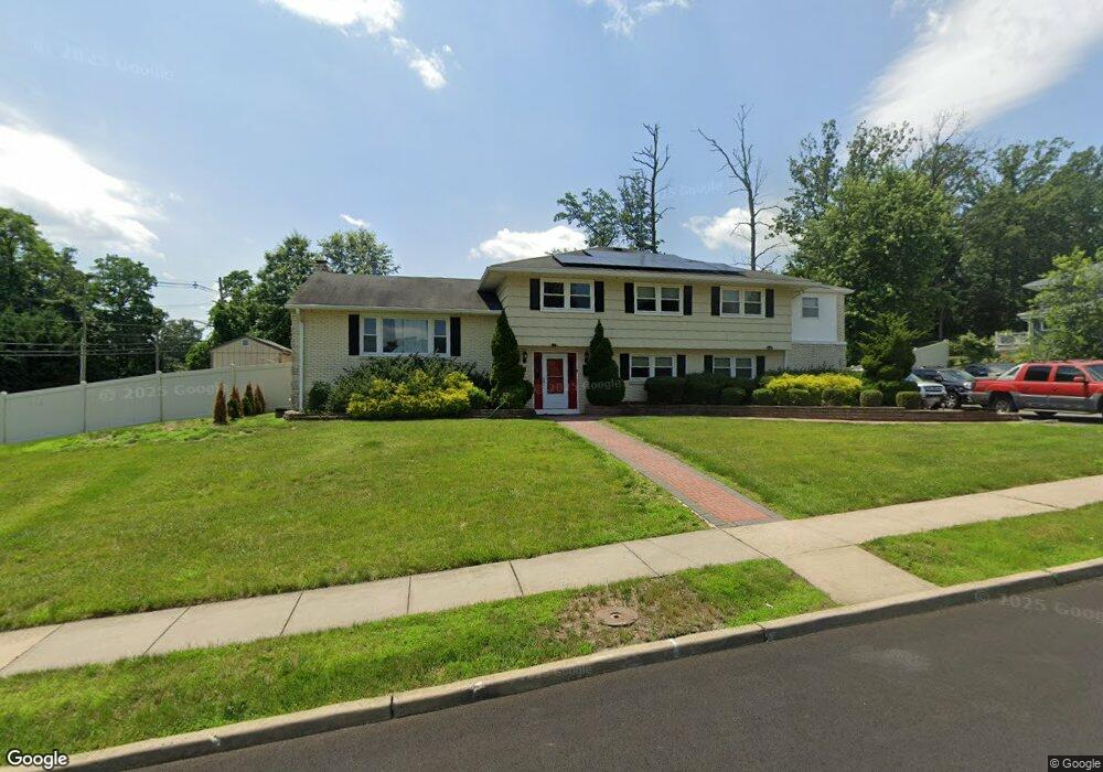
1 Oakland Rd Jamesburg, NJ 08831
Estimated Value: $679,441 - $738,000
6
Beds
7
Baths
2,868
Sq Ft
$247/Sq Ft
Est. Value
About This Home
This home is located at 1 Oakland Rd, Jamesburg, NJ 08831 and is currently estimated at $709,110, approximately $247 per square foot. 1 Oakland Rd is a home located in Middlesex County with nearby schools including John F. Kennedy Elementary School, Grace M. Breckwedel Middle School, and Immaculate Conception School.
Ownership History
Date
Name
Owned For
Owner Type
Purchase Details
Closed on
Jul 11, 2020
Sold by
Carneiro Christine and Carneiro Ricardo
Bought by
Asante Nancy
Current Estimated Value
Home Financials for this Owner
Home Financials are based on the most recent Mortgage that was taken out on this home.
Original Mortgage
$354,853
Interest Rate
2.9%
Mortgage Type
FHA
Purchase Details
Closed on
Nov 24, 2010
Sold by
Donato Rose and Carneiro Christine
Bought by
Carneiro Ricardo and Carneiro Christine
Purchase Details
Closed on
Oct 31, 2005
Sold by
Musso Domenico
Bought by
Donato Rose and Lucarelli Christine
Home Financials for this Owner
Home Financials are based on the most recent Mortgage that was taken out on this home.
Original Mortgage
$330,000
Interest Rate
6.14%
Mortgage Type
New Conventional
Create a Home Valuation Report for This Property
The Home Valuation Report is an in-depth analysis detailing your home's value as well as a comparison with similar homes in the area
Home Values in the Area
Average Home Value in this Area
Purchase History
| Date | Buyer | Sale Price | Title Company |
|---|---|---|---|
| Asante Nancy | $387,500 | Chicago Title Insurance Co | |
| Carneiro Ricardo | -- | None Available | |
| Donato Rose | $420,000 | -- |
Source: Public Records
Mortgage History
| Date | Status | Borrower | Loan Amount |
|---|---|---|---|
| Previous Owner | Asante Nancy | $354,853 | |
| Previous Owner | Donato Rose | $330,000 |
Source: Public Records
Tax History Compared to Growth
Tax History
| Year | Tax Paid | Tax Assessment Tax Assessment Total Assessment is a certain percentage of the fair market value that is determined by local assessors to be the total taxable value of land and additions on the property. | Land | Improvement |
|---|---|---|---|---|
| 2025 | $13,304 | $193,600 | $58,700 | $134,900 |
| 2024 | $12,865 | $193,600 | $58,700 | $134,900 |
| 2023 | $12,865 | $193,600 | $58,700 | $134,900 |
| 2022 | $12,743 | $193,600 | $58,700 | $134,900 |
| 2021 | $12,464 | $193,600 | $58,700 | $134,900 |
| 2020 | $12,357 | $193,600 | $58,700 | $134,900 |
| 2019 | $12,352 | $193,600 | $58,700 | $134,900 |
| 2018 | $12,224 | $193,600 | $58,700 | $134,900 |
| 2017 | $12,135 | $193,600 | $58,700 | $134,900 |
| 2016 | $12,048 | $193,600 | $58,700 | $134,900 |
| 2015 | $11,722 | $193,600 | $58,700 | $134,900 |
| 2014 | $11,200 | $193,600 | $58,700 | $134,900 |
Source: Public Records
Map
Nearby Homes
- 18 Parkside Dr
- 3 Peachtree Ln
- 26 Half Acre Rd
- 22 Half Acre Rd
- 11 Deerfield Ln Unit 6
- 72 Sand Hill Rd
- 2 Golfview Ct
- 58 Hickory Ct
- 54 Dogwood Ct Unit 112
- 14 Hooker St
- 29 Lincoln Ave
- 4 Deer Path
- 28 Sedgwick St
- 26 Sherman St
- 33 Stockton Ave
- 19 Christinalynn Dr
- 165 Stevens Ave
- 1 Whitehall Rd
- 135 Mcknight Ave
- 12 Whitehall Rd