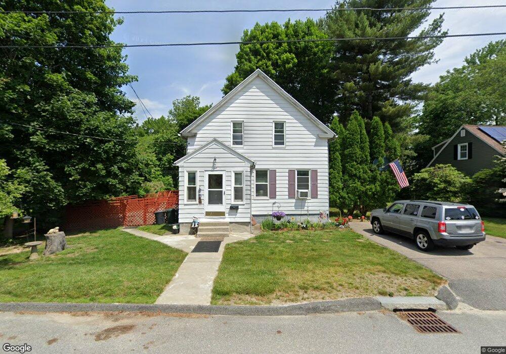
1 Orrison St Worcester, MA 01609
Salisbury Street NeighborhoodEstimated Value: $387,000 - $414,000
3
Beds
2
Baths
1,134
Sq Ft
$354/Sq Ft
Est. Value
About This Home
This home is located at 1 Orrison St, Worcester, MA 01609 and is currently estimated at $401,528, approximately $354 per square foot. 1 Orrison St is a home located in Worcester County with nearby schools including Chandler Magnet, Jacob Hiatt Magnet School, and Flagg Street School.
Create a Home Valuation Report for This Property
The Home Valuation Report is an in-depth analysis detailing your home's value as well as a comparison with similar homes in the area
Home Values in the Area
Average Home Value in this Area
Tax History Compared to Growth
Tax History
| Year | Tax Paid | Tax Assessment Tax Assessment Total Assessment is a certain percentage of the fair market value that is determined by local assessors to be the total taxable value of land and additions on the property. | Land | Improvement |
|---|---|---|---|---|
| 2025 | $4,168 | $316,000 | $119,000 | $197,000 |
| 2024 | $4,029 | $293,000 | $119,000 | $174,000 |
| 2023 | $3,843 | $268,000 | $103,500 | $164,500 |
| 2022 | $3,507 | $230,600 | $82,800 | $147,800 |
| 2021 | $3,287 | $201,900 | $66,200 | $135,700 |
| 2020 | $3,159 | $185,800 | $66,200 | $119,600 |
| 2019 | $3,033 | $168,500 | $59,700 | $108,800 |
| 2018 | $3,045 | $161,000 | $59,700 | $101,300 |
| 2017 | $2,931 | $152,500 | $59,700 | $92,800 |
| 2016 | $2,848 | $138,200 | $44,500 | $93,700 |
| 2015 | $2,774 | $138,200 | $44,500 | $93,700 |
| 2014 | $2,700 | $138,200 | $44,500 | $93,700 |
Source: Public Records
Map
Nearby Homes
- 5 Forest Hill Dr
- 12 Merlin Ct
- 33 Aylesbury Rd
- 32 Aylesbury Rd
- 7 Old Brook Dr
- 40 Rustic Dr
- 2 Baiting Brook Ln Unit 71
- 22 Audubon Rd
- 3 Carter Way
- 66 Brigham Rd
- 1029 Pleasant St Unit 19
- 134 Richmond Ave
- 3 Old English Rd
- 617 Salisbury St
- 12 Pinebrook Ln
- 9 Dennison Rd
- 980 Pleasant St
- 12 Copperfield Rd
- 3 Lynnwood Ln
- 477 Salisbury St