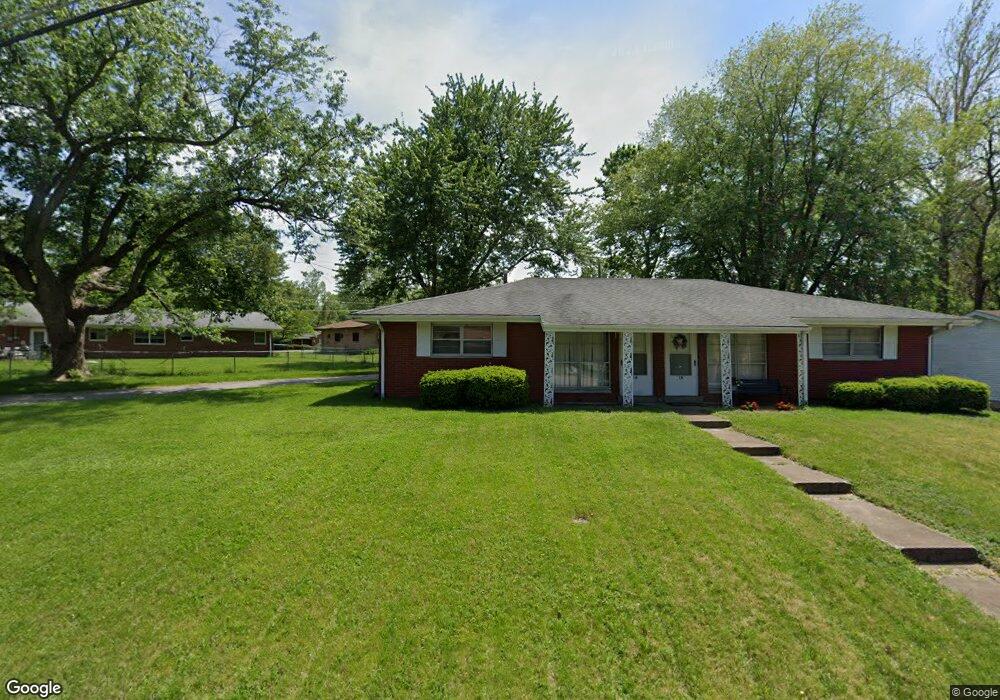
1 Pearson Dr Fairview Heights, IL 62208
Estimated Value: $156,000 - $166,000
Studio
--
Bath
1,674
Sq Ft
$96/Sq Ft
Est. Value
About This Home
This home is located at 1 Pearson Dr, Fairview Heights, IL 62208 and is currently estimated at $161,498, approximately $96 per square foot. 1 Pearson Dr is a home located in St. Clair County with nearby schools including Illini Elementary School, Grant Middle School, and Blessed Sacrament Catholic School.
Ownership History
Date
Name
Owned For
Owner Type
Purchase Details
Closed on
Oct 27, 2023
Sold by
Daniels Robert L
Bought by
Rivendell Realty Llc
Current Estimated Value
Home Financials for this Owner
Home Financials are based on the most recent Mortgage that was taken out on this home.
Original Mortgage
$72,000
Outstanding Balance
$70,665
Interest Rate
7.18%
Mortgage Type
Purchase Money Mortgage
Estimated Equity
$90,833
Purchase Details
Closed on
Jan 24, 2020
Sold by
Daniels June M
Bought by
Daniels Robert L
Purchase Details
Closed on
Mar 29, 2010
Sold by
Bouse Properties Llc
Bought by
Daniels Robert L and Daniels June M
Home Financials for this Owner
Home Financials are based on the most recent Mortgage that was taken out on this home.
Original Mortgage
$83,459
Interest Rate
4.96%
Mortgage Type
New Conventional
Purchase Details
Closed on
Jun 25, 2008
Sold by
Bouse Kevin
Bought by
Bouse Properties Llc
Create a Home Valuation Report for This Property
The Home Valuation Report is an in-depth analysis detailing your home's value as well as a comparison with similar homes in the area
Home Values in the Area
Average Home Value in this Area
Purchase History
| Date | Buyer | Sale Price | Title Company |
|---|---|---|---|
| Rivendell Realty Llc | $80,000 | Town & Country Title | |
| Daniels Robert L | -- | Attorney | |
| Daniels Robert L | $82,000 | Fatic | |
| Bouse Properties Llc | -- | None Available |
Source: Public Records
Mortgage History
| Date | Status | Borrower | Loan Amount |
|---|---|---|---|
| Open | Rivendell Realty Llc | $72,000 | |
| Previous Owner | Daniels Robert L | $83,459 |
Source: Public Records
Tax History
| Year | Tax Paid | Tax Assessment Tax Assessment Total Assessment is a certain percentage of the fair market value that is determined by local assessors to be the total taxable value of land and additions on the property. | Land | Improvement |
|---|---|---|---|---|
| 2024 | $3,491 | $44,231 | $4,698 | $39,533 |
| 2023 | $3,319 | $39,136 | $4,157 | $34,979 |
| 2022 | $3,173 | $36,636 | $4,074 | $32,562 |
| 2021 | $3,030 | $34,772 | $3,867 | $30,905 |
| 2020 | $2,980 | $32,938 | $3,663 | $29,275 |
| 2019 | $2,879 | $32,938 | $3,663 | $29,275 |
| 2018 | $2,985 | $34,150 | $3,916 | $30,234 |
| 2017 | $2,921 | $32,766 | $3,758 | $29,008 |
| 2016 | $2,941 | $32,026 | $3,673 | $28,353 |
| 2014 | $2,778 | $34,304 | $3,968 | $30,336 |
| 2013 | $2,928 | $34,936 | $4,041 | $30,895 |
Source: Public Records
Map
Nearby Homes
- 9931 South Rd
- 9915 North Rd
- 46 W Beacon Hill Rd
- 9614 Holdener Place
- 0 Holdener Dr
- 102 Dogwood Ln
- 24 Weinel Dr
- 225 Merriweather Ln
- 29 Highwood Dr
- 2800 Dutch Hollow Rd
- 4 Briarcliffe Dr
- 10 Meckfessel Dr
- 5 Helen Ct
- 208 Hillwood Dr
- 117 Primrose Ln
- 123 E School St
- 318 Union Hill Rd
- 41 Noles Dr
- 28 Oakleigh Dr
- 9002 de Boupre St
- 1 Pearson Dr Unit A
- 3 Pearson Dr
- 9759 Lincoln Trail
- 9763 Old Lincoln Trail
- 5 Pearson Dr
- 9755 Lincoln Trail
- 4 Pearson Dr
- 7 Pearson Dr
- 9762 Old Lincoln Trail
- 9766 Old Lincoln Trail
- 6 Pearson Dr
- 9758 Old Lincoln Trail
- 2 Brown Dr
- 9754 Old Lincoln Trail
- 1 Hill Dr
- 5 Hill Dr
- 5 Hill Dr
- 9 Carlin Dr
- 13 Carlin Dr
- 5 Carlin Dr
Your Personal Tour Guide
Ask me questions while you tour the home.