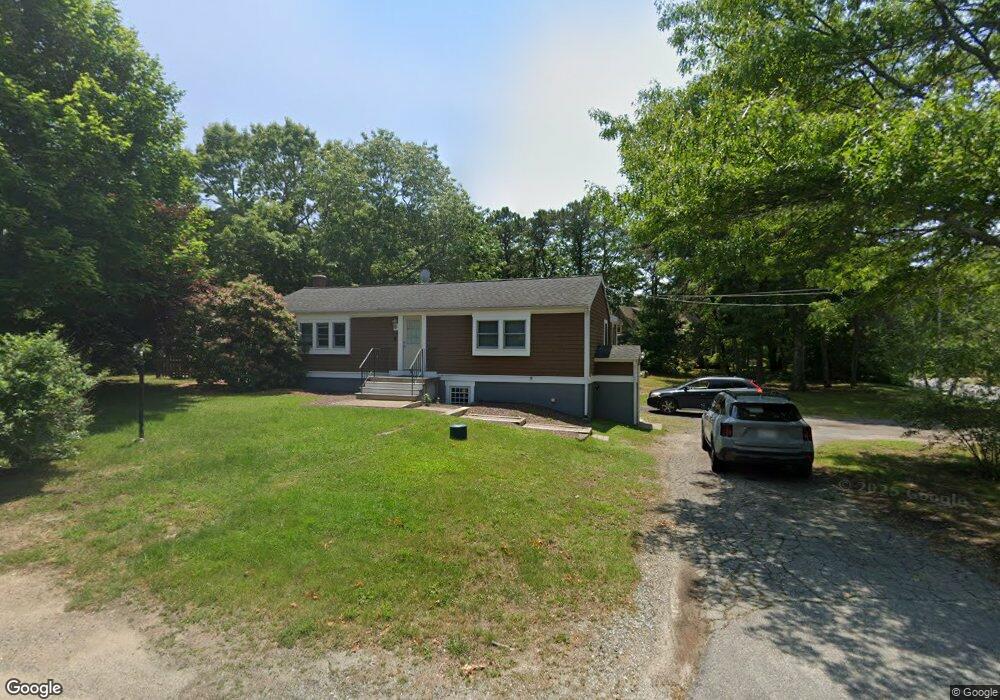
1 Pheasant Ave Plymouth, MA 02360
Estimated Value: $504,000 - $585,000
2
Beds
2
Baths
1,200
Sq Ft
$459/Sq Ft
Est. Value
About This Home
This home is located at 1 Pheasant Ave, Plymouth, MA 02360 and is currently estimated at $550,751, approximately $458 per square foot. 1 Pheasant Ave is a home located in Plymouth County with nearby schools including South Elementary School, Plymouth South Middle School, and Plymouth South High School.
Ownership History
Date
Name
Owned For
Owner Type
Purchase Details
Closed on
Aug 13, 2004
Sold by
Ward Kevin R and Ward Laura J
Bought by
Burr April M
Current Estimated Value
Home Financials for this Owner
Home Financials are based on the most recent Mortgage that was taken out on this home.
Original Mortgage
$223,840
Outstanding Balance
$112,176
Interest Rate
6.16%
Mortgage Type
Purchase Money Mortgage
Estimated Equity
$438,575
Purchase Details
Closed on
Aug 15, 1997
Sold by
Osprey Rt and Survillo Eugene
Bought by
Ward Kevin R
Purchase Details
Closed on
Jan 31, 1997
Sold by
Bank New York Tr
Bought by
Osprey Rt and Survillo Eugene
Purchase Details
Closed on
Dec 10, 1996
Sold by
Bank Of New York Tr and Henderson Carol A
Bought by
Bank Of New York Tr
Create a Home Valuation Report for This Property
The Home Valuation Report is an in-depth analysis detailing your home's value as well as a comparison with similar homes in the area
Home Values in the Area
Average Home Value in this Area
Purchase History
| Date | Buyer | Sale Price | Title Company |
|---|---|---|---|
| Burr April M | $279,800 | -- | |
| Ward Kevin R | $80,000 | -- | |
| Osprey Rt | $37,000 | -- | |
| Bank Of New York Tr | $37,000 | -- |
Source: Public Records
Mortgage History
| Date | Status | Borrower | Loan Amount |
|---|---|---|---|
| Open | Bank Of New York Tr | $223,840 | |
| Closed | Bank Of New York Tr | $55,960 | |
| Previous Owner | Bank Of New York Tr | $192,950 |
Source: Public Records
Tax History Compared to Growth
Tax History
| Year | Tax Paid | Tax Assessment Tax Assessment Total Assessment is a certain percentage of the fair market value that is determined by local assessors to be the total taxable value of land and additions on the property. | Land | Improvement |
|---|---|---|---|---|
| 2025 | $5,426 | $427,600 | $183,800 | $243,800 |
| 2024 | $5,256 | $408,400 | $180,000 | $228,400 |
| 2023 | $5,067 | $369,600 | $157,200 | $212,400 |
| 2022 | $4,859 | $314,900 | $142,900 | $172,000 |
| 2021 | $4,630 | $286,500 | $142,900 | $143,600 |
| 2020 | $4,578 | $280,000 | $139,100 | $140,900 |
| 2019 | $4,286 | $259,100 | $123,800 | $135,300 |
| 2018 | $4,066 | $247,000 | $114,300 | $132,700 |
| 2017 | $3,870 | $233,400 | $114,300 | $119,100 |
| 2016 | $3,643 | $223,900 | $104,800 | $119,100 |
| 2015 | $3,479 | $223,900 | $104,800 | $119,100 |
| 2014 | $3,323 | $219,600 | $104,800 | $114,800 |
Source: Public Records
Map
Nearby Homes
- 4 Sandpiper Ln
- 18 Scarlet Dr
- 15 S Wind Dr
- 2 Wind Rose Ln
- 19 Great Wind Dr
- 464 Lunns Way
- 455 Lunns Way
- 119 Nathan Ln
- 7 Central Ave
- 137 Sandy Beach Rd
- 32 Lake View Blvd
- 20 Towering Trees Rd
- 206R Bourne Rd
- 43 Freeman Dr
- 196 Bourne Rd
- 5 Bearberry Path Unit 5
- 8 Joyce Dr
- 29 Pioneer Trail
- 5 Daylily Dr Unit 5
- 21 Daisy Ln