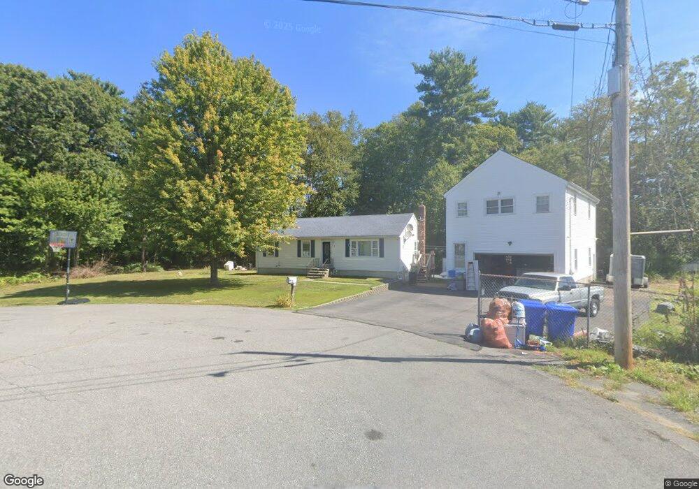
1 Pine Ridge Cir Taunton, MA 02780
Wades Corner NeighborhoodEstimated Value: $511,000 - $586,000
3
Beds
1
Bath
1,056
Sq Ft
$521/Sq Ft
Est. Value
About This Home
This home is located at 1 Pine Ridge Cir, Taunton, MA 02780 and is currently estimated at $550,427, approximately $521 per square foot. 1 Pine Ridge Cir is a home located in Bristol County with nearby schools including Edmund Hatch Bennett School, Taunton High School, and John F. Parker Middle School.
Ownership History
Date
Name
Owned For
Owner Type
Purchase Details
Closed on
Dec 30, 1998
Sold by
Sousa Antonio B and Sousa Maria F
Bought by
Miranda Patrick E and Miranda Lisette C
Current Estimated Value
Home Financials for this Owner
Home Financials are based on the most recent Mortgage that was taken out on this home.
Original Mortgage
$132,500
Interest Rate
6.84%
Mortgage Type
VA
Create a Home Valuation Report for This Property
The Home Valuation Report is an in-depth analysis detailing your home's value as well as a comparison with similar homes in the area
Home Values in the Area
Average Home Value in this Area
Purchase History
| Date | Buyer | Sale Price | Title Company |
|---|---|---|---|
| Miranda Patrick E | $132,500 | -- |
Source: Public Records
Mortgage History
| Date | Status | Borrower | Loan Amount |
|---|---|---|---|
| Open | Miranda Patrick E | $25,000 | |
| Open | Miranda Patrick E | $175,000 | |
| Closed | Miranda Patrick E | $132,500 | |
| Previous Owner | Miranda Patrick E | $82,000 |
Source: Public Records
Tax History Compared to Growth
Tax History
| Year | Tax Paid | Tax Assessment Tax Assessment Total Assessment is a certain percentage of the fair market value that is determined by local assessors to be the total taxable value of land and additions on the property. | Land | Improvement |
|---|---|---|---|---|
| 2025 | $5,451 | $498,300 | $141,200 | $357,100 |
| 2024 | $4,830 | $431,600 | $141,200 | $290,400 |
| 2023 | $4,883 | $405,200 | $147,600 | $257,600 |
| 2022 | $4,450 | $337,600 | $114,400 | $223,200 |
| 2021 | $10,746 | $302,200 | $104,000 | $198,200 |
| 2020 | $11,788 | $289,700 | $104,000 | $185,700 |
| 2019 | $12,520 | $278,800 | $104,000 | $174,800 |
| 2018 | $4,133 | $262,900 | $105,100 | $157,800 |
| 2017 | $12,283 | $254,300 | $99,600 | $154,700 |
| 2016 | $3,873 | $247,000 | $96,700 | $150,300 |
| 2015 | $3,768 | $251,000 | $99,700 | $151,300 |
| 2014 | $3,622 | $247,900 | $99,700 | $148,200 |
Source: Public Records
Map
Nearby Homes
- 0 Range Ave Unit 72771509
- 0 Range Ave Unit 72771508
- 165 Andrea Ln
- 852 Burt St
- 701 Winthrop St Unit 312
- 701 Winthrop St Unit 313
- 424 Winthrop St
- 0 Kimberly Rd
- 140 N Walker St Unit 511
- 130 N Walker St
- 301 Williams St
- 2181 Wheeler St
- 1945 Putters Way
- 876 Autumn St
- 70 Forest Hill Dr
- 233-R Summer St
- 0 Summer St
- 2045 Winthrop St
- 1181 Cohannet St
- 1421 Tremont St
- 2 Pine Ridge Cir
- 25 Pine Ridge Cir
- 12 Pine Ridge Cir
- 16 Range Ave
- 20 Range Ave
- 14 Range Ave
- 26 Pine Ridge Cir
- 35 Overlook Dr
- 42 Pine Ridge Cir
- 11 Overlook Dr
- 562 Winthrop St
- 19 Range Ave
- 52 Pine Ridge Cir
- 9 Range Ave
- 1 Range Ave
- 590 Winthrop St
- 59 Pine Ridge Cir
- 545 Winthrop St
- 595 Winthrop St
- 2 Range Ave