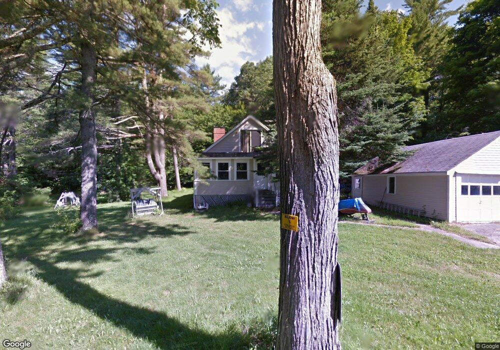
1 Pine Rock Rd Naples, ME 04055
Estimated Value: $425,000 - $520,000
3
Beds
2
Baths
2,016
Sq Ft
$236/Sq Ft
Est. Value
About This Home
This home is located at 1 Pine Rock Rd, Naples, ME 04055 and is currently estimated at $476,390, approximately $236 per square foot. 1 Pine Rock Rd is a home located in Cumberland County with nearby schools including Lake Region High School.
Ownership History
Date
Name
Owned For
Owner Type
Purchase Details
Closed on
Jul 8, 2021
Sold by
Slaugher Jack and Brown Mellisa F
Bought by
Brown Mellisa F
Current Estimated Value
Home Financials for this Owner
Home Financials are based on the most recent Mortgage that was taken out on this home.
Original Mortgage
$154,838
Outstanding Balance
$140,014
Interest Rate
2.96%
Mortgage Type
Purchase Money Mortgage
Estimated Equity
$336,376
Purchase Details
Closed on
Aug 14, 2009
Sold by
Cabana Gerard and Cabana Rosemary
Bought by
Slaughter Jack and Brown Melissa F
Home Financials for this Owner
Home Financials are based on the most recent Mortgage that was taken out on this home.
Original Mortgage
$193,063
Interest Rate
5.36%
Mortgage Type
Unknown
Create a Home Valuation Report for This Property
The Home Valuation Report is an in-depth analysis detailing your home's value as well as a comparison with similar homes in the area
Home Values in the Area
Average Home Value in this Area
Purchase History
| Date | Buyer | Sale Price | Title Company |
|---|---|---|---|
| Brown Mellisa F | -- | None Available | |
| Slaughter Jack | -- | -- |
Source: Public Records
Mortgage History
| Date | Status | Borrower | Loan Amount |
|---|---|---|---|
| Open | Brown Mellisa F | $154,838 | |
| Previous Owner | Slaughter Jack | $0 | |
| Previous Owner | Slaughter Jack | $193,063 |
Source: Public Records
Tax History
| Year | Tax Paid | Tax Assessment Tax Assessment Total Assessment is a certain percentage of the fair market value that is determined by local assessors to be the total taxable value of land and additions on the property. | Land | Improvement |
|---|---|---|---|---|
| 2025 | $2,795 | $294,188 | $88,992 | $205,196 |
| 2024 | $2,736 | $294,188 | $88,992 | $205,196 |
| 2023 | $2,692 | $294,188 | $88,992 | $205,196 |
| 2022 | $2,427 | $294,188 | $88,992 | $205,196 |
| 2021 | $2,391 | $179,105 | $53,395 | $125,710 |
| 2020 | $2,391 | $179,105 | $53,395 | $125,710 |
| 2019 | $2,391 | $179,105 | $53,395 | $125,710 |
| 2018 | $2,391 | $179,105 | $53,395 | $125,710 |
| 2017 | $2,391 | $179,105 | $53,395 | $125,710 |
| 2016 | $2,364 | $179,105 | $53,395 | $125,710 |
| 2015 | $2,427 | $179,105 | $53,395 | $125,710 |
| 2014 | $2,427 | $179,105 | $53,395 | $125,710 |
Source: Public Records
Map
Nearby Homes
- Lot 2 Jackson Cove Rd
- 7 Maplewood Dr
- 69 Roosevelt Trail
- 21 Hillside Ave
- 31 Sand Rd
- 27 Brilliant Way
- 29 Winsor Green Rd Unit 29
- Lot 11 Dillingham Rd
- 67 State Park Rd
- 679 Roosevelt Trail
- 23 Clifford Rd Unit 17
- 33 Knight Dr
- 510 Roosevelt Trail
- 56 Hydrangea Cir Unit 10
- 83 Hydrangea Cir Unit 11
- 21 Daffodil Ct Unit 16
- 16 Mason Ave
- 31 Pleasant View Dr
- 91 Gore Rd
- 87 & 91 Gore
- 5 Pine Rock Rd
- 135 Songo School Rd
- 9 Pine Rock Rd
- 127 Songo School Rd
- 0 Pine Rock Rd
- lot 2 Pine Rock
- 14 Pine Rock Rd
- 124 Songo School Rd
- 123 Songo School Rd
- 20 Pine Rock Rd
- A Pine Rock Rd
- 110 Songo School Rd
- 116 Songo School Rd
- 33 Pine Rock Rd
- 3 Dunton Rd
- 3 Dunton Rd
- 45 Pine Rock Rd
- 4 Dunton Rd
- 176 Songo School
- 82 Songo School Rd
Your Personal Tour Guide
Ask me questions while you tour the home.