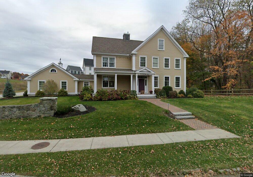
1 Point Shore Dr Amesbury, MA 01913
Estimated Value: $1,413,000 - $1,742,000
3
Beds
4
Baths
2,419
Sq Ft
$639/Sq Ft
Est. Value
About This Home
This home is located at 1 Point Shore Dr, Amesbury, MA 01913 and is currently estimated at $1,545,832, approximately $639 per square foot. 1 Point Shore Dr is a home located in Essex County with nearby schools including Amesbury High School and River Valley Charter School.
Ownership History
Date
Name
Owned For
Owner Type
Purchase Details
Closed on
Jan 25, 2012
Sold by
Mjm Farm T
Bought by
Cherbins Mary E
Current Estimated Value
Purchase Details
Closed on
Aug 9, 1991
Sold by
Podsen Robert and Berry Peter
Bought by
Johnson Frederick and Johnson Leslie
Create a Home Valuation Report for This Property
The Home Valuation Report is an in-depth analysis detailing your home's value as well as a comparison with similar homes in the area
Home Values in the Area
Average Home Value in this Area
Purchase History
| Date | Buyer | Sale Price | Title Company |
|---|---|---|---|
| Cherbins Mary E | -- | -- | |
| Johnson Frederick | $95,000 | -- |
Source: Public Records
Mortgage History
| Date | Status | Borrower | Loan Amount |
|---|---|---|---|
| Previous Owner | Johnson Frederick | $175,000 | |
| Closed | Johnson Frederick | $0 |
Source: Public Records
Tax History Compared to Growth
Tax History
| Year | Tax Paid | Tax Assessment Tax Assessment Total Assessment is a certain percentage of the fair market value that is determined by local assessors to be the total taxable value of land and additions on the property. | Land | Improvement |
|---|---|---|---|---|
| 2025 | $19,179 | $1,253,500 | $515,500 | $738,000 |
| 2024 | $18,416 | $1,177,500 | $486,200 | $691,300 |
| 2023 | $17,249 | $1,055,600 | $441,900 | $613,700 |
| 2022 | $16,484 | $931,800 | $378,700 | $553,100 |
| 2021 | $13,171 | $721,700 | $162,600 | $559,100 |
| 2020 | $12,057 | $701,800 | $156,400 | $545,400 |
| 2019 | $13,484 | $734,000 | $156,400 | $577,600 |
| 2018 | $13,101 | $689,900 | $148,900 | $541,000 |
| 2017 | $13,243 | $663,800 | $111,700 | $552,100 |
| 2016 | $4,135 | $203,900 | $111,700 | $92,200 |
| 2015 | $9,691 | $471,800 | $299,400 | $172,400 |
| 2014 | $8,514 | $406,000 | $262,800 | $143,200 |
Source: Public Records
Map
Nearby Homes
- 18 Hawkswood Estates
- 486 Main St
- 473 Main St
- 2 Birchwood Ct Unit 101
- 25 Clarks Rd Unit 307
- 435 Main St
- 434 Main St
- 394 Main St
- 30 Dorothy e Lucey Dr
- 356 Main St
- 510 Merrimac St Unit 512
- 8 Brown Ave
- 47 Macy St
- 191 Elm St
- 35 Merrimac St
- 45 Macy St Unit 302C
- 492 Merrimac St
- 6 Boyd Dr
- 12 Roosevelt Place
- 60 Merrimac St Unit 907
- 1 Point Shore Rd
- 19B Evans Place
- 2 Point Shore Dr
- 2 Evans Place Unit 2
- 3 Point Shore Rd
- 3 Point Shore Rd
- 18 Evans Place
- 16 Evans Place
- 17 Evans Place
- 502 Main St
- 5 Point Shore Rd
- 5 Point Shore Rd
- 1 Point Shore Overlook
- 15 Evans Place
- 3 Point Shore Overlook
- 500 Main St
- 498 Main St
- 7 4th St
- 496 Main St
- 0 Point Shore Overlook