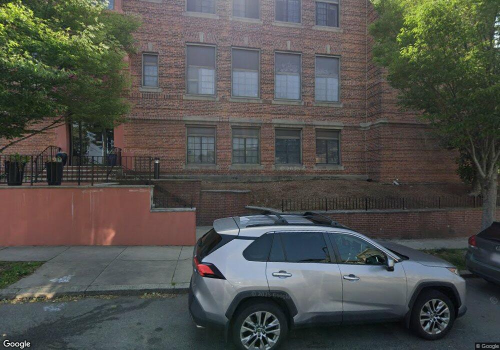
1 Prescott St Unit 203 Boston, MA 02128
Eagle Hill NeighborhoodEstimated Value: $402,000 - $506,000
2
Beds
1
Bath
868
Sq Ft
$524/Sq Ft
Est. Value
About This Home
This home is located at 1 Prescott St Unit 203, Boston, MA 02128 and is currently estimated at $455,162, approximately $524 per square foot. 1 Prescott St Unit 203 is a home located in Suffolk County with nearby schools including Excel Academy East Boston and East Boston Central Catholic School.
Ownership History
Date
Name
Owned For
Owner Type
Purchase Details
Closed on
Sep 2, 1999
Sold by
Matarese Marie
Bought by
Orellana Yuri
Current Estimated Value
Home Financials for this Owner
Home Financials are based on the most recent Mortgage that was taken out on this home.
Original Mortgage
$80,750
Interest Rate
7.5%
Mortgage Type
Purchase Money Mortgage
Purchase Details
Closed on
Mar 18, 1998
Sold by
Herbits Linda E
Bought by
Matarese Marie
Create a Home Valuation Report for This Property
The Home Valuation Report is an in-depth analysis detailing your home's value as well as a comparison with similar homes in the area
Home Values in the Area
Average Home Value in this Area
Purchase History
| Date | Buyer | Sale Price | Title Company |
|---|---|---|---|
| Orellana Yuri | $85,000 | -- | |
| Matarese Marie | $50,000 | -- |
Source: Public Records
Mortgage History
| Date | Status | Borrower | Loan Amount |
|---|---|---|---|
| Open | Matarese Marie | $104,105 | |
| Closed | Matarese Marie | $105,000 | |
| Closed | Matarese Marie | $80,750 |
Source: Public Records
Tax History Compared to Growth
Tax History
| Year | Tax Paid | Tax Assessment Tax Assessment Total Assessment is a certain percentage of the fair market value that is determined by local assessors to be the total taxable value of land and additions on the property. | Land | Improvement |
|---|---|---|---|---|
| 2025 | $4,454 | $384,600 | $0 | $384,600 |
| 2024 | $4,261 | $390,900 | $0 | $390,900 |
| 2023 | $4,154 | $386,800 | $0 | $386,800 |
| 2022 | $4,084 | $375,400 | $0 | $375,400 |
| 2021 | $3,927 | $368,000 | $0 | $368,000 |
| 2020 | $3,360 | $318,200 | $0 | $318,200 |
| 2019 | $3,106 | $294,700 | $0 | $294,700 |
| 2018 | $2,758 | $263,200 | $0 | $263,200 |
| 2017 | $2,533 | $239,200 | $0 | $239,200 |
| 2016 | $2,460 | $223,600 | $0 | $223,600 |
| 2015 | $2,351 | $194,100 | $0 | $194,100 |
| 2014 | $2,278 | $181,100 | $0 | $181,100 |
Source: Public Records
Map
Nearby Homes
- 221 Trenton St
- 1 Prescott St Unit 304
- 118 White St
- 280 Lexington St
- 215 Lexington St
- 278 Princeton St Unit 2
- 212 Princeton St Unit 1
- 316 Princeton St Unit 2
- 403-405 Saratoga St
- 305R Lexington St
- 421 Saratoga St Unit 4A
- 421 Saratoga St Unit 1
- 421 Saratoga St Unit 3
- 147 Trenton St Unit 3
- 125 Putnam St
- 167 Lexington St Unit 1
- 167 Lexington St Unit 167
- 233 Bennington St
- 123 Trenton St Unit 3
- 117 Falcon St Unit 3
- 1 Prescott St Unit 306
- 1 Prescott St Unit 305
- 1 Prescott St Unit 303
- 1 Prescott St Unit 302
- 1 Prescott St Unit 301
- 1 Prescott St Unit 206
- 1 Prescott St Unit 205
- 1 Prescott St Unit 204
- 1 Prescott St Unit 202
- 1 Prescott St Unit 201
- 1 Prescott St Unit 106
- 1 Prescott St Unit 105
- 1 Prescott St Unit 104
- 1 Prescott St Unit 103
- 1 Prescott St Unit 102
- 1 Prescott St Unit 101
- 1 Prescott St Unit 500
- 1 Prescott St
- 1 Prescott St Unit 201, 2
- 1 Prescott St Unit 3011