Estimated Value: $668,000 - $743,000
2
Beds
2
Baths
2,184
Sq Ft
$323/Sq Ft
Est. Value
About This Home
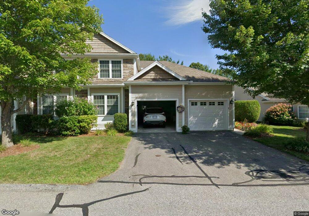
This home is located at 1 Preston Way, Acton, MA 01720 and is currently estimated at $706,299, approximately $323 per square foot. 1 Preston Way is a home located in Middlesex County with nearby schools including Acton-Boxborough Regional High School and Oak Meadow Montessori School.
Ownership History
Date
Name
Owned For
Owner Type
Purchase Details
Closed on
Mar 22, 2019
Sold by
Taylor Raynor W and Taylor Helen D
Bought by
Raynor & Helen Taylor Lt
Current Estimated Value
Purchase Details
Closed on
Dec 28, 2011
Sold by
Davis Alliance Llc
Bought by
Taylor Raynor W and Taylor Helen D
Purchase Details
Closed on
Oct 15, 2010
Sold by
Nic Realty Llc
Bought by
Davis Alliance Llc
Create a Home Valuation Report for This Property
The Home Valuation Report is an in-depth analysis detailing your home's value as well as a comparison with similar homes in the area
Home Values in the Area
Average Home Value in this Area
Purchase History
| Date | Buyer | Sale Price | Title Company |
|---|---|---|---|
| Raynor & Helen Taylor Lt | -- | -- | |
| Taylor Raynor W | $333,900 | -- | |
| Davis Alliance Llc | $150,000 | -- |
Source: Public Records
Tax History
| Year | Tax Paid | Tax Assessment Tax Assessment Total Assessment is a certain percentage of the fair market value that is determined by local assessors to be the total taxable value of land and additions on the property. | Land | Improvement |
|---|---|---|---|---|
| 2025 | $11,161 | $650,800 | $0 | $650,800 |
| 2024 | $10,540 | $632,300 | $0 | $632,300 |
| 2023 | $9,948 | $566,500 | $0 | $566,500 |
| 2022 | $10,060 | $517,200 | $0 | $517,200 |
| 2021 | $9,607 | $474,900 | $0 | $474,900 |
| 2020 | $8,833 | $459,100 | $0 | $459,100 |
| 2019 | $8,412 | $434,300 | $0 | $434,300 |
| 2018 | $8,041 | $414,900 | $0 | $414,900 |
| 2017 | $6,732 | $353,200 | $0 | $353,200 |
| 2016 | $6,909 | $359,300 | $0 | $359,300 |
| 2015 | $6,576 | $345,200 | $0 | $345,200 |
| 2014 | $6,428 | $330,500 | $0 | $330,500 |
Source: Public Records
Map
Nearby Homes
- 927 Main St
- 87 Canterbury Hill Rd
- 875 Acton St
- 5 Samantha Way Unit 5
- 420 Great Rd Unit B3
- 11 Walnut St
- 405 Great Elm Way
- 388 Great Rd Unit A9
- 388 Great Rd Unit B14
- 386 Great Rd Unit A8
- 18 Quail Run Unit 18
- 237 Brown Bear Crossing Unit 237
- 238 Brown Bear Crossing Unit 238
- 262 Brown Bear Crossing Unit 262
- 380A Great Rd Unit 301
- 380 Great Rd Unit B301
- 10 Blue Heron Way Unit 10
- 10 Blue Heron Way
- 18 Mcintosh Ln
- 11 Davis Rd Unit A5
- 1 Preston Way Unit 35
- 3 Preston Way
- 3 Preston Way Unit 3
- 3 Preston Way Unit 36
- 7 Preston Way
- 5 Preston Way
- 7 Preston Way Unit 7
- 7 Preston Way Unit 38
- 5 Preston Way Unit 37
- 11 Hartland Way
- 4 Preston Way
- 4 Preston Way Unit 4
- 4 Preston Way Unit 62
- 2 Preston Way
- 2 Preston Way Unit 2
- 2 Preston Way Unit 63
- 6 Preston Way
- 8 Preston Way
- 27 Hartland Way Unit 310
- 27 Hartland Way Unit 309
Your Personal Tour Guide
Ask me questions while you tour the home.