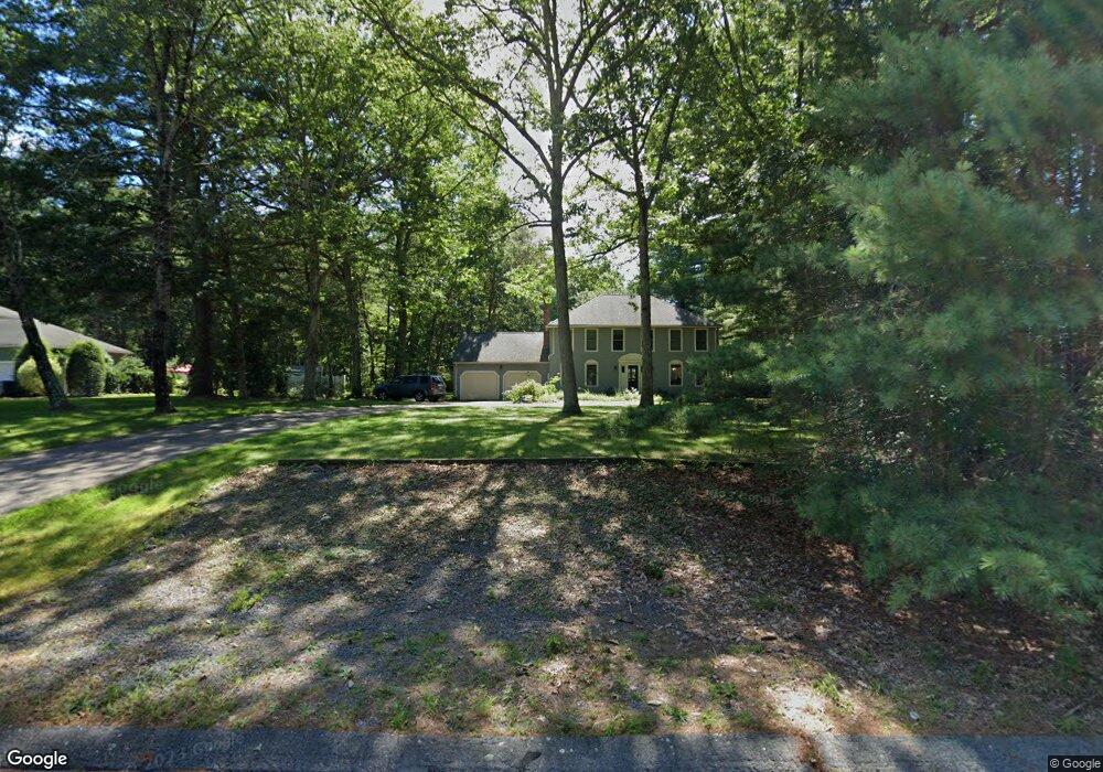
1 Puddingstone Ln Mendon, MA 01756
Estimated Value: $659,278 - $755,000
4
Beds
3
Baths
2,256
Sq Ft
$314/Sq Ft
Est. Value
About This Home
This home is located at 1 Puddingstone Ln, Mendon, MA 01756 and is currently estimated at $707,570, approximately $313 per square foot. 1 Puddingstone Ln is a home located in Worcester County with nearby schools including Nipmuc Regional High School.
Ownership History
Date
Name
Owned For
Owner Type
Purchase Details
Closed on
May 2, 2022
Sold by
Susan G Barnett 2019 T G and Susan Barnett
Bought by
Forsythe Jeffrey and Forsythe Hannah
Current Estimated Value
Home Financials for this Owner
Home Financials are based on the most recent Mortgage that was taken out on this home.
Original Mortgage
$475,000
Outstanding Balance
$443,445
Interest Rate
4.16%
Mortgage Type
Purchase Money Mortgage
Estimated Equity
$264,125
Purchase Details
Closed on
Nov 8, 2019
Sold by
Barnett Susan G
Bought by
Susan G Barnett 2019 T
Purchase Details
Closed on
Feb 20, 2014
Sold by
Barnett Susan G and Barnett Ronald W
Bought by
Barnett Susan G
Home Financials for this Owner
Home Financials are based on the most recent Mortgage that was taken out on this home.
Original Mortgage
$160,000
Interest Rate
4.5%
Mortgage Type
New Conventional
Purchase Details
Closed on
Feb 28, 2001
Sold by
Anp Blackstone Energy
Bought by
Barnett Ronald W and Barnett Susan G
Purchase Details
Closed on
Sep 20, 2000
Sold by
Maclean R J R and Maclean Deborah A
Bought by
Anp Blackstone Engergy
Purchase Details
Closed on
Jan 28, 2000
Sold by
Moran Timothy P and Moran Cynthia E
Bought by
Aanp Blackstone Energy
Create a Home Valuation Report for This Property
The Home Valuation Report is an in-depth analysis detailing your home's value as well as a comparison with similar homes in the area
Home Values in the Area
Average Home Value in this Area
Purchase History
| Date | Buyer | Sale Price | Title Company |
|---|---|---|---|
| Forsythe Jeffrey | $500,000 | None Available | |
| Susan G Barnett 2019 T | -- | -- | |
| Barnett Susan G | -- | -- | |
| Barnett Susan G | -- | -- | |
| Barnett Susan G | -- | -- | |
| Barnett Ronald W | $290,000 | -- | |
| Anp Blackstone Engergy | $347,129 | -- | |
| Aanp Blackstone Energy | $383,112 | -- |
Source: Public Records
Mortgage History
| Date | Status | Borrower | Loan Amount |
|---|---|---|---|
| Open | Forsythe Jeffrey | $475,000 | |
| Previous Owner | Barnett Susan G | $160,000 |
Source: Public Records
Tax History
| Year | Tax Paid | Tax Assessment Tax Assessment Total Assessment is a certain percentage of the fair market value that is determined by local assessors to be the total taxable value of land and additions on the property. | Land | Improvement |
|---|---|---|---|---|
| 2025 | $8,945 | $668,000 | $169,900 | $498,100 |
| 2024 | $8,780 | $640,400 | $163,400 | $477,000 |
| 2023 | $8,557 | $586,100 | $145,800 | $440,300 |
| 2022 | $8,405 | $545,400 | $145,700 | $399,700 |
| 2021 | $7,985 | $475,600 | $141,300 | $334,300 |
| 2020 | $7,474 | $446,200 | $135,400 | $310,800 |
| 2019 | $7,197 | $429,900 | $125,800 | $304,100 |
| 2018 | $7,071 | $416,900 | $125,800 | $291,100 |
| 2017 | $7,096 | $399,800 | $125,800 | $274,000 |
| 2016 | $6,753 | $391,500 | $121,400 | $270,100 |
| 2015 | $6,129 | $382,800 | $121,400 | $261,400 |
| 2014 | $5,842 | $364,700 | $117,700 | $247,000 |
Source: Public Records
Map
Nearby Homes
- 183 Elm St Unit 185
- 5 Bernier Ln
- 11 Bellingham Rd
- 31 Cemetery St
- 36 Indian Run Rd
- 11 Quail Run Rd
- 5 Whitman Cir Unit 5
- 111 Providence St
- 3 Whitman Cir Unit 3
- 1 Whitman Cir Unit 1
- 27 Liberty Hill Dr
- 0 North St Unit 73440626
- 93 Providence St Unit B
- 1, 3, 5 Old Lincoln St
- 50 Hartford Ave E
- 8 Puffer Dr
- 123-125 Mendon St
- 6 Barrows Rd
- 162 Blackstone St
- 183 Blackstone St
- 1A Puddingstone Ln
- 3 Colonial Dr
- 5 Colonial Dr
- 2 Puddingstone Ln
- 3 Puddingstone Ln
- 4 Puddingstone Ln
- 7 Colonial Dr
- 14 Colonial Dr
- 5 Puddingstone Ln
- 16 Colonial Dr
- 18 Colonial Dr
- 9 Colonial Dr
- 6 Puddingstone Ln
- 12 Spruce St
- 20 Colonial Dr
- 7 Puddingstone Ln
- 11 Colonial Dr
- 22 Colonial Dr
- 8 Puddingstone Ln
- 9 Puddingstone Ln
Your Personal Tour Guide
Ask me questions while you tour the home.