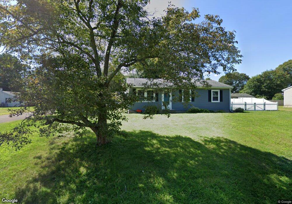
1 Robin Ln Clinton, CT 06413
Estimated Value: $306,000 - $381,000
1
Bed
1
Bath
1,000
Sq Ft
$341/Sq Ft
Est. Value
About This Home
This home is located at 1 Robin Ln, Clinton, CT 06413 and is currently estimated at $341,115, approximately $341 per square foot. 1 Robin Ln is a home located in Middlesex County with nearby schools including Lewin G. Joel Jr. School, The Morgan School, and Oxford Academy.
Ownership History
Date
Name
Owned For
Owner Type
Purchase Details
Closed on
Dec 13, 1996
Sold by
Terrio Peter J and Terrio Dara L
Bought by
Allen Pamela N
Current Estimated Value
Home Financials for this Owner
Home Financials are based on the most recent Mortgage that was taken out on this home.
Original Mortgage
$107,800
Outstanding Balance
$18,293
Interest Rate
7.75%
Mortgage Type
Unknown
Estimated Equity
$322,822
Purchase Details
Closed on
Oct 13, 1992
Sold by
Dattilo Donna M and Dattilo Frank A
Bought by
Terrio Peter J and Terrio Dara L
Home Financials for this Owner
Home Financials are based on the most recent Mortgage that was taken out on this home.
Original Mortgage
$107,700
Interest Rate
7.99%
Mortgage Type
Unknown
Create a Home Valuation Report for This Property
The Home Valuation Report is an in-depth analysis detailing your home's value as well as a comparison with similar homes in the area
Home Values in the Area
Average Home Value in this Area
Purchase History
| Date | Buyer | Sale Price | Title Company |
|---|---|---|---|
| Allen Pamela N | $113,500 | -- | |
| Allen Pamela N | $113,500 | -- | |
| Terrio Peter J | $109,000 | -- | |
| Terrio Peter J | $109,000 | -- |
Source: Public Records
Mortgage History
| Date | Status | Borrower | Loan Amount |
|---|---|---|---|
| Open | Terrio Peter J | $107,800 | |
| Closed | Terrio Peter J | $107,800 | |
| Previous Owner | Terrio Peter J | $107,700 |
Source: Public Records
Tax History Compared to Growth
Tax History
| Year | Tax Paid | Tax Assessment Tax Assessment Total Assessment is a certain percentage of the fair market value that is determined by local assessors to be the total taxable value of land and additions on the property. | Land | Improvement |
|---|---|---|---|---|
| 2025 | $3,833 | $123,100 | $43,700 | $79,400 |
| 2024 | $3,725 | $123,100 | $43,700 | $79,400 |
| 2023 | $3,672 | $123,100 | $43,700 | $79,400 |
| 2022 | $3,672 | $123,100 | $43,700 | $79,400 |
| 2021 | $3,505 | $117,500 | $42,500 | $75,000 |
| 2020 | $3,672 | $117,500 | $42,500 | $75,000 |
| 2019 | $3,672 | $117,500 | $42,500 | $75,000 |
| 2018 | $3,588 | $117,500 | $42,500 | $75,000 |
| 2017 | $3,514 | $117,500 | $42,500 | $75,000 |
| 2016 | $3,189 | $117,500 | $42,500 | $75,000 |
| 2015 | $3,322 | $124,100 | $49,200 | $74,900 |
| 2014 | $3,260 | $124,100 | $49,200 | $74,900 |
Source: Public Records
Map
Nearby Homes
- 50 & 61 Grove Way
- 51 Linden Ave N
- 0 Causeway
- 56 Linden Ave N
- 176 Shore Rd
- 86 Grove Beach Rd N
- 280 E Main St Unit E6
- 144 Shore Rd
- 153 Shore Rd Unit 2
- 407 Grove Beach Rd N
- 59 Old Post Rd Unit AR1
- 448 A - B Grove Beach Rd N
- 59 Founders Village
- 0 E Main St
- 31 Founders Village
- 192 E Main St
- 8 W Woods Dr
- 6 Kingfisher Ln
- 6 Osprey Commons
- 201 Old Mail Trail
- 1 Hickory Hill Rd
- 3 Robin Ln
- 0 Robin Ln
- 4 Hickory Hill Rd
- 6 Hickory Hill Rd
- 2 Robin Ln
- 2 Hickory Hill Rd
- 5 Robin Ln
- 4 Robin Ln
- 30 Bluff Ave
- 8 Hickory Hill Rd
- 31 Bluff Ave
- 29 Bluff Ave
- 10 Bluff Ave Unit 1-4
- 10 Bluff Ave Unit 2-2
- 10 Bluff Ave Unit 1-2-2
- 10 Bluff Ave Unit 1-5
- 10 Bluff Ave
- 35 Bluff Ave
- 25 Bluff Ave