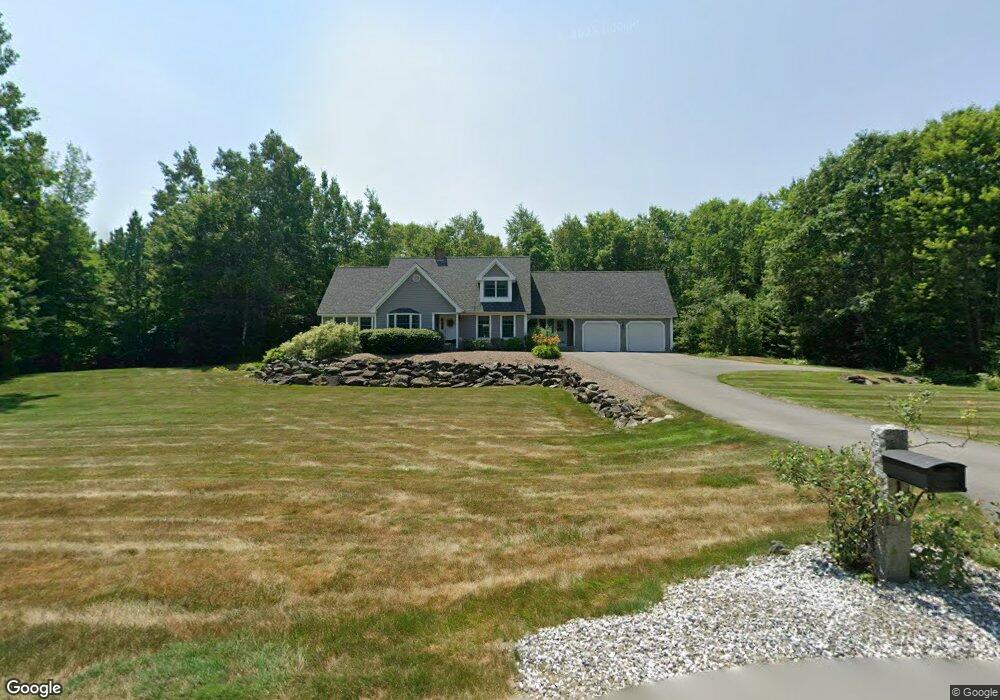
1 Rock Ridge Dr Winslow, ME 04901
Estimated Value: $476,000 - $583,000
4
Beds
3
Baths
2,512
Sq Ft
$203/Sq Ft
Est. Value
About This Home
This home is located at 1 Rock Ridge Dr, Winslow, ME 04901 and is currently estimated at $509,434, approximately $202 per square foot. 1 Rock Ridge Dr is a home located in Kennebec County with nearby schools including Winslow Elementary School, Winslow Junior High School, and Winslow High School.
Ownership History
Date
Name
Owned For
Owner Type
Purchase Details
Closed on
Jul 6, 2016
Sold by
Merrill Pamela
Bought by
Bard Paul P and Bard Kathleen M
Current Estimated Value
Home Financials for this Owner
Home Financials are based on the most recent Mortgage that was taken out on this home.
Original Mortgage
$60,000
Outstanding Balance
$47,991
Interest Rate
3.64%
Mortgage Type
New Conventional
Estimated Equity
$461,443
Purchase Details
Closed on
Nov 4, 2013
Sold by
Strahan Arlene M and Strahan Roy L
Bought by
Bard Kathleen M and Bard Paul P
Create a Home Valuation Report for This Property
The Home Valuation Report is an in-depth analysis detailing your home's value as well as a comparison with similar homes in the area
Home Values in the Area
Average Home Value in this Area
Purchase History
| Date | Buyer | Sale Price | Title Company |
|---|---|---|---|
| Bard Paul P | -- | -- | |
| Bard Kathleen M | -- | -- |
Source: Public Records
Mortgage History
| Date | Status | Borrower | Loan Amount |
|---|---|---|---|
| Open | Bard Paul P | $60,000 |
Source: Public Records
Tax History Compared to Growth
Tax History
| Year | Tax Paid | Tax Assessment Tax Assessment Total Assessment is a certain percentage of the fair market value that is determined by local assessors to be the total taxable value of land and additions on the property. | Land | Improvement |
|---|---|---|---|---|
| 2024 | $6,291 | $419,400 | $56,900 | $362,500 |
| 2023 | $6,291 | $419,400 | $56,900 | $362,500 |
| 2022 | $4,738 | $247,800 | $30,300 | $217,500 |
| 2021 | $5,135 | $254,200 | $30,300 | $223,900 |
| 2020 | $4,784 | $254,200 | $30,300 | $223,900 |
| 2019 | $4,738 | $254,200 | $30,300 | $223,900 |
| 2018 | $4,560 | $254,200 | $30,300 | $223,900 |
| 2017 | $4,255 | $254,200 | $30,300 | $223,900 |
| 2016 | $4,001 | $254,200 | $30,300 | $223,900 |
| 2015 | $3,962 | $255,600 | $31,700 | $223,900 |
| 2014 | $3,962 | $255,600 | $31,700 | $223,900 |
Source: Public Records
Map
Nearby Homes
- 1 S Ridge Dr
- 1 S Reynolds Rd
- 701 China Rd
- 90 Patterson Ave
- 235 S Reynolds Rd
- TBD China Rd
- Lot 76 Bassett Rd
- lot 75 Bassett Rd
- 486 Garland Rd
- 242 China Rd
- 2 and 3 Blue Heron Ln
- 14 Marie St
- 5 Mar Val Terrace Unit D7
- 441 S Reynolds Rd
- 308 Cushman Rd
- 5 Robert St
- 327 Cushman Rd
- 75 Halifax St Unit 31
- 85 Halifax St
- 73 Halifax St