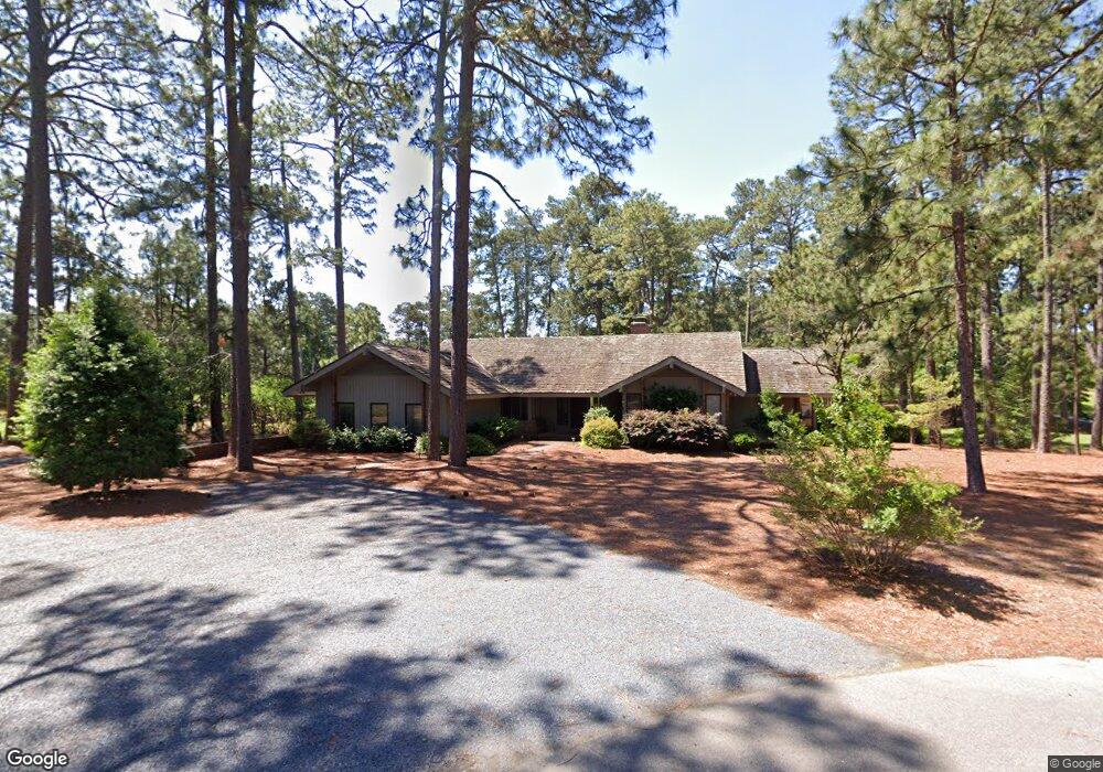
1 Rockland Ln Pinehurst, NC 28374
Estimated Value: $704,000 - $903,000
3
Beds
3
Baths
2,617
Sq Ft
$317/Sq Ft
Est. Value
About This Home
This home is located at 1 Rockland Ln, Pinehurst, NC 28374 and is currently estimated at $830,386, approximately $317 per square foot. 1 Rockland Ln is a home located in Moore County with nearby schools including Pinehurst Elementary School, West Pine Middle School, and Pinecrest High School.
Ownership History
Date
Name
Owned For
Owner Type
Purchase Details
Closed on
Feb 24, 2021
Sold by
Black Rudorth
Bought by
Player Kay Millikan and Millikan Robert
Current Estimated Value
Purchase Details
Closed on
Nov 25, 2020
Sold by
Rockland Pointe Llc
Bought by
Murzyn Michael and Murzyn Alicia
Purchase Details
Closed on
Jun 4, 2018
Sold by
Underwood M Dean
Bought by
Marois Francis P and Marois Debbie A
Home Financials for this Owner
Home Financials are based on the most recent Mortgage that was taken out on this home.
Original Mortgage
$397,600
Interest Rate
4.5%
Mortgage Type
New Conventional
Create a Home Valuation Report for This Property
The Home Valuation Report is an in-depth analysis detailing your home's value as well as a comparison with similar homes in the area
Home Values in the Area
Average Home Value in this Area
Purchase History
| Date | Buyer | Sale Price | Title Company |
|---|---|---|---|
| Player Kay Millikan | -- | None Available | |
| Murzyn Michael | $665,000 | None Available | |
| Marois Francis P | $447,500 | None Available |
Source: Public Records
Mortgage History
| Date | Status | Borrower | Loan Amount |
|---|---|---|---|
| Previous Owner | Marois Francis P | $397,600 |
Source: Public Records
Tax History Compared to Growth
Tax History
| Year | Tax Paid | Tax Assessment Tax Assessment Total Assessment is a certain percentage of the fair market value that is determined by local assessors to be the total taxable value of land and additions on the property. | Land | Improvement |
|---|---|---|---|---|
| 2024 | $3,948 | $689,540 | $232,500 | $457,040 |
| 2023 | $4,120 | $689,540 | $232,500 | $457,040 |
| 2022 | $3,400 | $407,200 | $142,500 | $264,700 |
| 2021 | $3,522 | $407,200 | $142,500 | $264,700 |
| 2020 | $3,486 | $407,200 | $142,500 | $264,700 |
| 2019 | $3,486 | $407,200 | $142,500 | $264,700 |
| 2018 | $3,163 | $395,360 | $142,500 | $252,860 |
| 2017 | $3,123 | $395,360 | $142,500 | $252,860 |
| 2015 | $3,064 | $395,360 | $142,500 | $252,860 |
| 2014 | $3,223 | $421,350 | $157,350 | $264,000 |
| 2013 | -- | $421,350 | $157,350 | $264,000 |
Source: Public Records
Map
Nearby Homes
- 1 Linden Ln
- 3 Belair Ct
- 4 Belair Ct Unit 11
- 5 Halter Place Unit 8
- 6 Montclair Ct
- 9 Halter Place
- 965 Monticello Dr
- 10 Pine Tree Rd Unit 125
- 10 Pine Tree Rd Unit 214
- 10 Pine Tree Rd Unit 203
- 10 Pine Tree Rd Unit 132
- 13 Sulky Ln Unit 8A
- 215 Surry Cir N Unit 8
- 50 Cherry Hill Dr
- 1245 Monticello Dr
- 0 King Unit 100519471
- 0 King Unit 100484882
- Freeport Plan at South Pinehurst Cottages
- Clifton Plan at South Pinehurst Cottages
- Azalea Plan at South Pinehurst Cottages