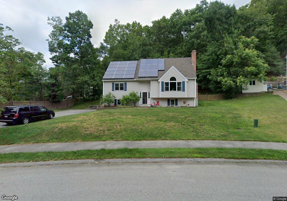
1 Rollie Shepard Dr Millbury, MA 01527
Estimated Value: $604,552 - $683,000
3
Beds
3
Baths
2,005
Sq Ft
$322/Sq Ft
Est. Value
About This Home
This home is located at 1 Rollie Shepard Dr, Millbury, MA 01527 and is currently estimated at $646,388, approximately $322 per square foot. 1 Rollie Shepard Dr is a home located in Worcester County with nearby schools including Elmwood Street Elementary School, Raymond E. Shaw Elementary School, and Millbury Junior/Senior High School.
Ownership History
Date
Name
Owned For
Owner Type
Purchase Details
Closed on
Mar 3, 2000
Sold by
Rollie Shepard Rt and Miles
Bought by
Hartshorn Robert F and Hartshorn Marion A
Current Estimated Value
Home Financials for this Owner
Home Financials are based on the most recent Mortgage that was taken out on this home.
Original Mortgage
$179,623
Interest Rate
8.21%
Mortgage Type
Purchase Money Mortgage
Create a Home Valuation Report for This Property
The Home Valuation Report is an in-depth analysis detailing your home's value as well as a comparison with similar homes in the area
Home Values in the Area
Average Home Value in this Area
Purchase History
| Date | Buyer | Sale Price | Title Company |
|---|---|---|---|
| Hartshorn Robert F | $195,000 | -- | |
| Hartshorn Robert F | $195,000 | -- |
Source: Public Records
Mortgage History
| Date | Status | Borrower | Loan Amount |
|---|---|---|---|
| Open | Hartshorn Robert F | $156,429 | |
| Closed | Hartshorn Robert F | $186,000 | |
| Closed | Hartshorn Robert F | $184,000 | |
| Closed | Hartshorn Robert F | $179,623 |
Source: Public Records
Tax History Compared to Growth
Tax History
| Year | Tax Paid | Tax Assessment Tax Assessment Total Assessment is a certain percentage of the fair market value that is determined by local assessors to be the total taxable value of land and additions on the property. | Land | Improvement |
|---|---|---|---|---|
| 2025 | $7,251 | $541,500 | $126,100 | $415,400 |
| 2024 | $6,659 | $503,300 | $116,700 | $386,600 |
| 2023 | $5,888 | $407,500 | $81,600 | $325,900 |
| 2022 | $5,729 | $381,900 | $81,600 | $300,300 |
| 2021 | $5,593 | $362,500 | $81,600 | $280,900 |
| 2020 | $5,408 | $352,800 | $81,600 | $271,200 |
| 2019 | $5,078 | $346,800 | $81,300 | $265,500 |
| 2018 | $50 | $329,200 | $81,300 | $247,900 |
| 2017 | $5,291 | $291,300 | $81,300 | $210,000 |
| 2016 | $4,772 | $289,900 | $81,300 | $208,600 |
| 2015 | $4,711 | $286,200 | $82,900 | $203,300 |
| 2014 | $4,261 | $249,200 | $86,600 | $162,600 |
Source: Public Records
Map
Nearby Homes
- 3 May St
- 86 Wheelock Ave
- 2 Diane St
- 90 Macarthur Dr
- 12 Irene Ct
- 11 Westview Ave
- 1 Pineland Ave
- 1 Broadmeadow Ave
- 12 Alstead Path
- 330 Millbury Ave
- 46 John Dr Unit 46
- 11 Maplewood Rd
- 5 Edward Dr
- 27 A-B Grafton St
- 21 Lordvale Blvd Unit 406
- 28 Lincoln Ln
- 5 Lincoln Ln Unit 5
- 3 Stidsen Way
- 497 Massasoit Rd
- 76 Samuel Dr
- 3 Rollie Shepard Dr
- 23 Macarthur Dr
- 25 Macarthur Dr
- 21 Macarthur Dr
- 52 Tiffany Cir
- 51 Tiffany Cir
- 50 Tiffany Cir
- 49 Tiffany Cir
- 27 Macarthur Dr
- 48 Tiffany Cir
- 47 Tiffany Cir
- 46 Tiffany Cir
- 6 Rollie Shepard Dr
- 7 Rollie Shepard Dr
- 56 Tiffany Cir
- 55 Tiffany Cir
- 54 Tiffany Cir
- 53 Tiffany Cir
- 19 Macarthur Dr
- 31 Macarthur Dr