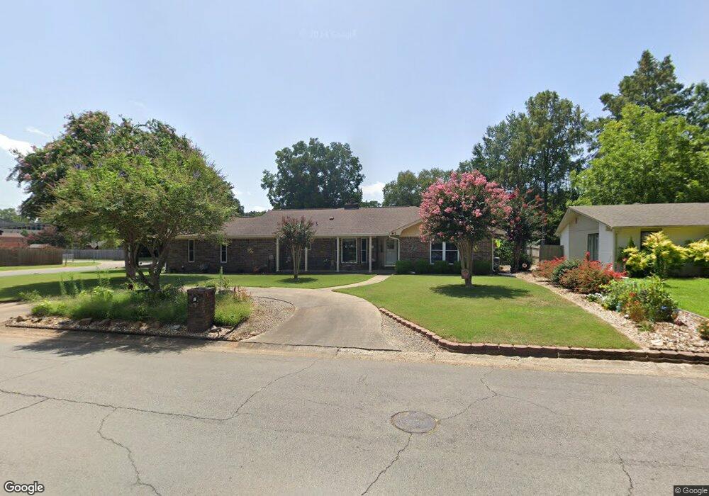
1 Rosewood Dr Conway, AR 72034
Southwest Conway NeighborhoodEstimated Value: $301,330 - $348,000
--
Bed
2
Baths
2,868
Sq Ft
$114/Sq Ft
Est. Value
About This Home
This home is located at 1 Rosewood Dr, Conway, AR 72034 and is currently estimated at $327,583, approximately $114 per square foot. 1 Rosewood Dr is a home located in Faulkner County with nearby schools including Marguerite Vann Elementary School, Carl Stuart Middle School, and Conway Junior High School.
Ownership History
Date
Name
Owned For
Owner Type
Purchase Details
Closed on
Mar 21, 2006
Bought by
Carter
Current Estimated Value
Purchase Details
Closed on
Mar 14, 2006
Bought by
Carter
Purchase Details
Closed on
Jul 14, 2003
Bought by
New
Purchase Details
Closed on
Sep 19, 1994
Bought by
New
Purchase Details
Closed on
Jul 25, 1986
Bought by
Grummer
Create a Home Valuation Report for This Property
The Home Valuation Report is an in-depth analysis detailing your home's value as well as a comparison with similar homes in the area
Home Values in the Area
Average Home Value in this Area
Purchase History
| Date | Buyer | Sale Price | Title Company |
|---|---|---|---|
| Carter | $175,000 | -- | |
| Carter | $175,000 | -- | |
| New | -- | -- | |
| New | $106,000 | -- | |
| Grummer | $92,000 | -- |
Source: Public Records
Tax History Compared to Growth
Tax History
| Year | Tax Paid | Tax Assessment Tax Assessment Total Assessment is a certain percentage of the fair market value that is determined by local assessors to be the total taxable value of land and additions on the property. | Land | Improvement |
|---|---|---|---|---|
| 2025 | $1,767 | $68,171 | $3,600 | $64,571 |
| 2024 | $1,609 | $59,220 | $3,600 | $55,620 |
| 2023 | $1,609 | $40,720 | $3,600 | $37,120 |
| 2022 | $1,234 | $40,720 | $3,600 | $37,120 |
| 2021 | $1,234 | $40,720 | $3,600 | $37,120 |
| 2020 | $1,234 | $40,020 | $3,600 | $36,420 |
| 2019 | $1,234 | $40,020 | $3,600 | $36,420 |
| 2018 | $1,259 | $40,020 | $3,600 | $36,420 |
| 2017 | $1,259 | $40,020 | $3,600 | $36,420 |
| 2016 | $1,259 | $31,790 | $3,600 | $28,190 |
| 2015 | $1,609 | $42,020 | $3,600 | $38,420 |
| 2014 | $1,259 | $42,020 | $3,600 | $38,420 |
Source: Public Records
Map
Nearby Homes
- 7 Red Bud Dr
- 2700 Stonebrook Cove
- 2759 Carl Stuart St
- 2913 Joanna Dr
- Lot 6 Orchard Hill Ph 4
- 297 Southwick Cove
- 207 Fairway Dr
- 1951 Torreyson St
- 3065 Cottontop Rd
- 905 Wineberry
- 2585 Adamsbrooke Dr
- 925 Wineberry
- 2410 Marie Dr
- 1365 Bruce St
- 3107 Stermer Rd
- 2550 Adamsbrooke Dr
- 2400 Eighteen Loop
- 2435 Eighteen Loop
- 1005 Wineberry
- 409 Mitchell St
- 0 Rosewood Dr
- 102 Robinwood Dr
- 104 Robinwood Dr
- 18 Red Bud Dr
- 5 Rosewood Dr
- 4 Rosewood Dr
- 98 Shamrock Dr
- 106 Robinwood Dr
- 6 Rosewood Dr
- 100 Shamrock Dr
- 105 Shamrock Dr
- 108 Robinwood Dr
- 7 Rosewood Dr
- 102 Oaklawn Dr
- 16 Red Bud Dr
- 8 Rosewood Dr
- 106 Shamrock Dr
- 107 Shamrock Dr
- 107 Robinwood Dr
- 1 Oakdale Dr