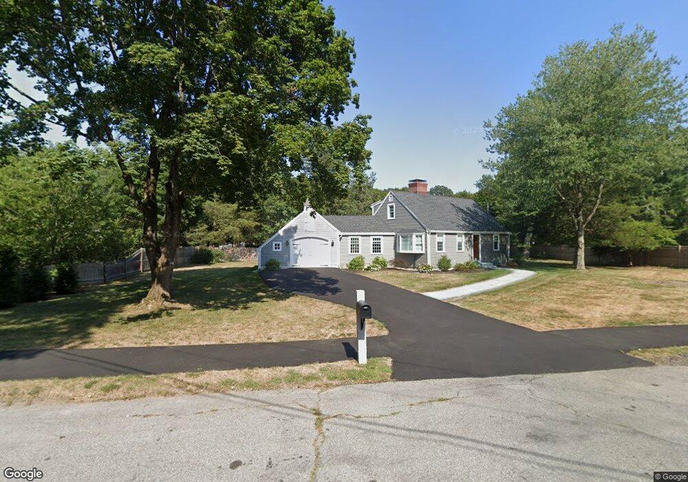
1 Scott Hill Rd Ipswich, MA 01938
Estimated Value: $610,000 - $1,275,882
2
Beds
2
Baths
1,553
Sq Ft
$584/Sq Ft
Est. Value
About This Home
This home is located at 1 Scott Hill Rd, Ipswich, MA 01938 and is currently estimated at $907,221, approximately $584 per square foot. 1 Scott Hill Rd is a home located in Essex County with nearby schools including Ipswich High School and Pingree School.
Ownership History
Date
Name
Owned For
Owner Type
Purchase Details
Closed on
Mar 6, 2023
Sold by
Fitzgerald David J
Bought by
Kane Alexander
Current Estimated Value
Home Financials for this Owner
Home Financials are based on the most recent Mortgage that was taken out on this home.
Original Mortgage
$500,000
Outstanding Balance
$483,229
Interest Rate
6.15%
Mortgage Type
Purchase Money Mortgage
Estimated Equity
$423,992
Purchase Details
Closed on
Jan 7, 2003
Sold by
Cutright Catharyn T
Bought by
Fitzgerald David J
Home Financials for this Owner
Home Financials are based on the most recent Mortgage that was taken out on this home.
Original Mortgage
$220,000
Interest Rate
6.08%
Mortgage Type
Purchase Money Mortgage
Purchase Details
Closed on
Dec 10, 1999
Sold by
Alcock Ft
Bought by
Cutright Paul Brooks and Cutright Catharyn T
Create a Home Valuation Report for This Property
The Home Valuation Report is an in-depth analysis detailing your home's value as well as a comparison with similar homes in the area
Home Values in the Area
Average Home Value in this Area
Purchase History
| Date | Buyer | Sale Price | Title Company |
|---|---|---|---|
| Kane Alexander | $625,000 | None Available | |
| Fitzgerald David J | $395,000 | -- | |
| Fitzgerald David J | $395,000 | -- | |
| Cutright Paul Brooks | $292,000 | -- | |
| Cutright Paul Brooks | $292,000 | -- |
Source: Public Records
Mortgage History
| Date | Status | Borrower | Loan Amount |
|---|---|---|---|
| Open | Kane Alexander | $500,000 | |
| Previous Owner | Cutright Paul Brooks | $193,000 | |
| Previous Owner | Cutright Paul Brooks | $218,500 | |
| Previous Owner | Cutright Paul Brooks | $220,000 |
Source: Public Records
Tax History
| Year | Tax Paid | Tax Assessment Tax Assessment Total Assessment is a certain percentage of the fair market value that is determined by local assessors to be the total taxable value of land and additions on the property. | Land | Improvement |
|---|---|---|---|---|
| 2025 | $8,822 | $791,200 | $337,800 | $453,400 |
| 2024 | $7,337 | $644,700 | $336,400 | $308,300 |
| 2023 | $6,976 | $570,400 | $297,400 | $273,000 |
| 2022 | $6,719 | $522,500 | $267,300 | $255,200 |
| 2021 | $6,523 | $493,400 | $256,700 | $236,700 |
| 2020 | $6,553 | $467,400 | $239,000 | $228,400 |
| 2019 | $6,288 | $446,300 | $226,600 | $219,700 |
| 2018 | $6,001 | $421,400 | $212,400 | $209,000 |
| 2017 | $5,720 | $403,100 | $201,800 | $201,300 |
| 2016 | $5,719 | $385,100 | $198,300 | $186,800 |
| 2015 | $5,312 | $393,200 | $191,200 | $202,000 |
Source: Public Records
Map
Nearby Homes
- 125 Topsfield Rd
- 133 Topsfield Rd
- 45 Pineswamp Rd
- 24 Primrose Ln Unit 24
- 500 Colonial Dr Unit 5
- 9 Booth Ct Unit 9
- 9 Booth Ct
- 30 Buttonwood
- 38 Buttonwood
- 38 Buttonwood Unit 30
- 9 Ryan Ave
- 8 Cleveland Ave
- 11 Washington St Unit 11
- 11 Washington St Unit 7
- 11 Washington St Unit 5
- 11 Washington St Unit 4
- 11 Washington St Unit 12
- 59 S Main St Unit 1
- 64 County Rd Unit 1
- 16 Elm St
- 1 Scott Hill Rd
- 2 Cedarview Rd
- 3 Scott Hill Rd
- 4 Cedarview Rd
- 1 Cedarview Rd
- 162 Topsfield Rd
- 2 Scott Hill Rd
- 5 Scott Hill Rd
- 6 Cedarview Rd
- 5 Cedarview Rd
- 179 Topsfield Rd
- 156 Topsfield Rd
- 8 Cedarview Rd
- 7 Scott Hill Rd
- 1 Sunset Dr
- 7 Cedarview Rd
- 4 Scott Hill Rd
- 10 Cedarview Rd
- 154 Topsfield Rd
- 165 Topsfield Rd
Your Personal Tour Guide
Ask me questions while you tour the home.