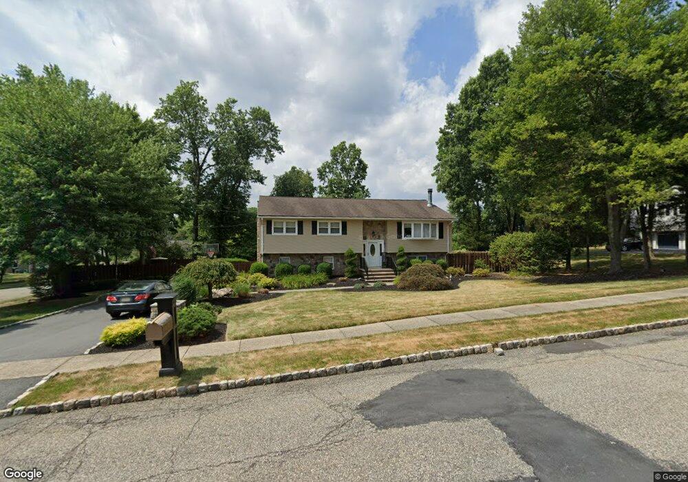
1 Seamount Dr Whippany, NJ 07981
Estimated Value: $772,540 - $908,000
--
Bed
--
Bath
2,343
Sq Ft
$366/Sq Ft
Est. Value
About This Home
This home is located at 1 Seamount Dr, Whippany, NJ 07981 and is currently estimated at $856,385, approximately $365 per square foot. 1 Seamount Dr is a home located in Morris County with nearby schools including Whippany Park High School, Arrow Academy, and The Morristown-Beard School.
Ownership History
Date
Name
Owned For
Owner Type
Purchase Details
Closed on
Jan 12, 2005
Sold by
Decheser Michael
Bought by
Cefolo Joseph and Cefolo Amy
Current Estimated Value
Home Financials for this Owner
Home Financials are based on the most recent Mortgage that was taken out on this home.
Original Mortgage
$355,000
Outstanding Balance
$178,285
Interest Rate
5.67%
Mortgage Type
Adjustable Rate Mortgage/ARM
Estimated Equity
$678,100
Purchase Details
Closed on
Aug 24, 2001
Sold by
Murray Michael
Bought by
Decheser Michael and Decheser Kara
Home Financials for this Owner
Home Financials are based on the most recent Mortgage that was taken out on this home.
Original Mortgage
$275,000
Interest Rate
7.21%
Create a Home Valuation Report for This Property
The Home Valuation Report is an in-depth analysis detailing your home's value as well as a comparison with similar homes in the area
Home Values in the Area
Average Home Value in this Area
Purchase History
| Date | Buyer | Sale Price | Title Company |
|---|---|---|---|
| Cefolo Joseph | $555,000 | -- | |
| Decheser Michael | $400,000 | -- |
Source: Public Records
Mortgage History
| Date | Status | Borrower | Loan Amount |
|---|---|---|---|
| Open | Cefolo Joseph | $355,000 | |
| Previous Owner | Decheser Michael | $275,000 |
Source: Public Records
Tax History Compared to Growth
Tax History
| Year | Tax Paid | Tax Assessment Tax Assessment Total Assessment is a certain percentage of the fair market value that is determined by local assessors to be the total taxable value of land and additions on the property. | Land | Improvement |
|---|---|---|---|---|
| 2025 | $9,699 | $460,100 | $229,300 | $230,800 |
| 2024 | $9,658 | $460,100 | $229,300 | $230,800 |
| 2023 | $9,658 | $460,100 | $229,300 | $230,800 |
| 2022 | $8,834 | $460,100 | $229,300 | $230,800 |
| 2021 | $8,705 | $460,100 | $229,300 | $230,800 |
| 2020 | $8,677 | $460,100 | $229,300 | $230,800 |
| 2019 | $8,705 | $460,100 | $229,300 | $230,800 |
| 2018 | $8,553 | $460,100 | $229,300 | $230,800 |
| 2017 | $8,300 | $460,100 | $229,300 | $230,800 |
| 2016 | $8,181 | $460,100 | $229,300 | $230,800 |
| 2015 | $7,854 | $460,100 | $229,300 | $230,800 |
| 2014 | $7,684 | $460,100 | $229,300 | $230,800 |
Source: Public Records
Map
Nearby Homes
- 26 Gladstone Ct
- 00 Algonquin Pkwy
- 100 Louis St
- 67 Branford Rd
- 11 Nemic Ln
- 72 Reynolds Ave
- 39 Lefke Ln
- 67 Parsippany Rd
- 96 Parsippany Rd
- 304 Beaverbrook Terrace Unit 304
- 12 Candice Way
- 51 S Ridgedale Ave
- 8 Eden Ln
- 7 Heritage Ln
- Monterey Plan at The Grove - The Monterey Collection
- Pershing Plan at The Grove - The Pershing Collection
- 36 Gladstone Ct
- 23 Gladstone Ct
- 39 Gladstone Ct
- 42 Gladstone Ct
- 3 Seamount Dr
- 15 Manchester Dr
- 79 Black Brook Dr
- 11 Manchester Dr
- 19 Manchester Dr
- 80 Black Brook Dr
- 9 Manchester Dr
- 4 Seamount Dr
- 81 Black Brook Dr
- 5 Seamount Dr
- 82 Black Brook Dr
- 6 Seamount Dr
- 7 Manchester Dr
- 83 Black Brook Dr
- 14 Manchester Dr
- 12 Manchester Dr
- 20 Kathryn Dr
- 16 Manchester Dr
- 12 Kathryn Dr
- 7 Seamount Dr