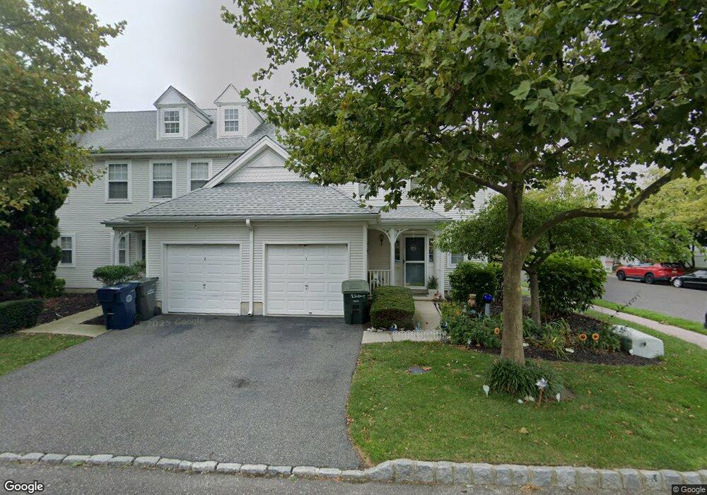
1 Sextant Dr Atlantic City, NJ 08401
Uptown Atlantic City NeighborhoodEstimated Value: $234,832 - $307,000
--
Bed
--
Bath
1,692
Sq Ft
$164/Sq Ft
Est. Value
About This Home
This home is located at 1 Sextant Dr, Atlantic City, NJ 08401 and is currently estimated at $277,208, approximately $163 per square foot. 1 Sextant Dr is a home located in Atlantic County with nearby schools including Uptown Complex School, Atlantic City High School, and New Hope Christian Academy/Robinson Small Learning Center.
Ownership History
Date
Name
Owned For
Owner Type
Purchase Details
Closed on
Aug 30, 1994
Sold by
K Hovnanian Atlantic City
Bought by
Palmer Marceline
Current Estimated Value
Home Financials for this Owner
Home Financials are based on the most recent Mortgage that was taken out on this home.
Original Mortgage
$66,000
Interest Rate
8.55%
Create a Home Valuation Report for This Property
The Home Valuation Report is an in-depth analysis detailing your home's value as well as a comparison with similar homes in the area
Home Values in the Area
Average Home Value in this Area
Purchase History
| Date | Buyer | Sale Price | Title Company |
|---|---|---|---|
| Palmer Marceline | $85,671 | -- |
Source: Public Records
Mortgage History
| Date | Status | Borrower | Loan Amount |
|---|---|---|---|
| Closed | Palmer Marceline | $66,000 |
Source: Public Records
Tax History Compared to Growth
Tax History
| Year | Tax Paid | Tax Assessment Tax Assessment Total Assessment is a certain percentage of the fair market value that is determined by local assessors to be the total taxable value of land and additions on the property. | Land | Improvement |
|---|---|---|---|---|
| 2025 | $4,274 | $123,800 | $45,000 | $78,800 |
| 2024 | $4,274 | $123,800 | $45,000 | $78,800 |
| 2023 | $4,676 | $123,800 | $45,000 | $78,800 |
| 2022 | $4,676 | $123,800 | $45,000 | $78,800 |
| 2021 | $4,829 | $123,800 | $45,000 | $78,800 |
| 2020 | $4,870 | $123,800 | $45,000 | $78,800 |
| 2019 | $4,980 | $125,000 | $62,500 | $62,500 |
| 2018 | $4,416 | $125,000 | $62,500 | $62,500 |
| 2017 | $4,276 | $125,000 | $62,500 | $62,500 |
| 2016 | $4,825 | $125,000 | $62,500 | $62,500 |
| 2015 | $9,342 | $273,000 | $115,000 | $158,000 |
Source: Public Records
Map
Nearby Homes
- 57 Anchorage Ct Unit 705
- 75 Anchorage Ct Unit 75
- 6 Spinnaker Way
- 6 Spinnaker Way Unit 6
- 5 Barkentine Ct
- 335 N Massachusetts Ave
- 429 N New Hampshire Ave
- 108 Liberty Ave
- 16 Lighthouse Ct Unit 27E
- 409 N Massachusetts Ave
- 332 N Massachusetts Ave
- 442 N Massachusetts Ave
- 507 Adriatic Ave
- 504 N Massachusetts Ave
- 314 N Massachusetts Ave
- 519 Wabash Ave
- 502 N Massachusetts Ave
- 509 Caspian Ave
- 441 N Connecticut Ave
- 403 N Connecticut Ave
- 2 Sextant Dr Unit 11D
- 3 Sextant Dr
- 4 Sextant Dr
- 75 Anchorage Ct
- 75 Anchorage Ct Unit 1001
- 74 Anchorage Ct Unit 10B
- 73 Anchorage Ct Unit 10C
- 5 Sextant Dr
- 72 Anchorage Ct Unit 10D
- 71 Anchorage Ct Unit 1005
- 71 Anchorage Ct Unit 10E
- 66 Lighthouse Ct Unit 20H
- 6 Sextant Dr Unit 12H
- 65 Lighthouse Ct Unit 20G
- 7 Sextant Dr
- 1 Starboard Ct Unit 31A
- 2 Starboard Ct Unit 31B
- 64 Lighthouse Ct
- 69 Anchorage Ct
- 3 Starboard Ct Unit 31C