Estimated Value: $174,896 - $228,000
Studio
2
Baths
2,006
Sq Ft
$102/Sq Ft
Est. Value
About This Home
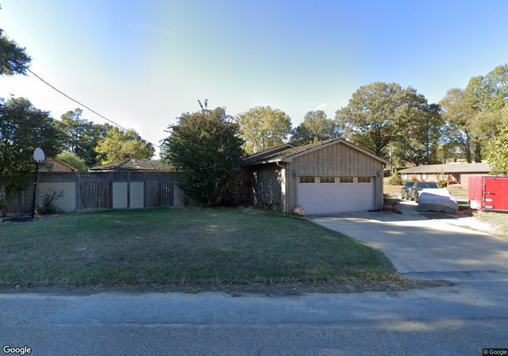
This home is located at 1 Shannon Dr, Wynne, AR 72396 and is currently estimated at $204,224, approximately $101 per square foot. 1 Shannon Dr is a home located in Cross County with nearby schools including Wynne Intermediate School, Wynne Primary School, and Wynne Junior High School.
Ownership History
Date
Name
Owned For
Owner Type
Purchase Details
Closed on
Aug 26, 2019
Sold by
Emerson Stephanie
Bought by
Emerson Austin
Current Estimated Value
Purchase Details
Closed on
Mar 16, 1998
Bought by
Emerson Stephanie E
Purchase Details
Closed on
Jun 7, 1993
Bought by
Emerson Stephanie E
Purchase Details
Closed on
Oct 1, 1991
Bought by
Raines John and Blades Buffy
Purchase Details
Closed on
Oct 31, 1990
Bought by
Stewart Stewart W and Stewart D
Create a Home Valuation Report for This Property
The Home Valuation Report is an in-depth analysis detailing your home's value as well as a comparison with similar homes in the area
Purchase History
| Date | Buyer | Sale Price | Title Company |
|---|---|---|---|
| Emerson Austin | -- | None Available | |
| Emerson Stephanie E | -- | -- | |
| Emerson Stephanie E | $85,000 | -- | |
| Raines John | -- | -- | |
| Stewart Stewart W | $70,000 | -- |
Source: Public Records
Tax History
| Year | Tax Paid | Tax Assessment Tax Assessment Total Assessment is a certain percentage of the fair market value that is determined by local assessors to be the total taxable value of land and additions on the property. | Land | Improvement |
|---|---|---|---|---|
| 2025 | $616 | $38,510 | $6,110 | $32,400 |
| 2024 | $718 | $25,420 | $4,570 | $20,850 |
| 2023 | $793 | $25,420 | $4,570 | $20,850 |
| 2022 | $843 | $25,420 | $4,570 | $20,850 |
| 2021 | $843 | $25,420 | $4,570 | $20,850 |
| 2020 | $788 | $25,420 | $4,570 | $20,850 |
| 2019 | $732 | $22,370 | $3,890 | $18,480 |
| 2018 | $757 | $22,370 | $3,890 | $18,480 |
| 2017 | $757 | $22,370 | $3,890 | $18,480 |
| 2016 | $757 | $22,370 | $3,890 | $18,480 |
| 2015 | $757 | $22,370 | $3,890 | $18,480 |
| 2014 | $738 | $21,980 | $4,440 | $17,540 |
Source: Public Records
Map
Nearby Homes
- 1621 Dodd Dr
- 1420 Hamilton Ave E
- 205 Kerry Dr
- 129 Lombardy Ln
- 39 Morningside Dr
- 594 Malone St N
- 1310 Forrest Ave E
- 1204 Forrest Ave E
- 1104 Hamilton Ave E
- 1011 Hilltop Dr
- 1106 Marion Dr
- 12 Wynnewood Dr N
- 1406 Airpark Rd
- 909 Killough Rd N
- 226 Nathan Dr E
- 1404 Airpark Rd
- 108 Nathan Dr E
- 109 Nathan Dr E
- 1201 Peterson Dr
- 621 Lemons St N
- 1489 Hamilton Ave E
- 1485 Hamilton Ave E
- 1451 Hamilton Ave E
- 1486 Hamilton Ave E
- 1484 Hamilton Ave E
- 1449 Hamilton Ave E
- 3 Shannon Dr
- 7 Londonderry Cir
- 1447 Hamilton Ave E
- 27 Shannon Dr
- 1622 Dodd Dr
- 1470 Hamilton Ave E
- 1620 Dodd Dr
- 1445 Hamilton Ave E
- 6 Londonderry Cir
- 6 Londonderry Cir
- 5 Shannon Dr
- 2 Londonderry Cir
- 1618 Dodd Dr
- 25 Shannon Dr
Your Personal Tour Guide
Ask me questions while you tour the home.